The annular-total solar eclipse of November 3, 2013


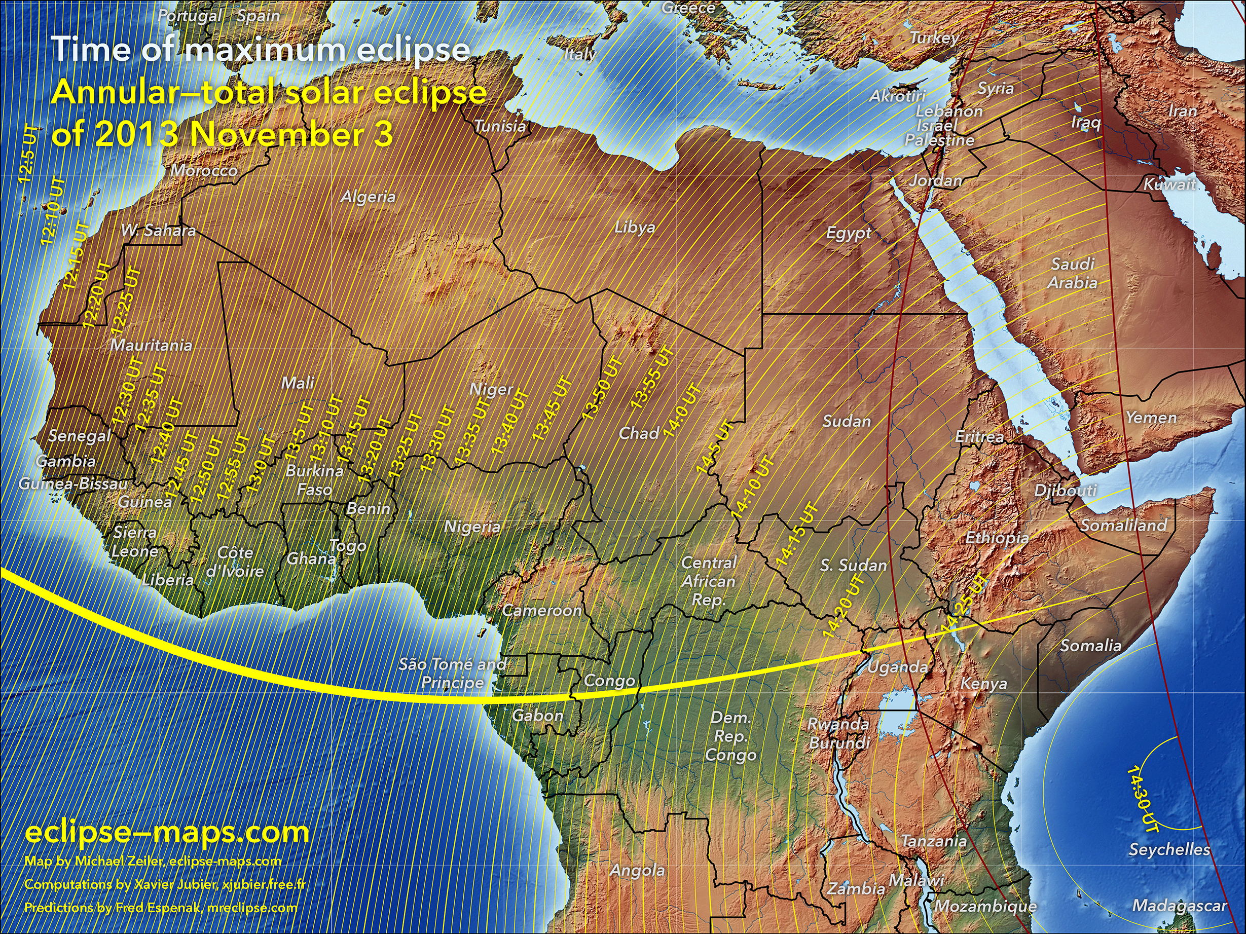
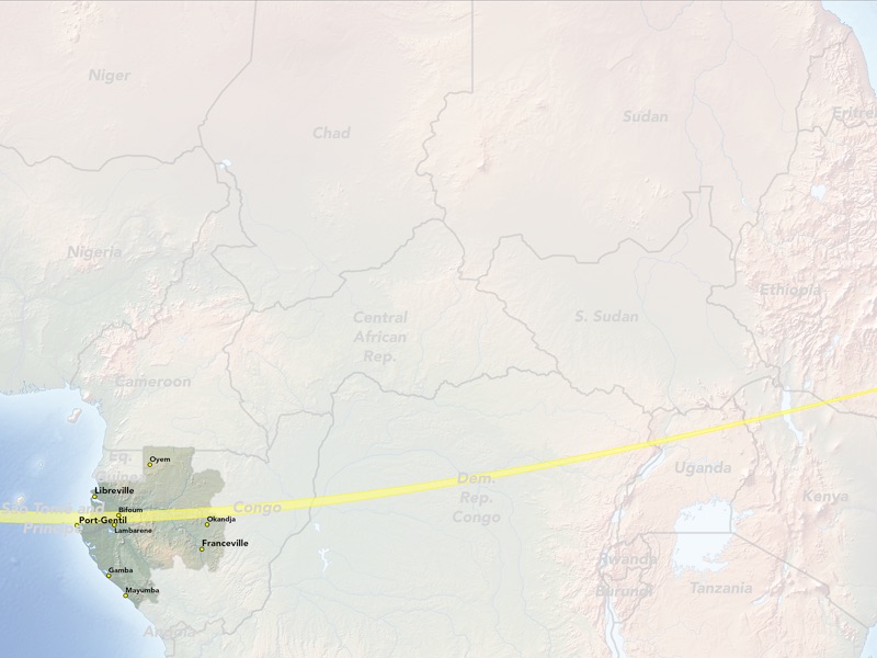
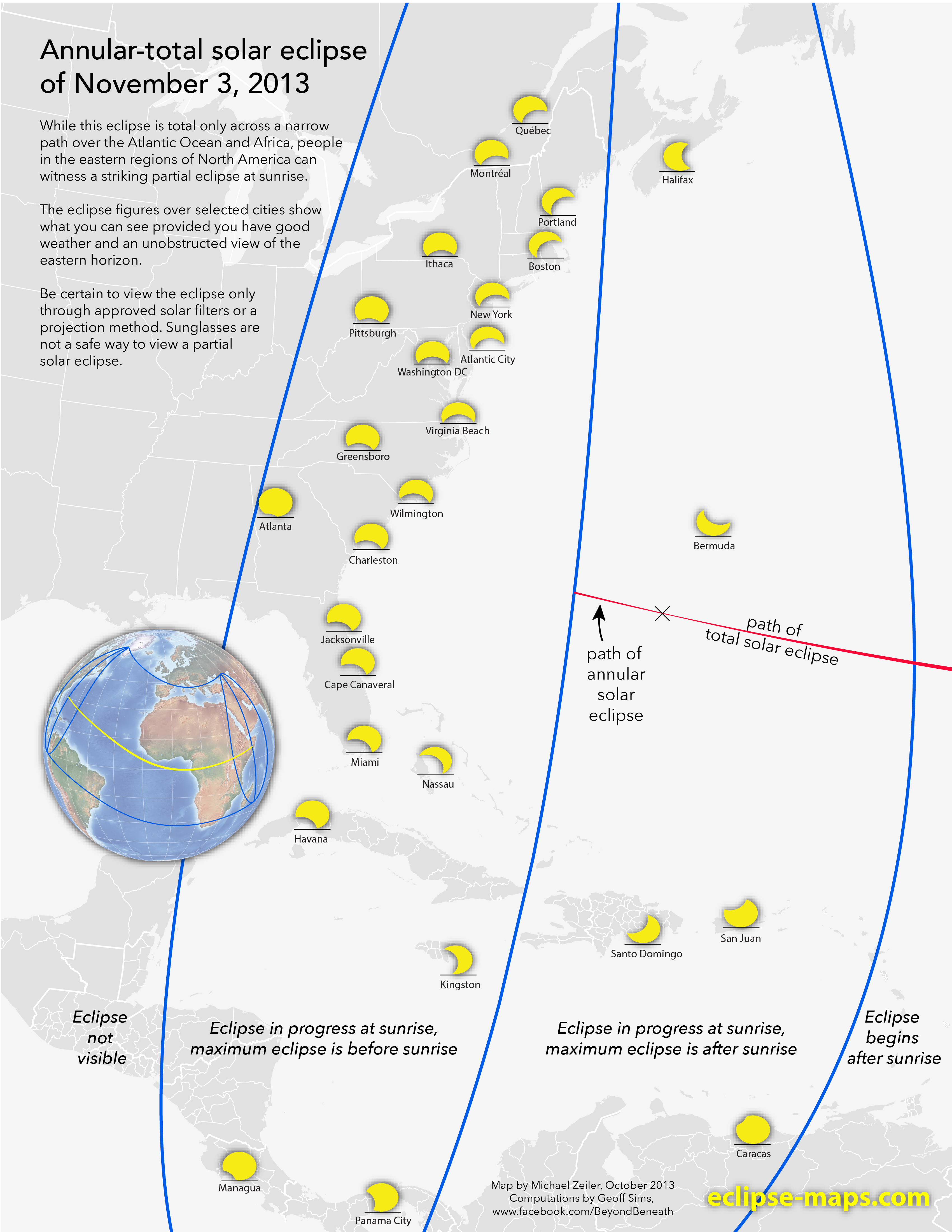


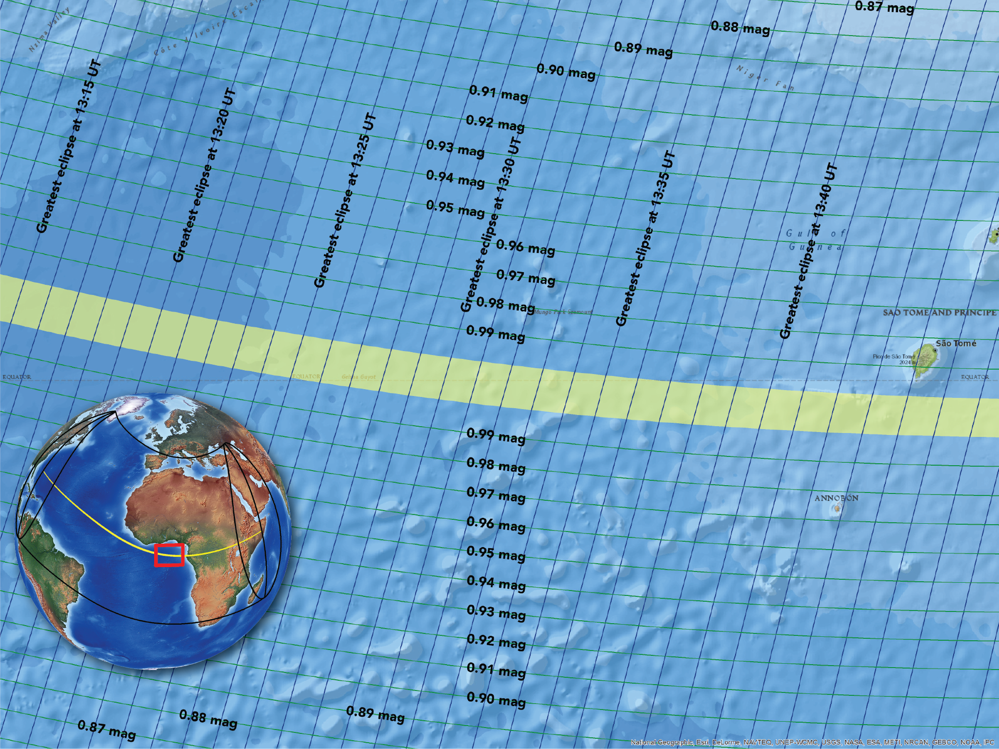


On November 3, 2013, an annular solar eclipse begins over the Atlantic Ocean and quickly transitions to a total solar eclipse. After crossing the Atlantic, the eclipse enters Africa at Gabon and crosses Congo, Uganda, Kenya, Ethiopia, and Somalia.
While thousands of eclipse chasers are traveling to Africa to see this event, millions of people in eastern North America and northern South America can see a dramatic partial solar eclipse at sunrise. This spectacular sight can only be safely observed with approved solar filters or by projecting an image of the eclipsed Sun onto a flat white surface. Find safe observing instructions here.
Recommended links for further information
Interactive Google eclipse map by Xavier Jubier
NASA’s eclipse web site by Fred Espenak
Weather prospect and maps by Jay Anderson
Eclipse maps and photography by Bill Kramer
IAU Working Group on Solar Eclipses by Jay Pasachoff
U.S. Naval Observatory & HM Nautical Almanac Office
Credits
The maps on this page are made by Michael Zeiler, curator of eclipse-maps.com, using GIS software from his employer, www.esri.com. The eclipse calculations behind these maps are from Solar Eclipse Maestro by Xavier Jubier. The Besselian elements used for eclipse calculations are calculated by Fred Espenak from the JPL DE405 ephemeris.
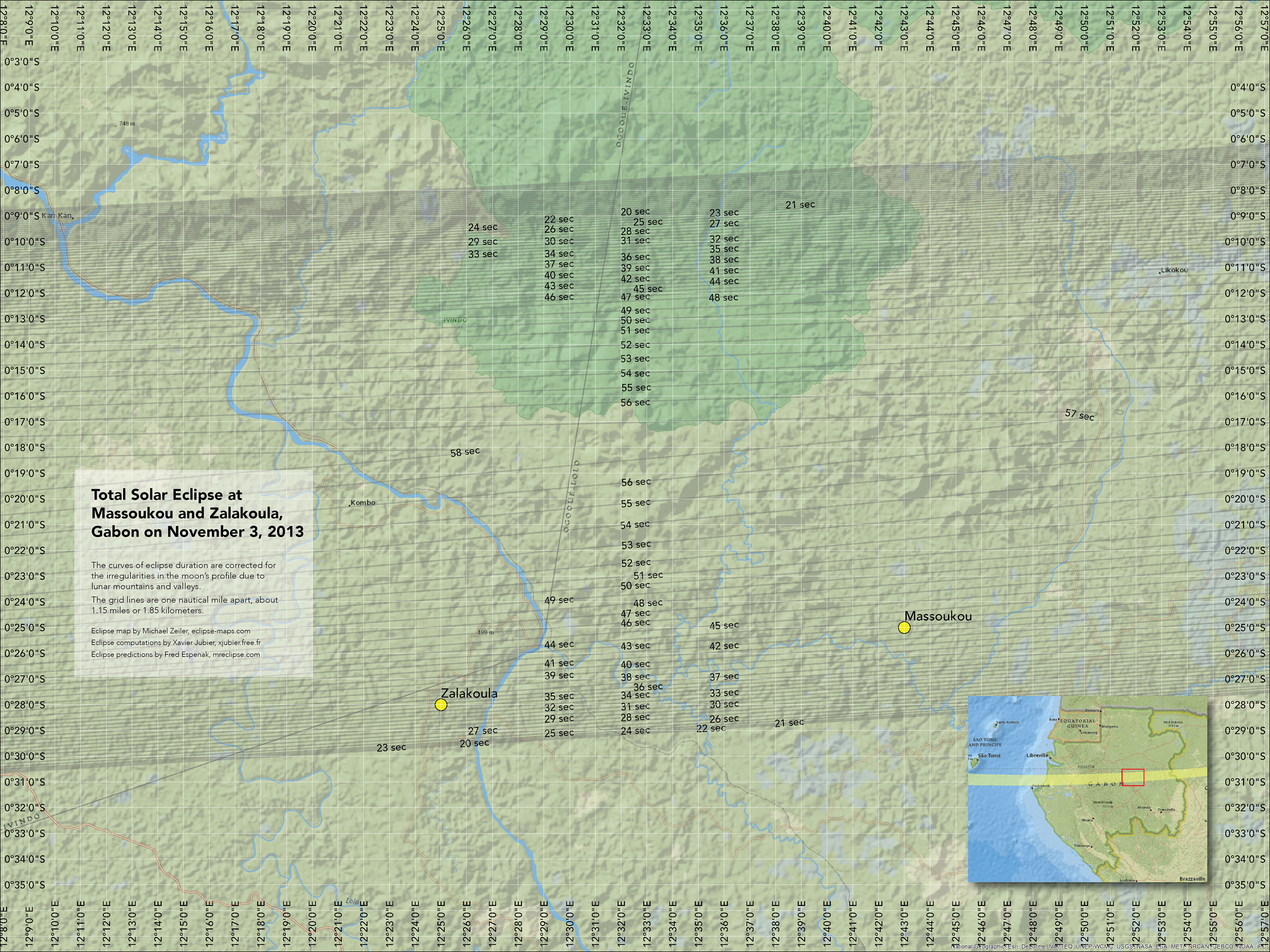
The careful map reader will note that isodurations (lines of equal eclipse duration) on the maps are not symmetric around the central line of eclipse or perfectly smooth; this is due to corrections for the actual lunar profile.
Eclipse
t-shirts and
maps here

Click on any map on this page for a high-resolution view
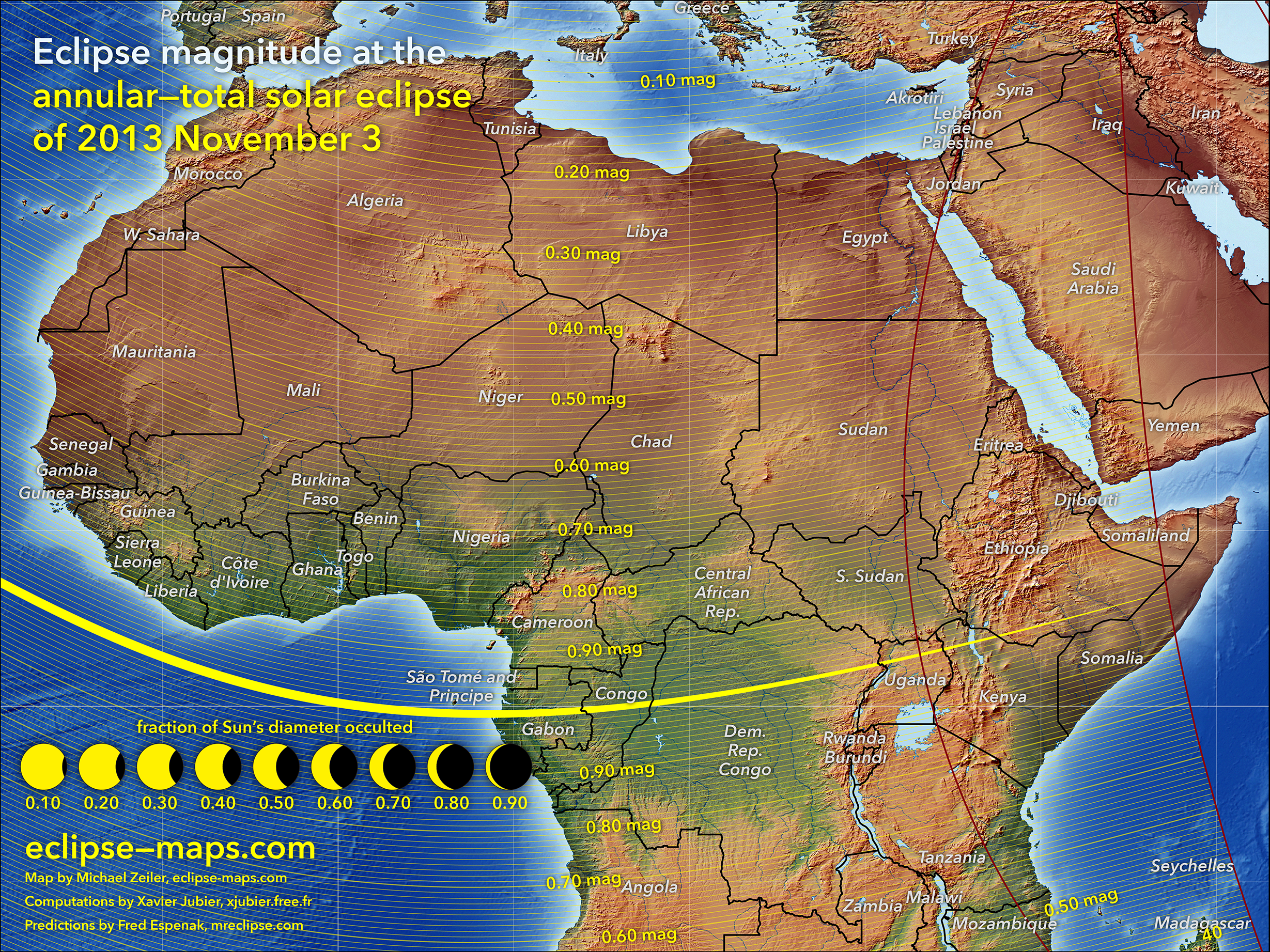
Overview map showing eclipse magnitude (fraction of Sun’s diameter eclipsed)
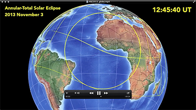
Video showing the progress of the eclipse from the perspective of the sun
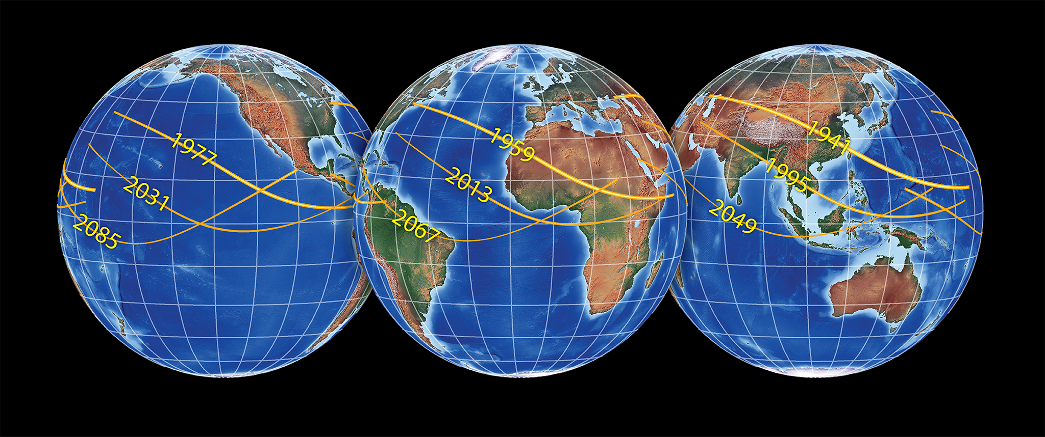
This eclipse is a member of Saros cycle 143. This map shows the four preceding and four succeeding eclipse paths of this cycle. For more on this Saros cycle, consult http://eclipse.gsfc.nasa.gov/SEsaros/SEsaros143.html
If you are not among the intrepid eclipse chasers trekking to Africa, you can still see a dramatic sight if you are in the eastern North America. A partial solar eclipse will be visible at sunrise on November 3rd if you have good weather and a clear eastern horizon.
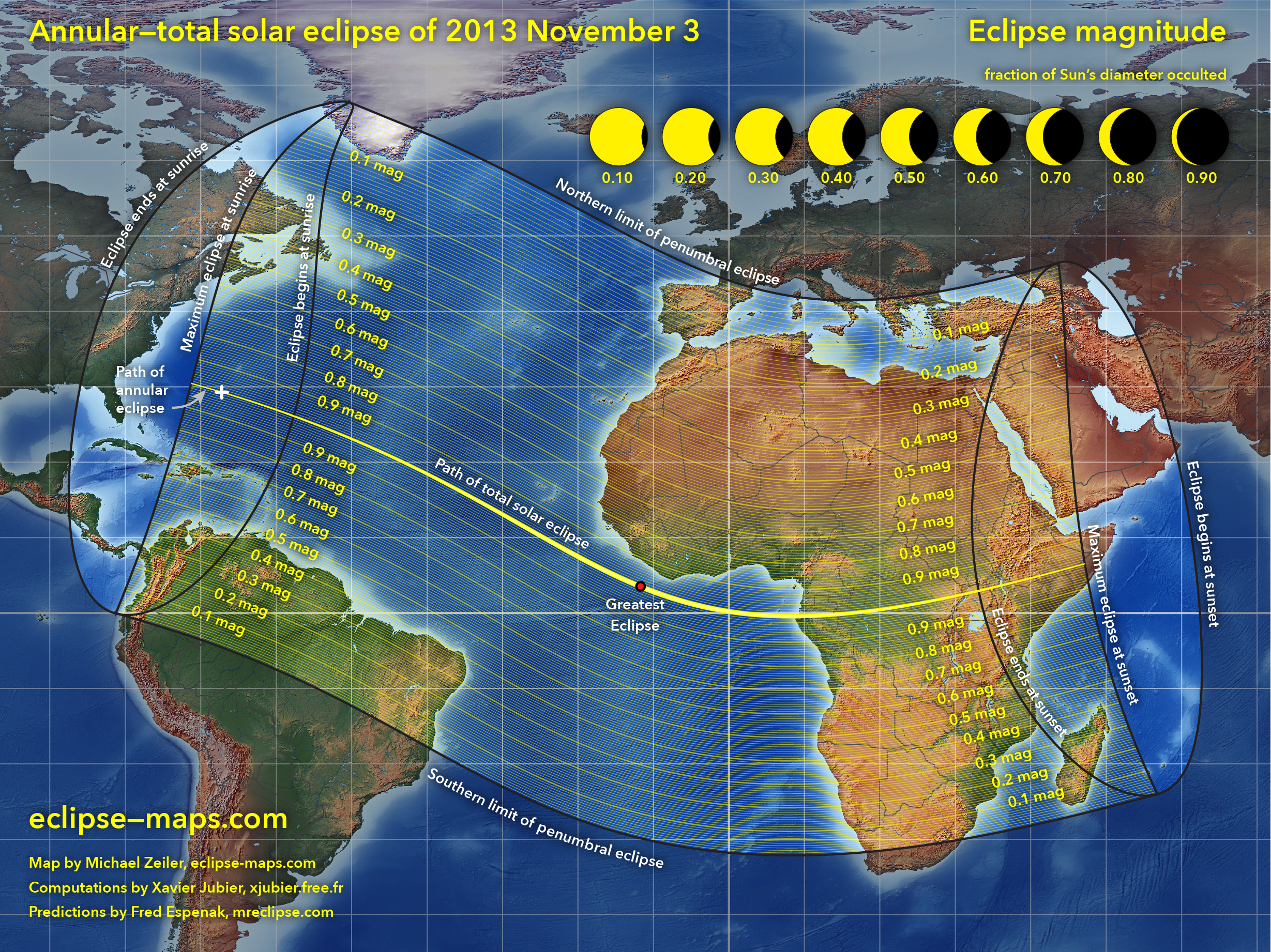
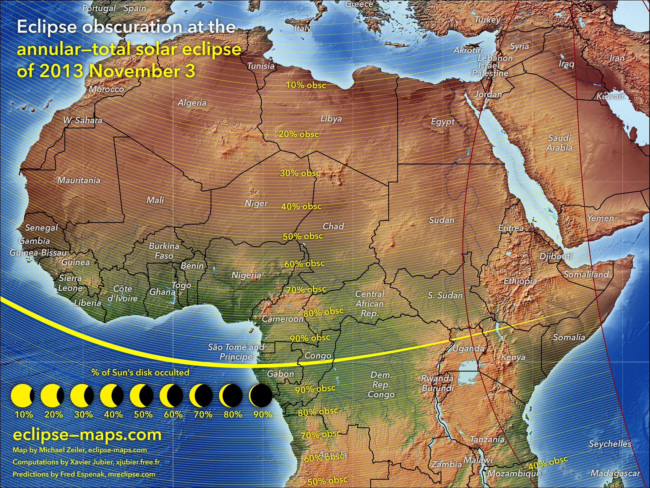
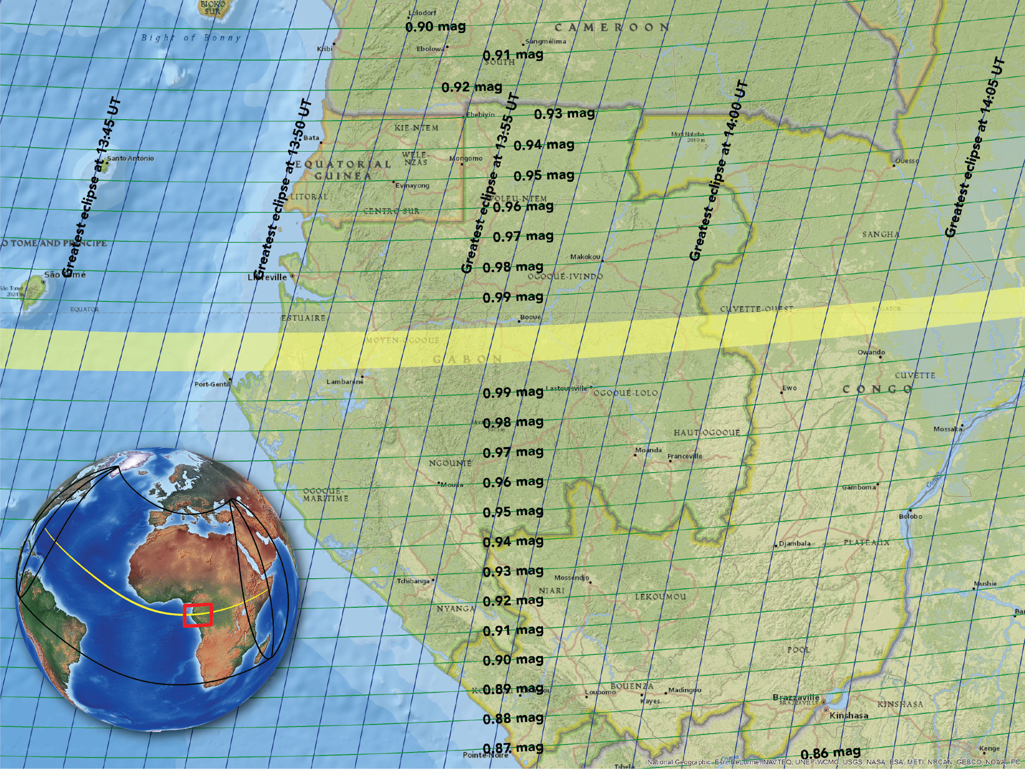
Eclipse obscuration
The fraction of the sun’s disk occulted
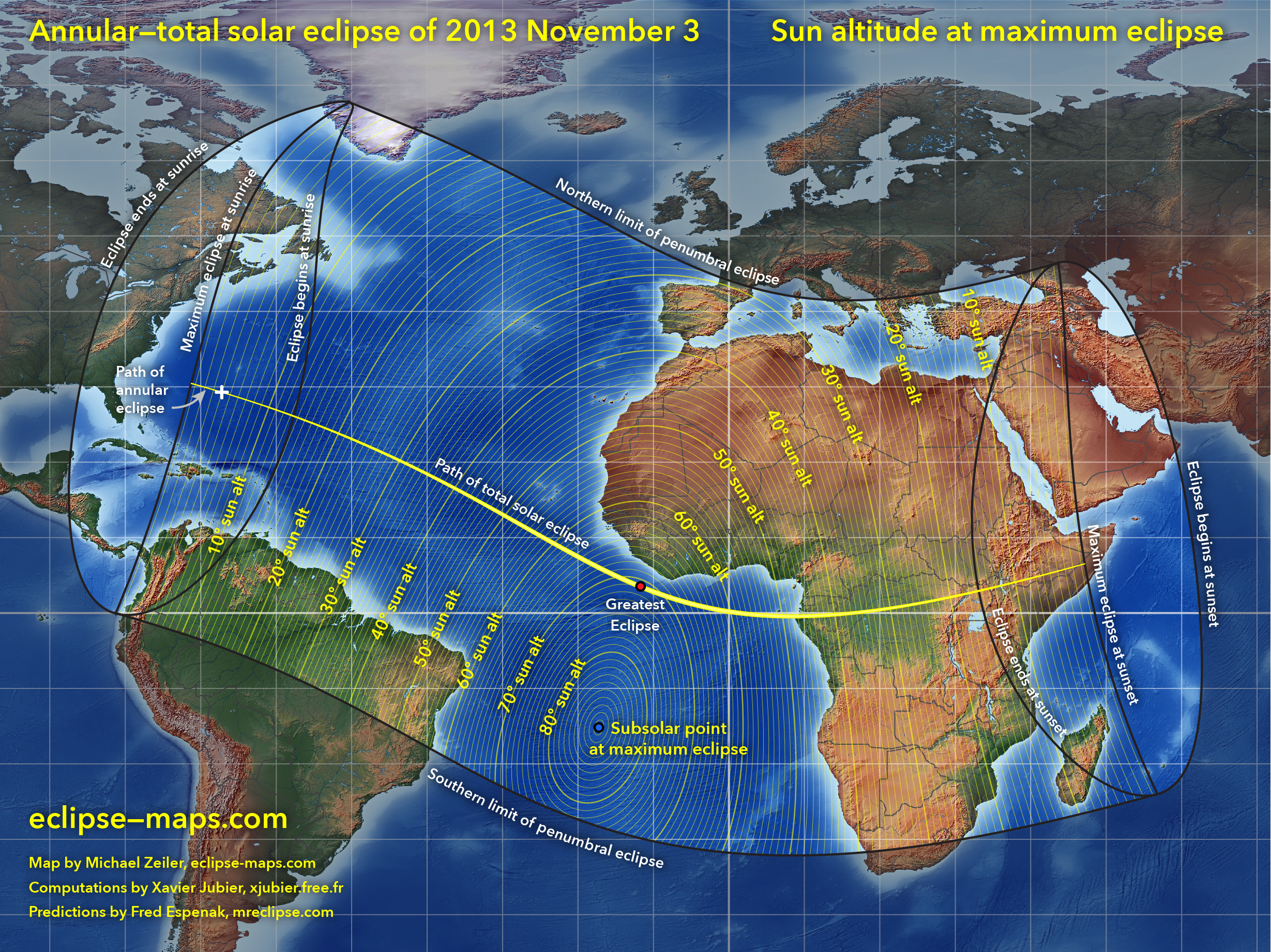
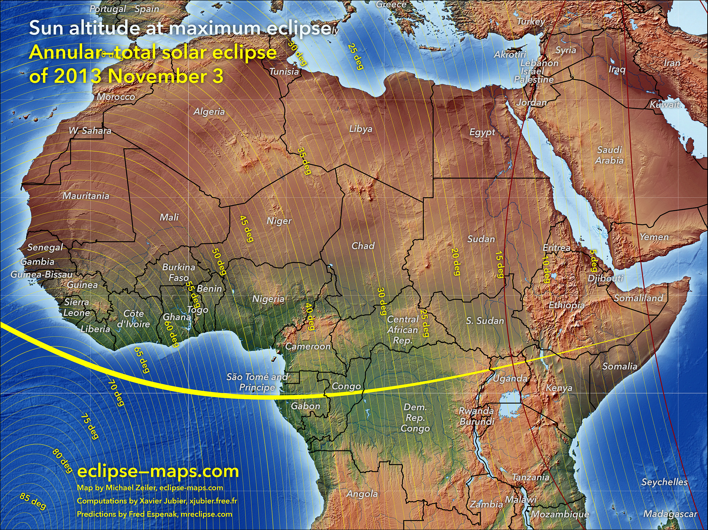
Sun altitude during greatest eclipse
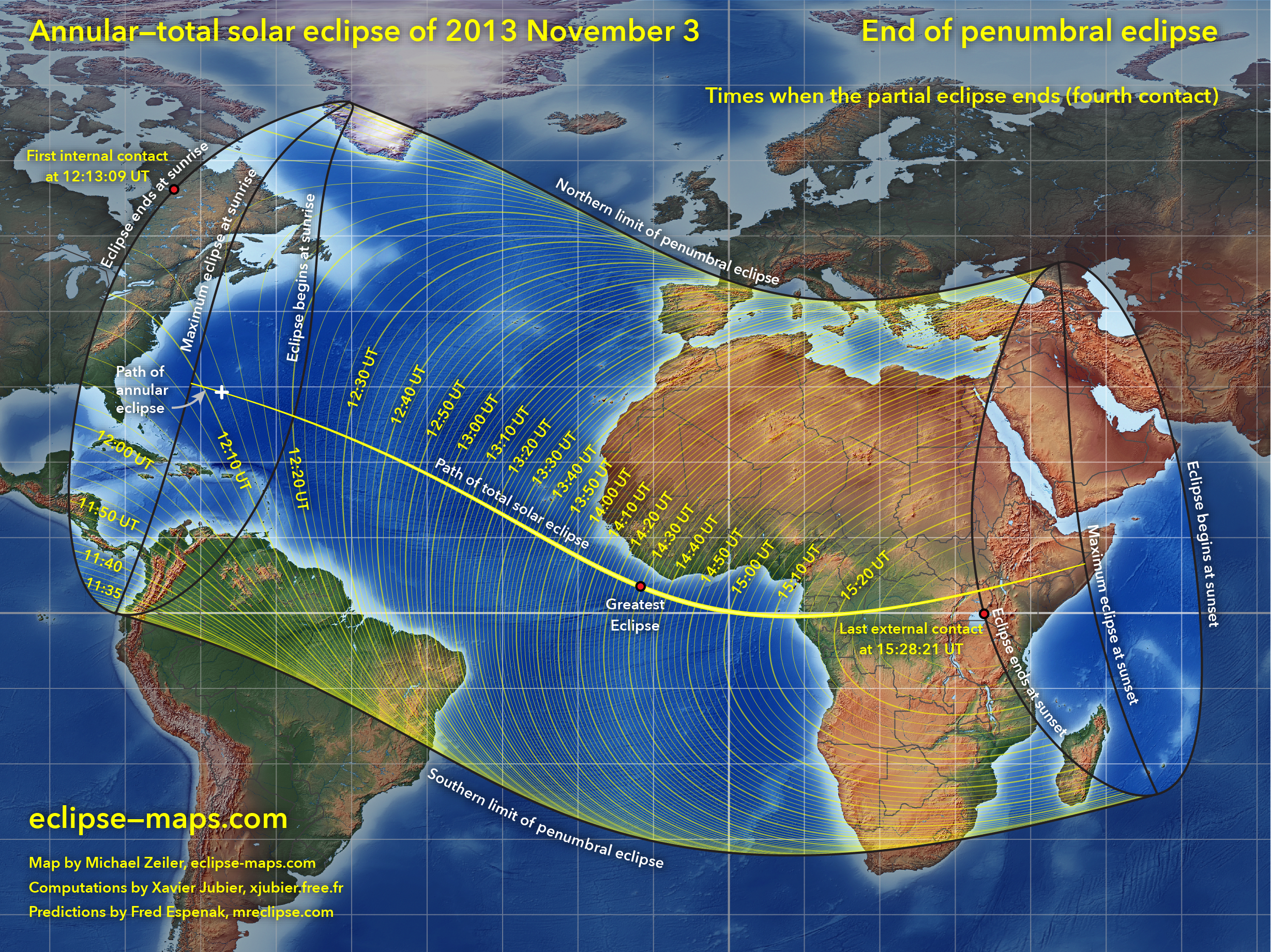
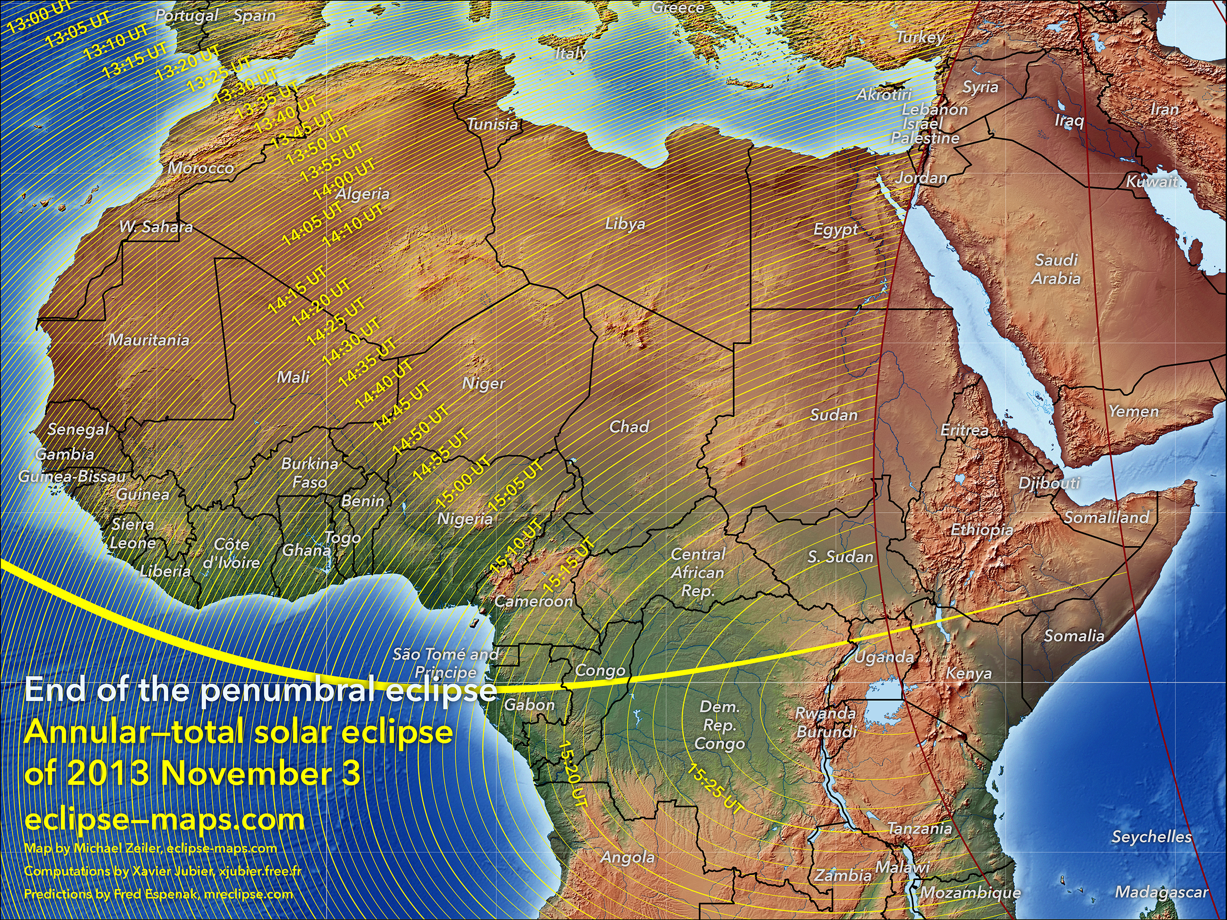
Times when penumbral eclipse ends
(fourth contact)
Times when penumbral eclipse begins
(first contact)
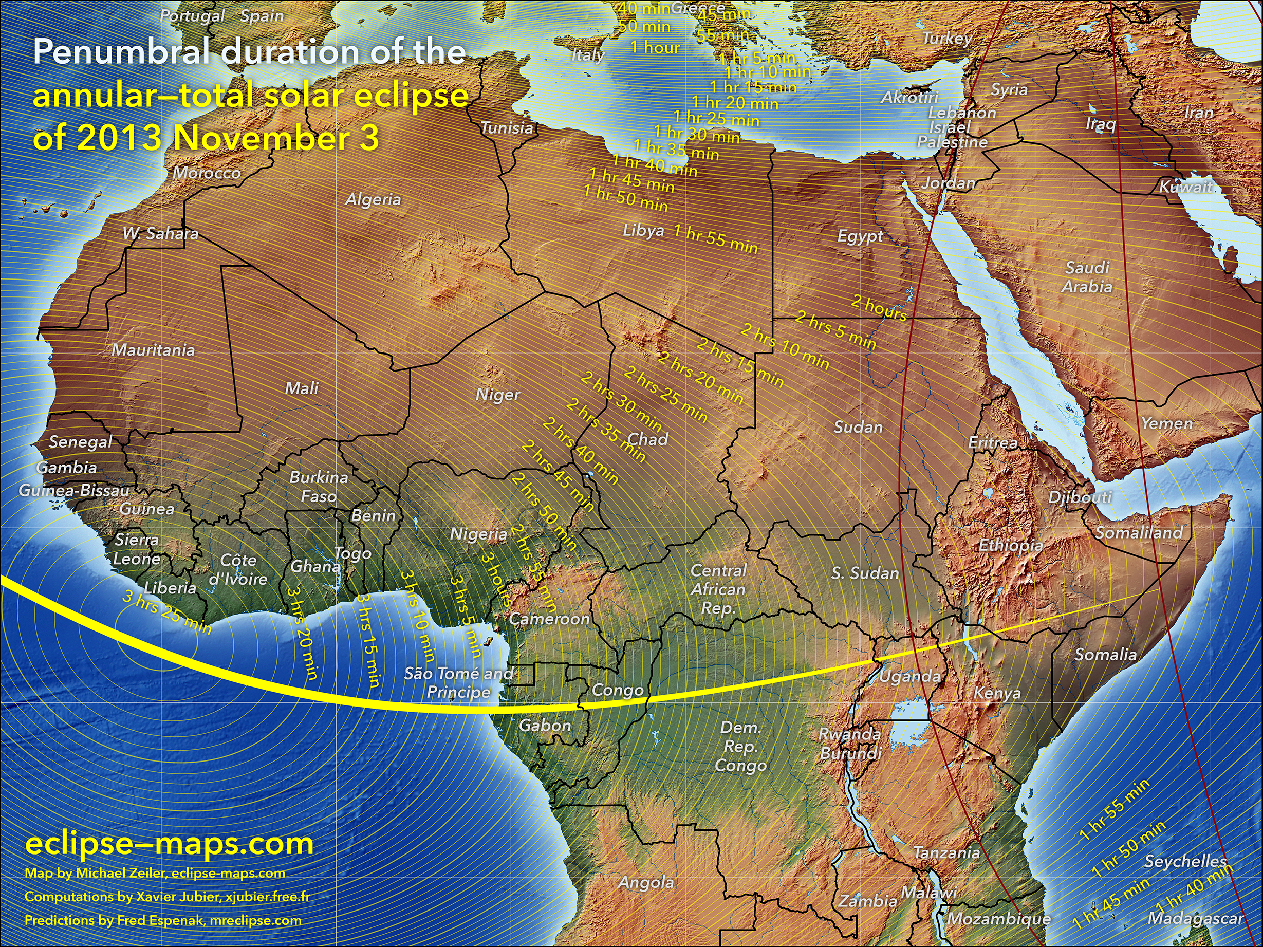
Penumbral duration
The length of time between begin and end of penumbral (partial) eclipse
Times of maximum eclipse
Eclipse obscuration
The fraction of the sun’s disk occulted
Eclipse magnitude
The fraction of the sun’s disk occulted
Africa is the only land mass visited by the total solar eclipse with a maximum duration of just over one minute.
Times when penumbral eclipse ends
(fourth contact)
Times when penumbral eclipse begins
(first contact)
Times of maximum eclipse
Sun altitude during greatest eclipse
Penumbral duration
The length of time between begin and end of penumbral (partial) eclipse
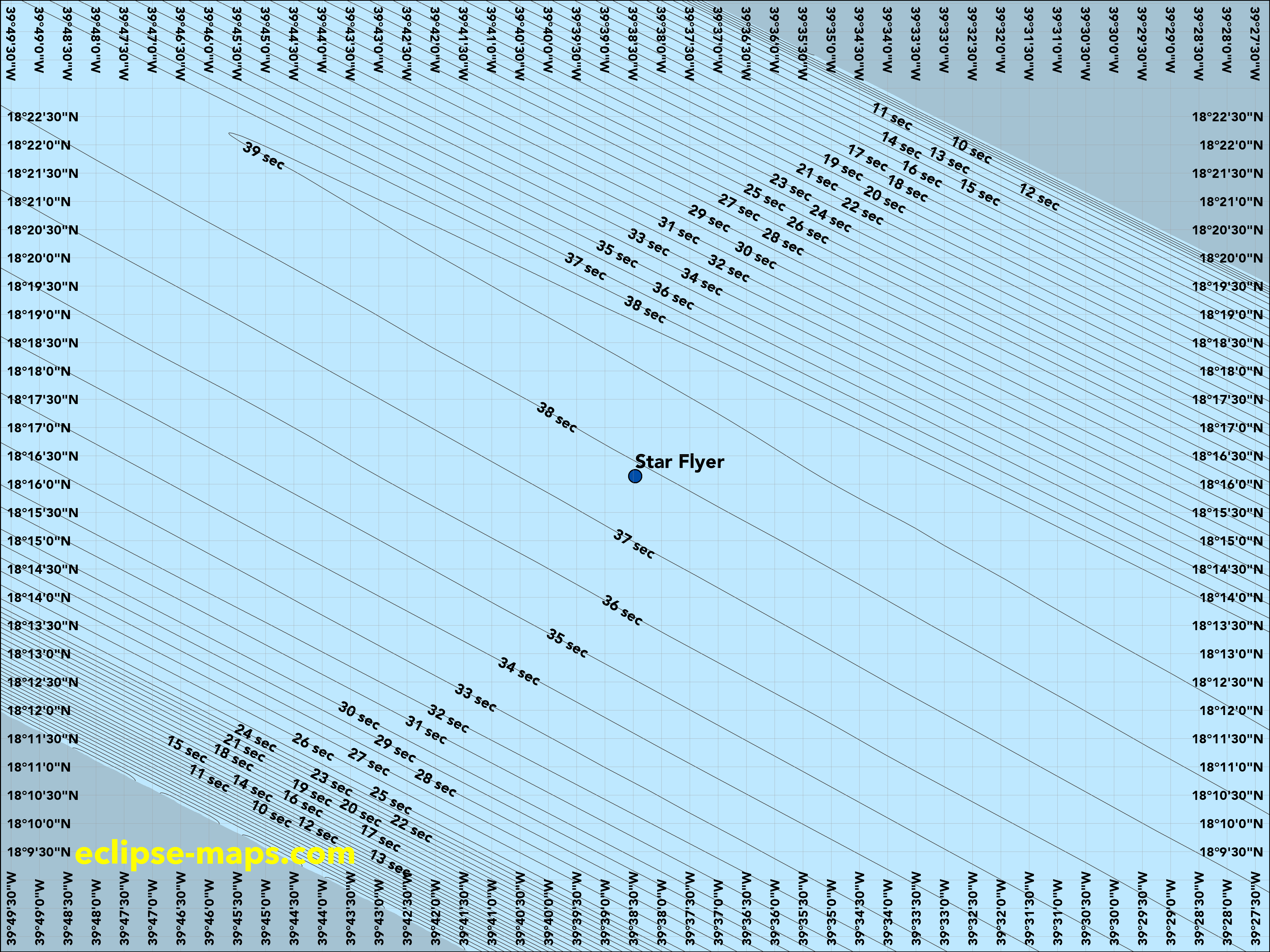
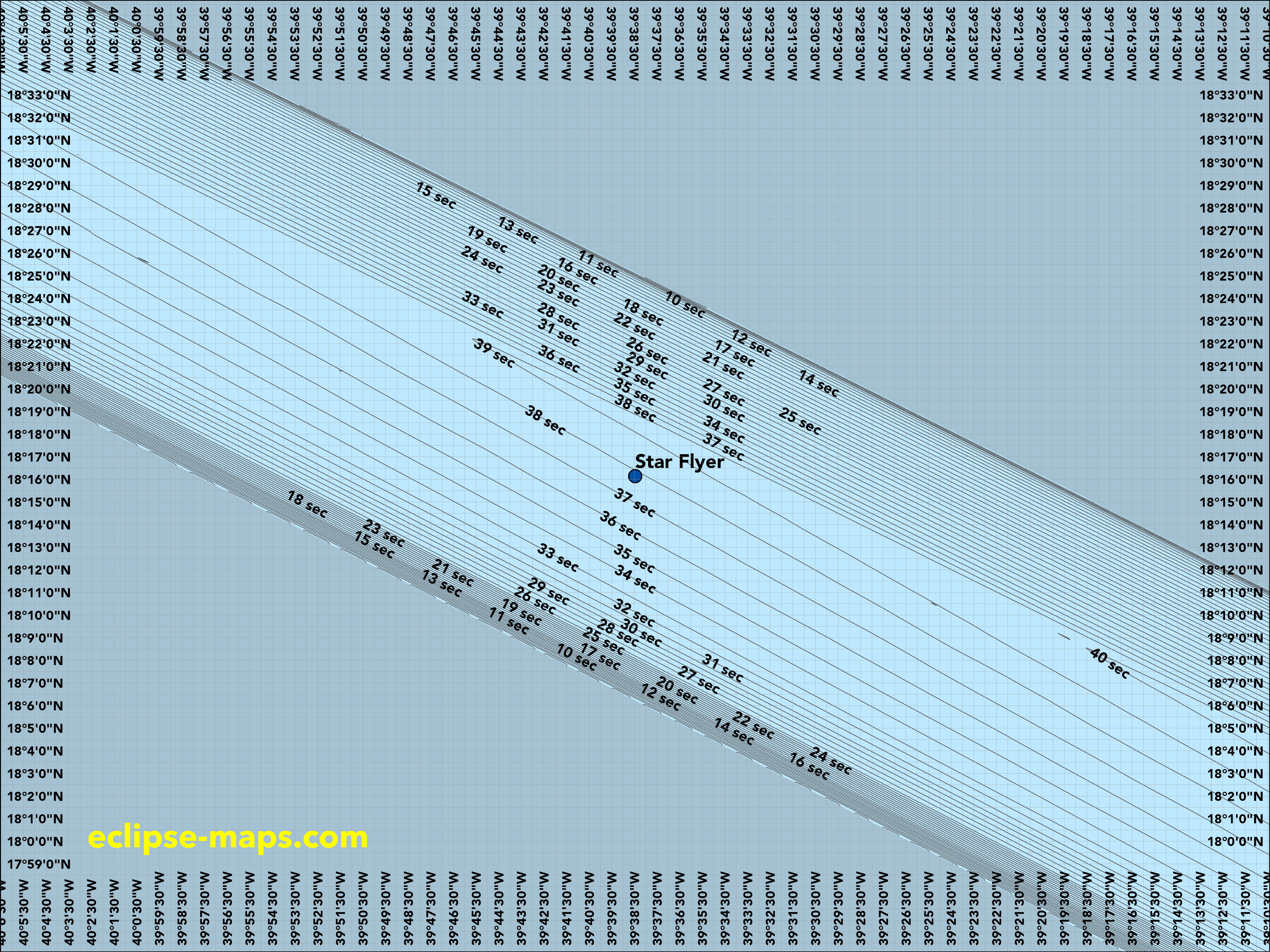
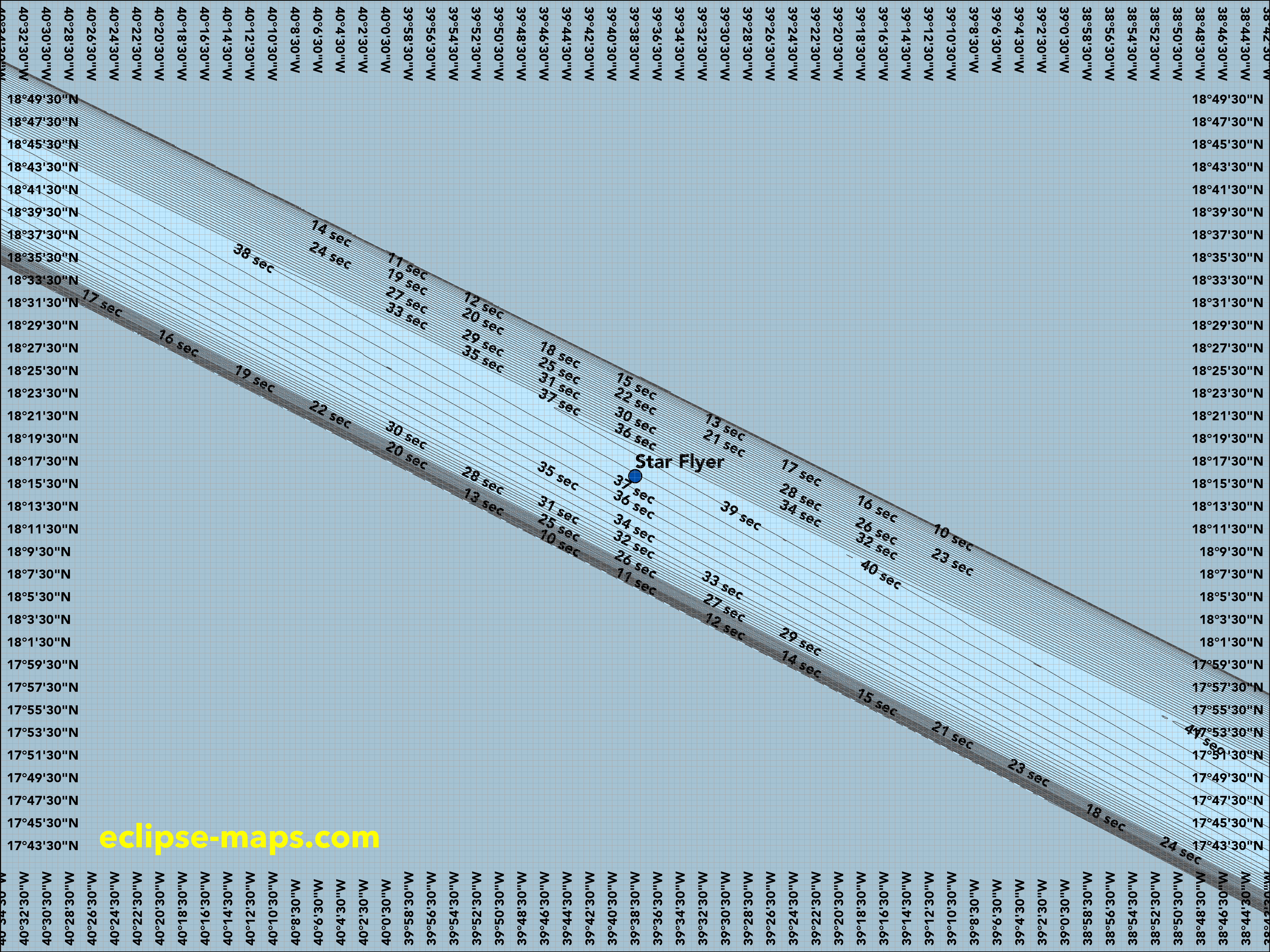
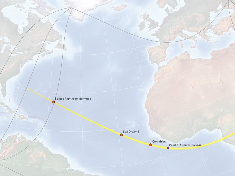
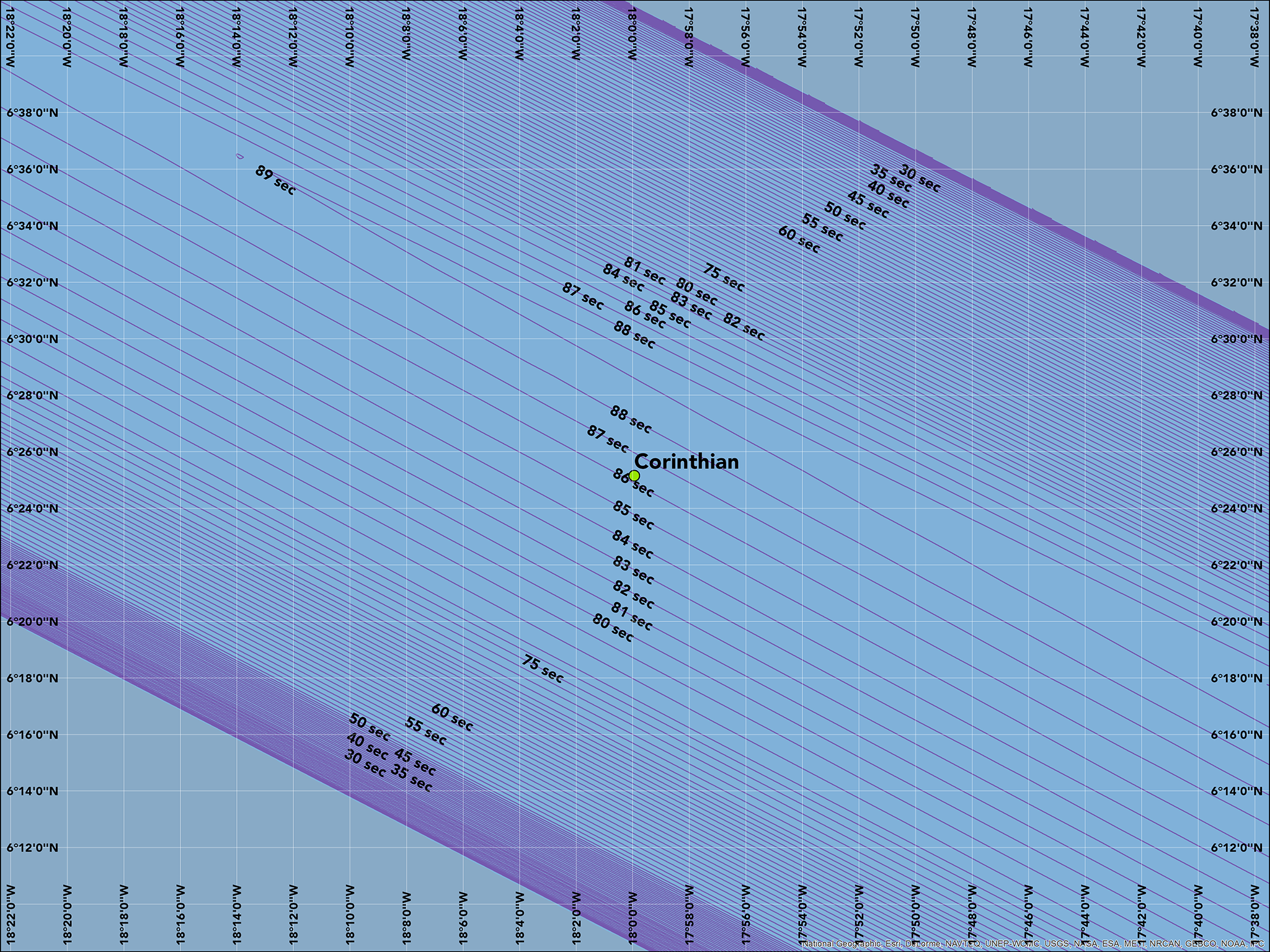
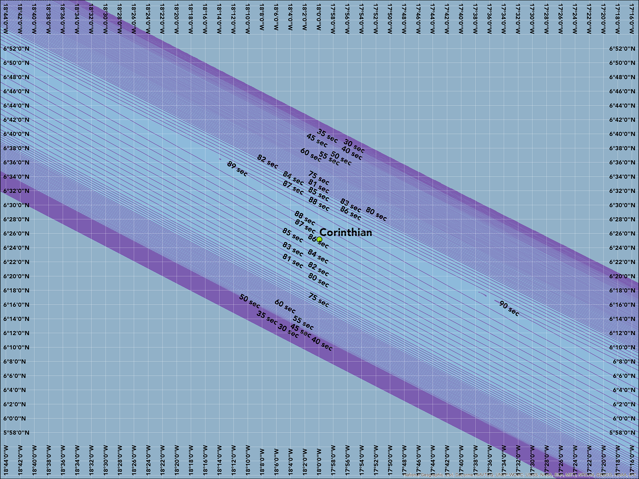
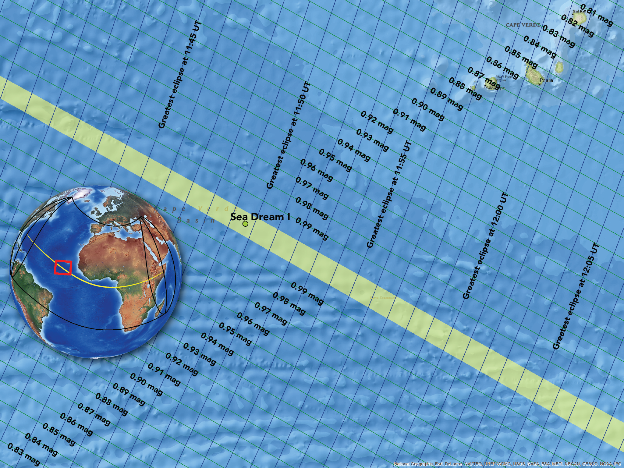
Several ships and aircraft will view the eclipse from the Atlantic Ocean. The tradeoff is this: a ship or aircraft will offer greater mobility then land transport in Africa, plus a potentially longer eclipse duration (up to about 1 minutes and 40 seconds) versus a less stable platform for astrophotography.
Target zone for the Sea Dream I
(large scale)
Target zone for the Sea Dream I
(medium scale)
Target zone for the Corinthian
(large scale)
Target zone for the Corinthian
(medium scale)
Overview of zone for the Sea Dream I
Overview of zone for the Corinthian
Overview at point of greatest eclipse
Overview approaching Sao Tome
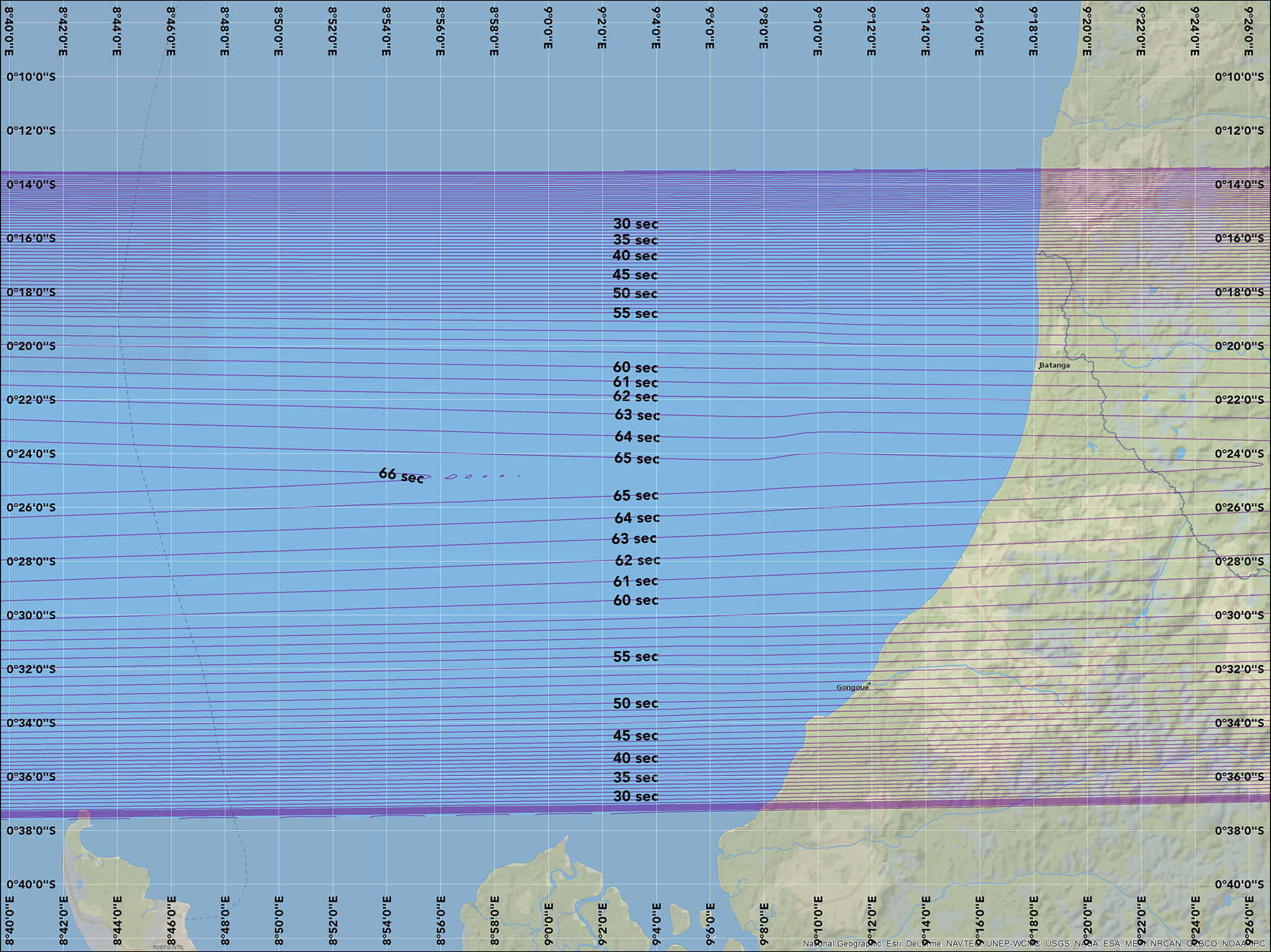
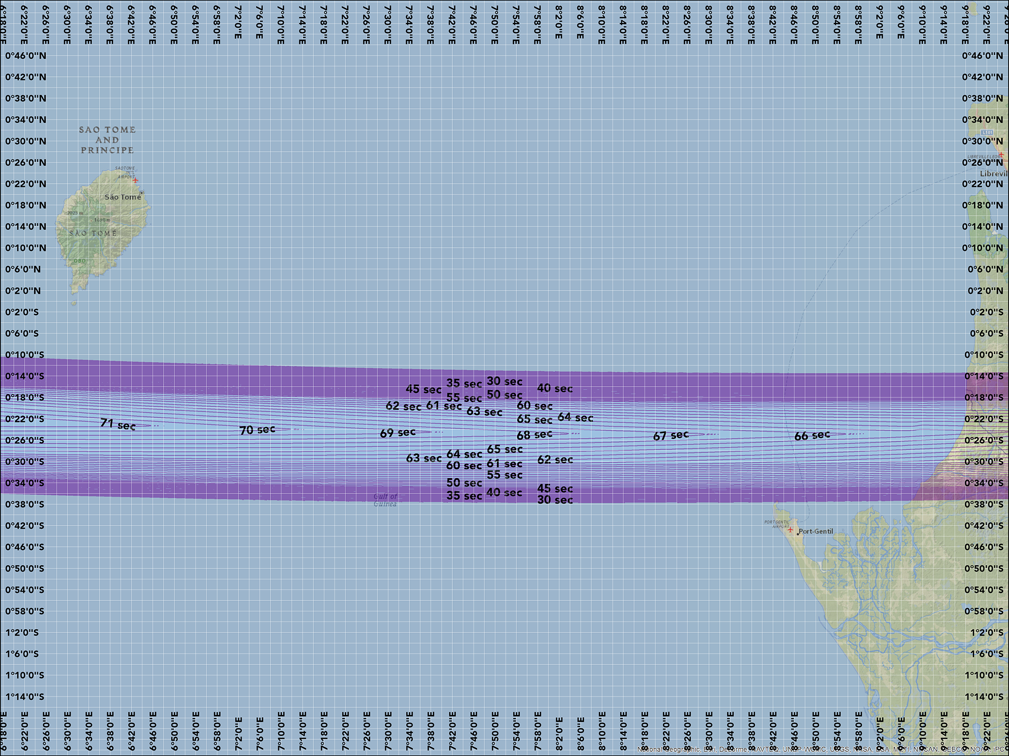
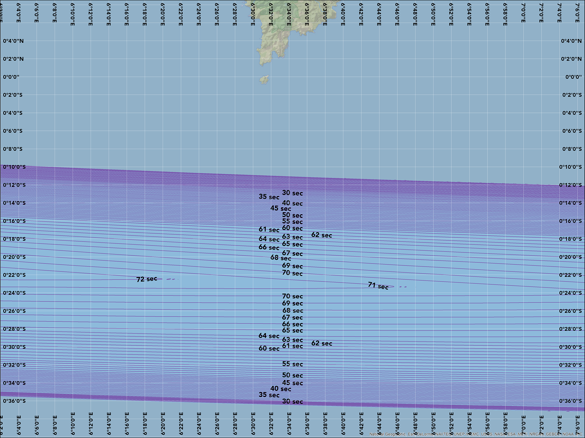
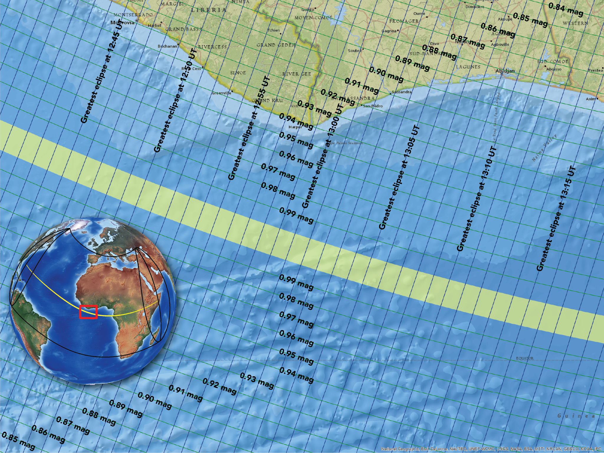
The equatorial African nation of Gabon is the first land fall for the total solar eclipse. While the cloud-cover prospects are less then ideal, some eclipse chasers are choosing Gabon due to the longer duration of eclipse (about a minute) compared with a duration of a dozen or fewer seconds in eastern Africa.
Overland travel in Gabon is difficult but a train from Libreville stops at Lope National Park where one can combine an eclipse experience with wildlife viewing. Another possibility is the northern tip of the Port Gentil peninsula where about 27 seconds of totality will be visible.
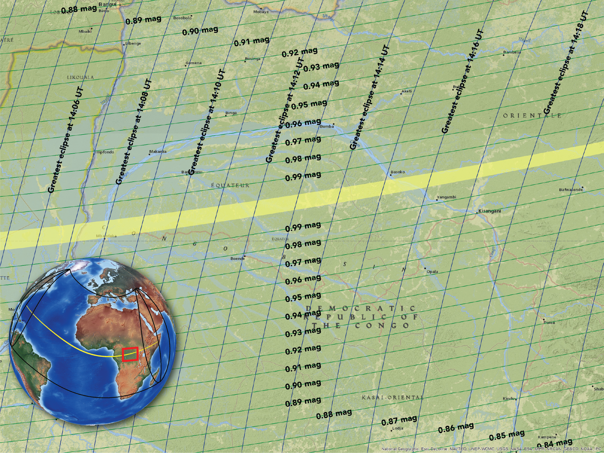
It is not expected that western eclipse chasers will visit the Congo because of political instability.
Durations for the Sao Tome and Gabon coastal area
Durations at sea below Sao Tome
Durations for the coast of Gabon
Overview of coastal Gabon
Overview of the interior of Gabon
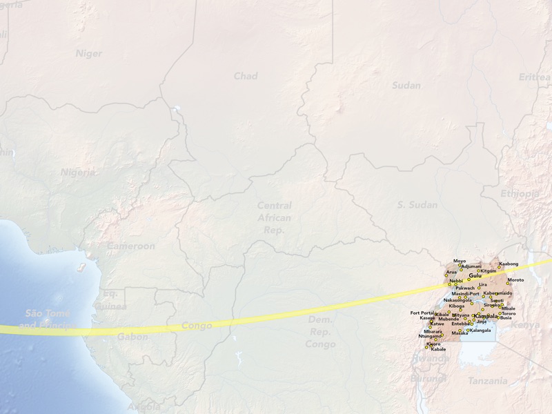
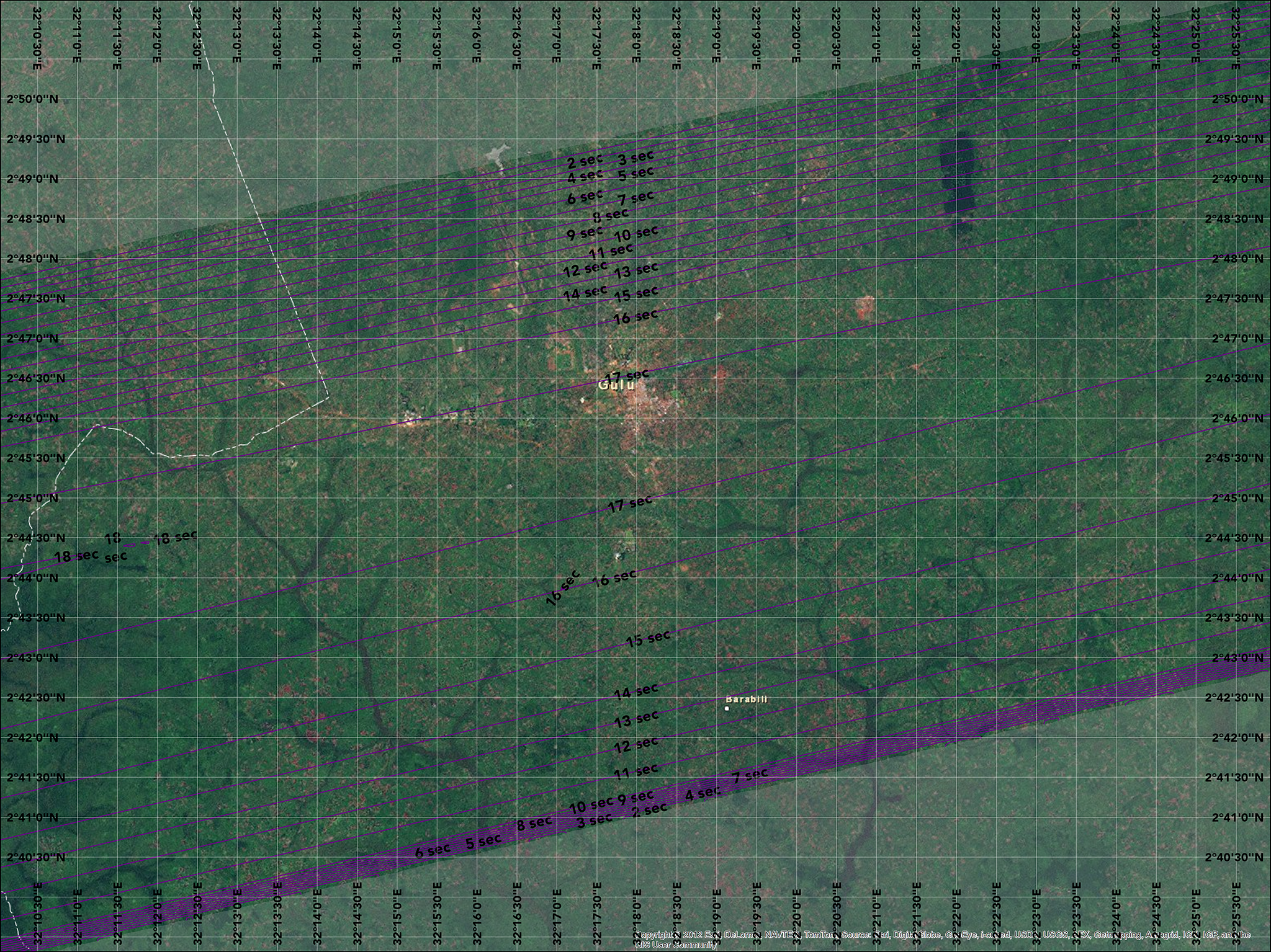
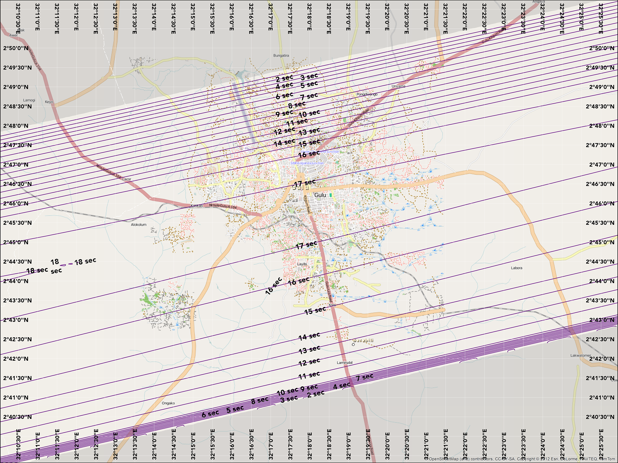
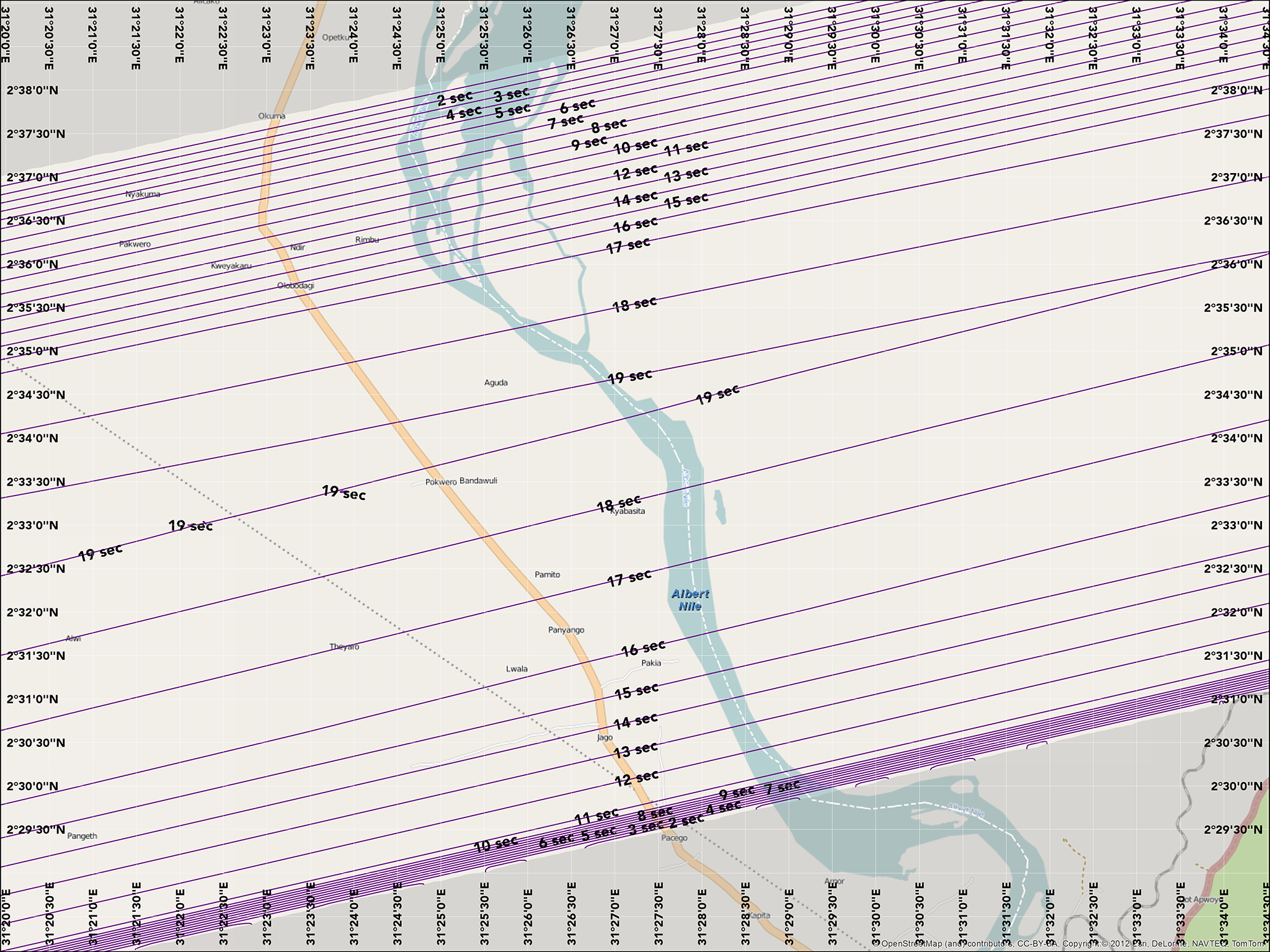
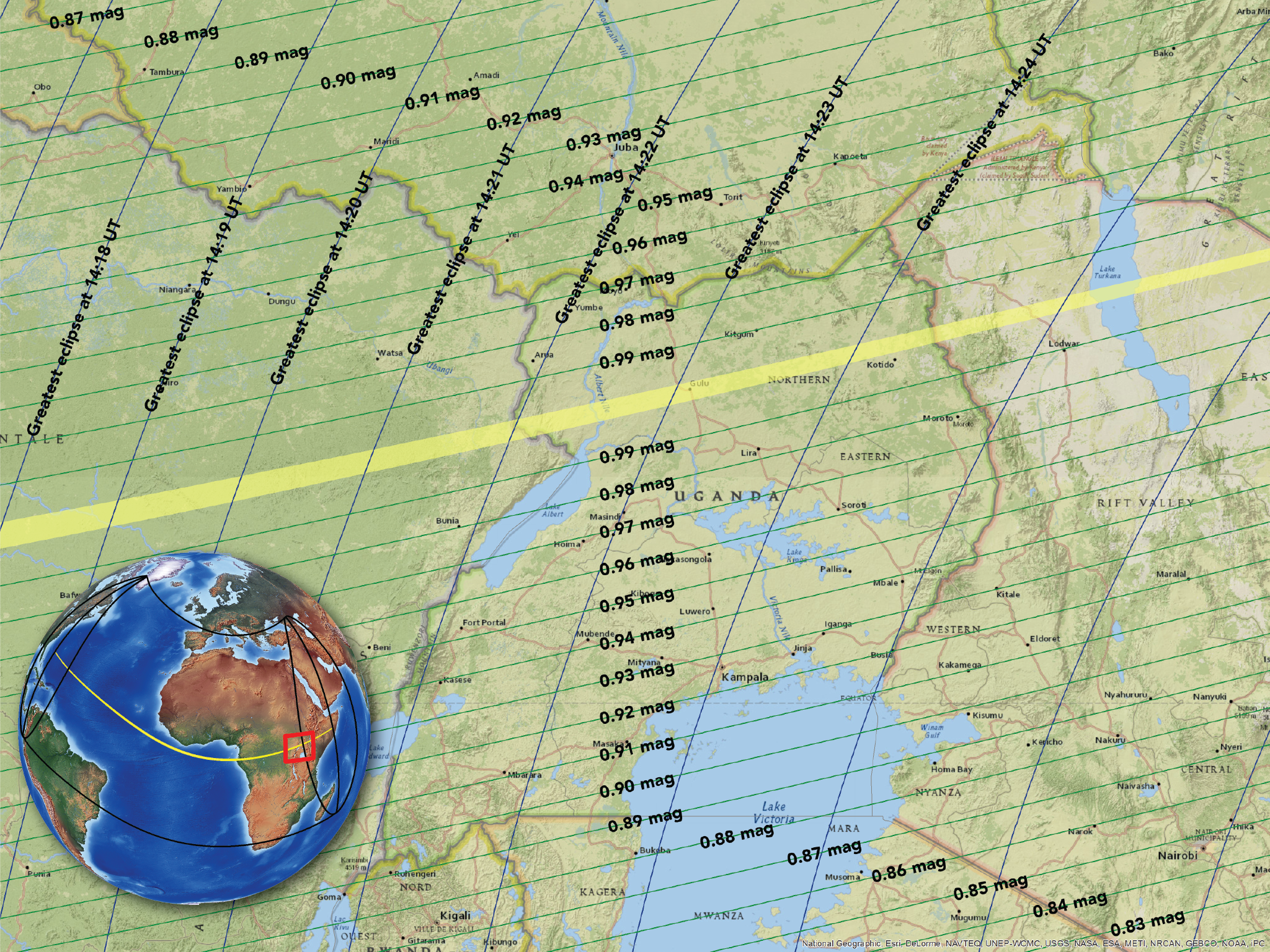
Uganda is another destination for eclipse tourists. The city of Gulu is the largest populated city along the track of the eclipse and the village of Pokwero is accessible via a road north from Lake Albert.
Note that these maps incorporate precise corrections for the actual shape of the moon. Compared to classical eclipse calculations, the durations are slightly shorter and the limit lines are a bit narrower.
You’ll see in the animated map that the shape of the moon’s shadow is stretched and irregular as it crosses Uganda. This is the actual shape of the moon’s shadow applying computations from Solar Eclipse Maestro, http://xjubier.free.fr/en/site_pages/solar_eclipses/Solar_Eclipse_Maestro_Photography_Software.html
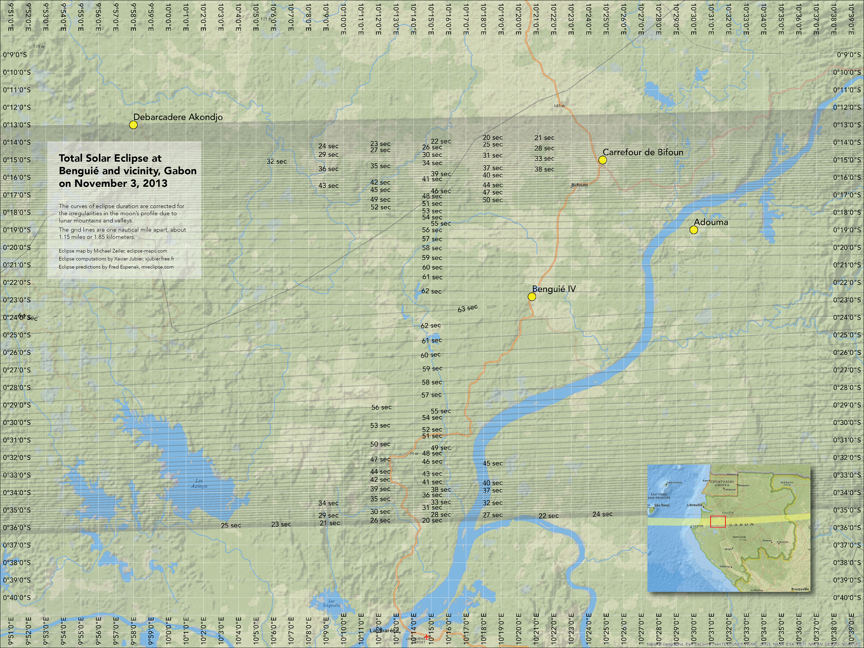


Durations at Benguie, Gabon
Durations at Wonga Wongue, Gabon
Overview of durations across Gabon
Durations at Lope National Park, Gabon
Durations at Massoukou, Gabon
Durations at Ndjole, Gabon

Durations at Tebe, Gabon
Durations on street map of Gulu, Uganda
Durations on imagery map of Gulu, Uganda
Durations on street map of Pokwero, Uganda
Durations on imagery map of Pokwero, Uganda
Overview map of Uganda
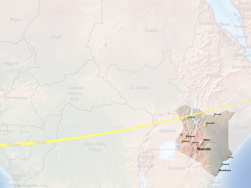
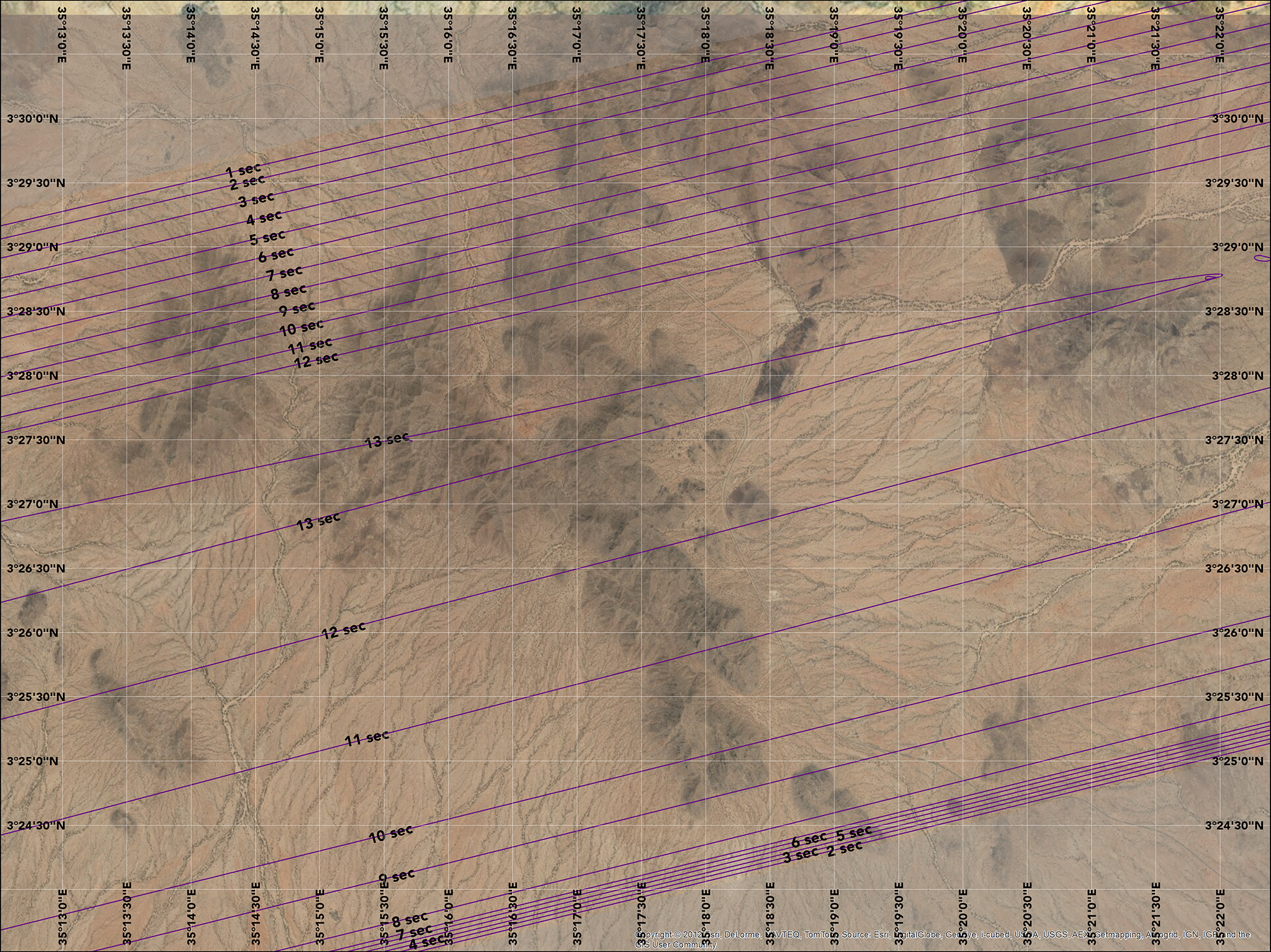
Kenya will be a popular destination for eclipse tourists. While the eclipse duration is this country is only a dozen seconds or less, the northwest region of Kenya has excellent weather prospects. Even though the eclipse will be brief, viewers in this area will enjoy an extended view of the sun’s chromosphere (the innermost red region of the sun’s corona) and a fantastic display of Baily’s Beads.
Note that these maps incorporate precise corrections for the actual shape of the moon. Compared to classical eclipse calculations, the durations are slightly shorter and the limit lines are a bit narrower.
You’ll see in the animated map that the shape of the moon’s shadow is progressively more stretched and irregular as it crosses Kenya. This is the actual shape of the moon’s shadow applying computations from Solar Eclipse Maestro.
Durations on street map near Lodwar, Kenya
Durations on imagery map near Lodwar, Kenya
Durations on street map at Lake Turkana, Kenya
Durations on imagery map at Lake Turkana, Kenya
Overview map of Kenya
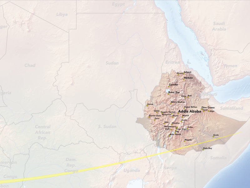
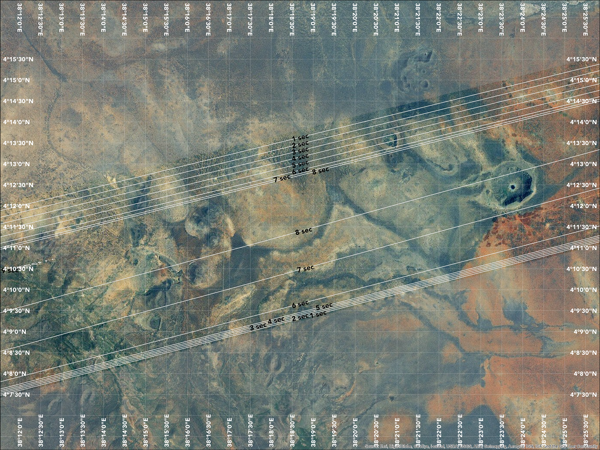
The eclipse races to an end near sunset at Ethiopia. This area also enjoys favorable weather prospects and holds an appeal for those seeking a dramatic view of a total solar eclipse near sunset.
Note that these maps incorporate precise corrections for the actual shape of the moon. Compared to classical eclipse calculations, the durations are slightly shorter and the limit lines are a bit narrower.
You’ll see in the animated map that the shape of the moon’s shadow is progressively more stretched and irregular as it crosses Ethiopia. This is the actual shape of the moon’s shadow applying computations from Solar Eclipse Maestro.
Durations on street map near Madacho, Ethiopia
Durations on imagery map near Madacho, Ethiopia
Overview map of Ethiopia
You can view a slideshow of many of the maps on this page by clicking on any map below.
Target zone for the Star Flyer
(large scale)
Target zone for the Star Flyer
(medium scale)
Target zone for the Star Flyer
(small scale)
Target zone for the Star Flyer
(corrected umbral shapes)