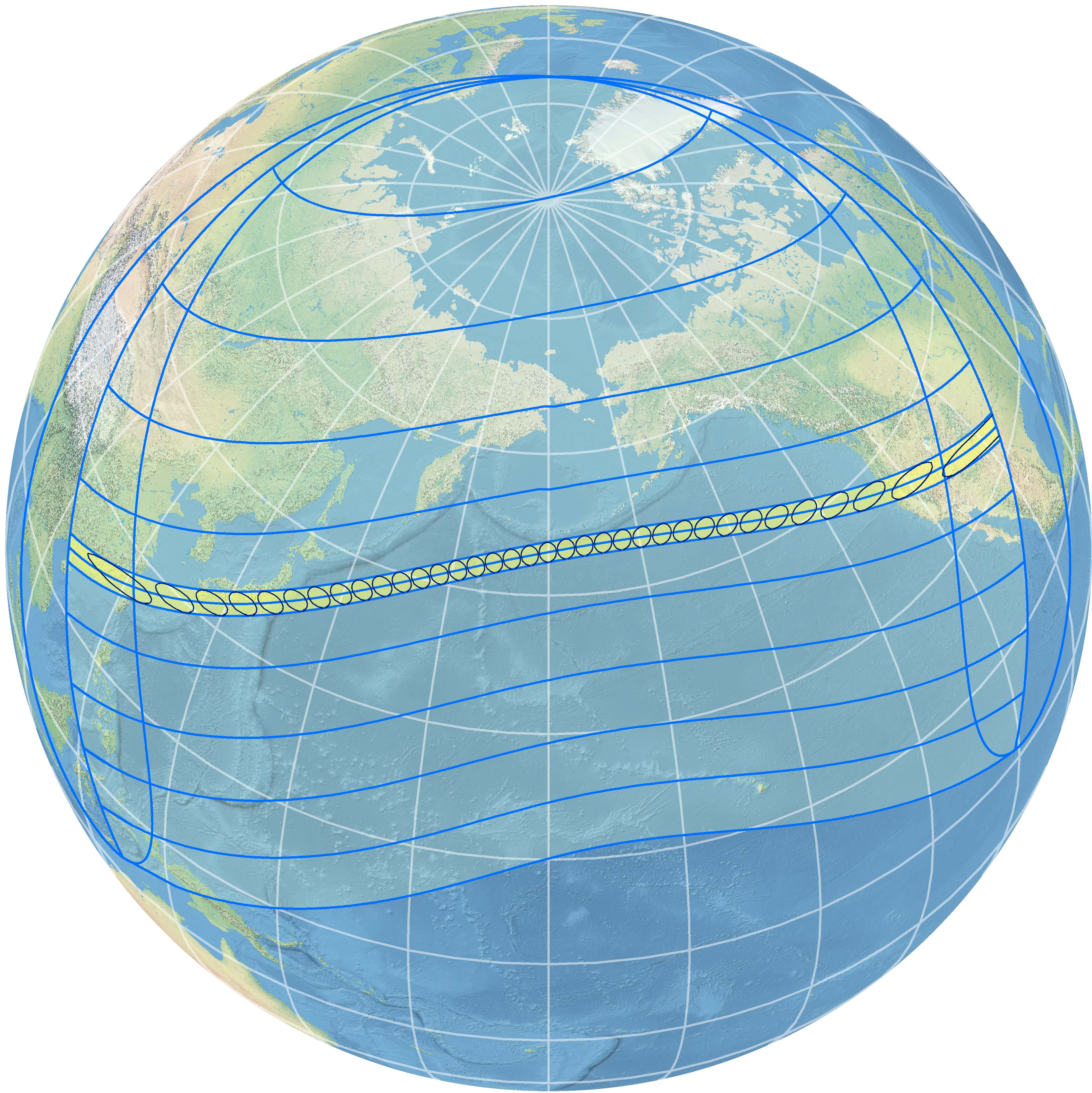
The annular solar eclipse of May 20-21, 2012 over China, Japan, and United States
I live within the path of this eclipse near Santa Fe, New Mexico USA. Over an 10-day period in May 2011, I watched the skies carefully for a preview of the weather prospects for eclipse day. From my experience living here, May is a generally good month for clear skies but this is not certain and you should plan for mobility as these photos attest. Below are some for first contact and time of greatest eclipse for these days (4th contact is after sunset).
At my location (35 44’ North, 106 00’ East), first contact is at 6:27 PM Mountain Daylight Time, second contact is at 7:33 PM MDT, third contact is at 7:36 PM MDT, sunset is at 8:04 PM MDT, and fourth contact is at 8:35 PM MDT. Click on each photo for a larger view.
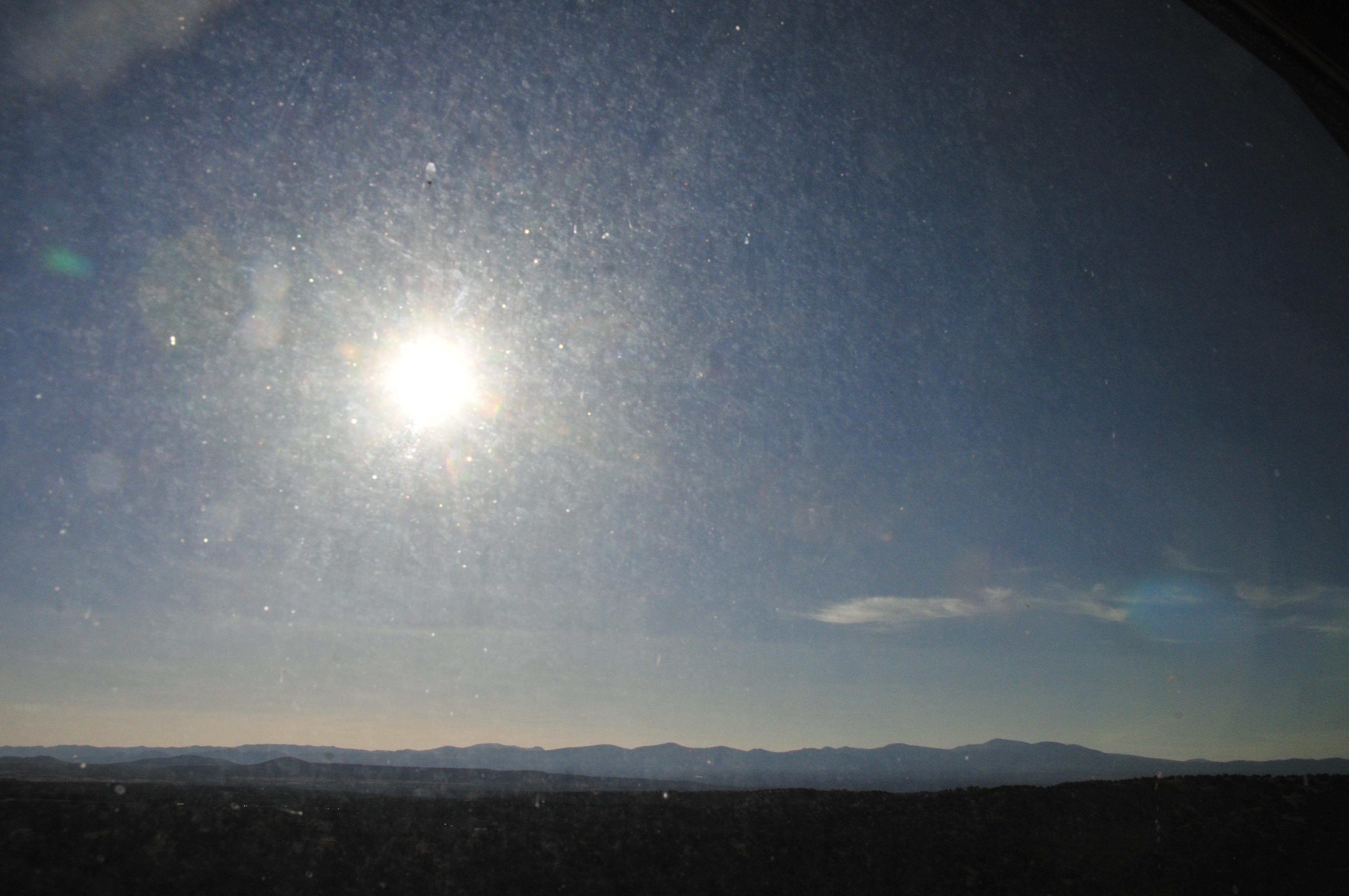
May 15, 2011
time of 1st contact
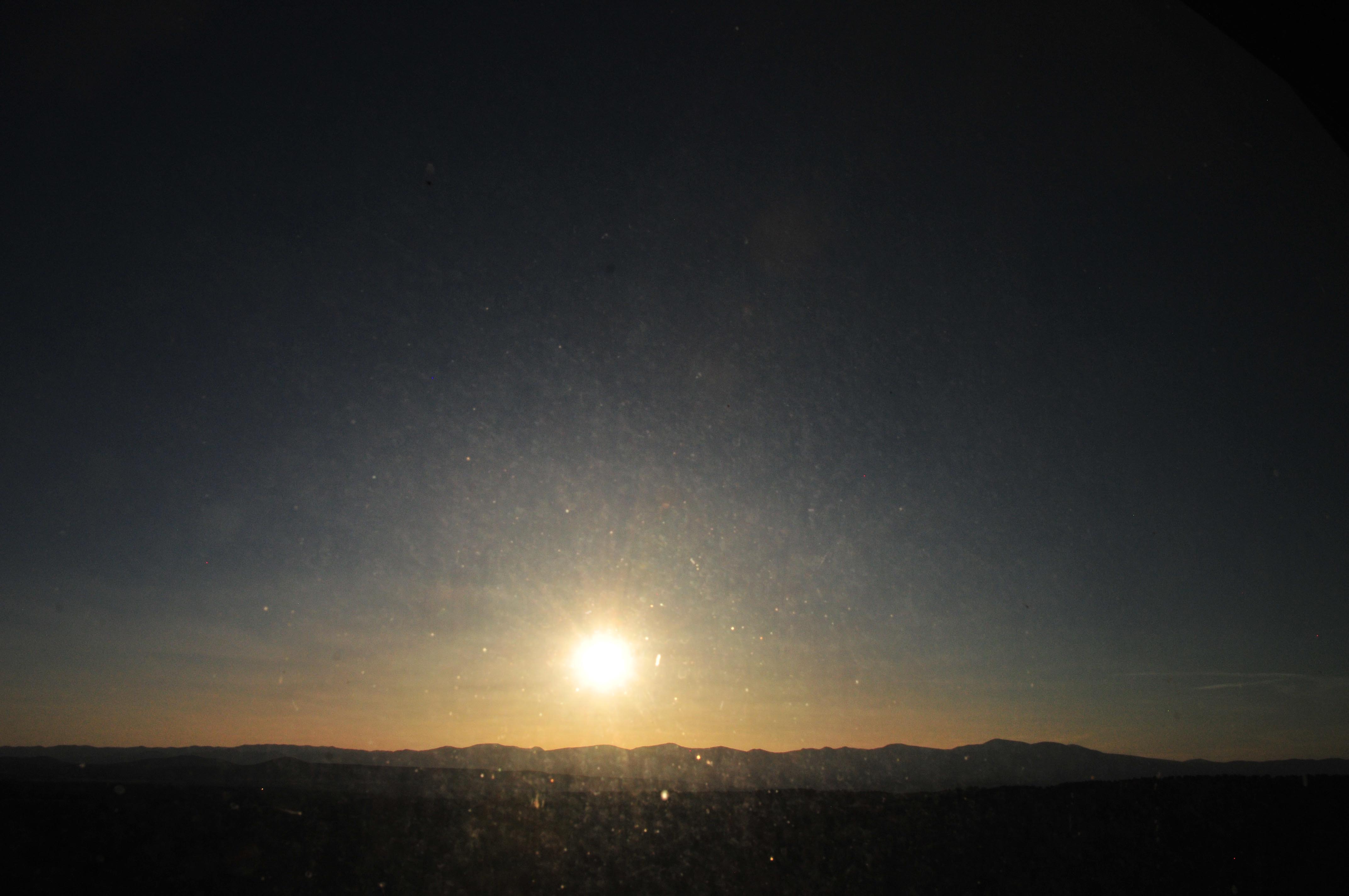
May 15, 2011
time of greatest eclipse
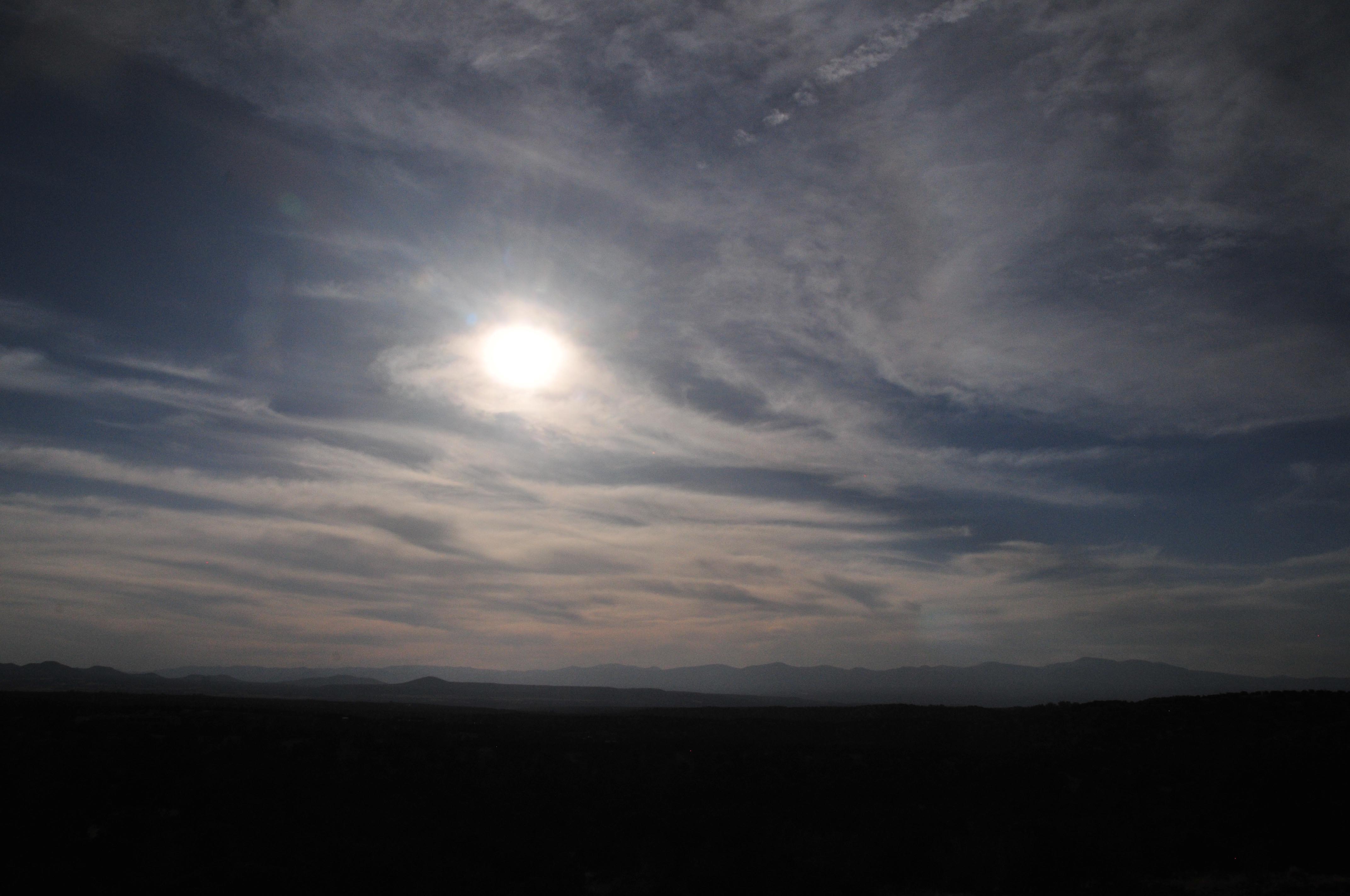
May 16, 2011
time of 1st contact
May 16, 2011
time of greatest eclipse
May 17, 2011
time of 1st contact
May 17, 2011
time of greatest eclipse
May 18, 2011
time of 1st contact
May 18, 2011
time of greatest eclipse
May 19, 2011
time of 1st contact
May 19, 2011
time of greatest eclipse
May 20, 2011
time of 1st contact
May 20, 2011
time of greatest eclipse
May 21, 2011
time of 1st contact
May 21, 2011
time of greatest eclipse
May 22, 2011
time of 1st contact
May 22, 2011
time of greatest eclipse
May 23, 2011
time of 1st contact
May 23, 2011
time of greatest eclipse
May 24, 2011
time of 1st contact
May 24, 2011
time of greatest eclipse
May 25, 2011
time of 1st contact
May 25, 2011
time of greatest eclipse
May 26, 2011
time of 1st contact
May 26, 2011
time of greatest eclipse


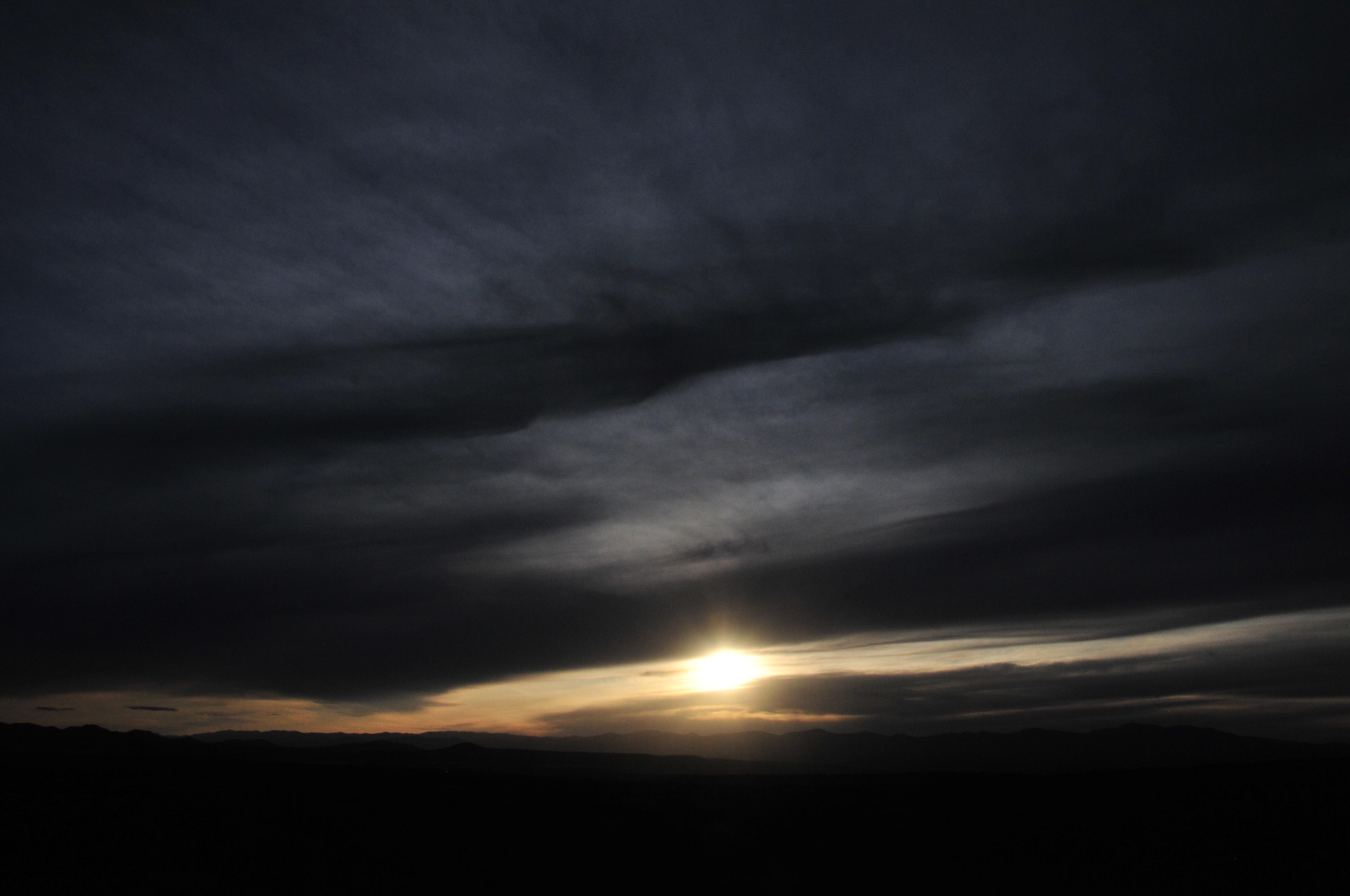
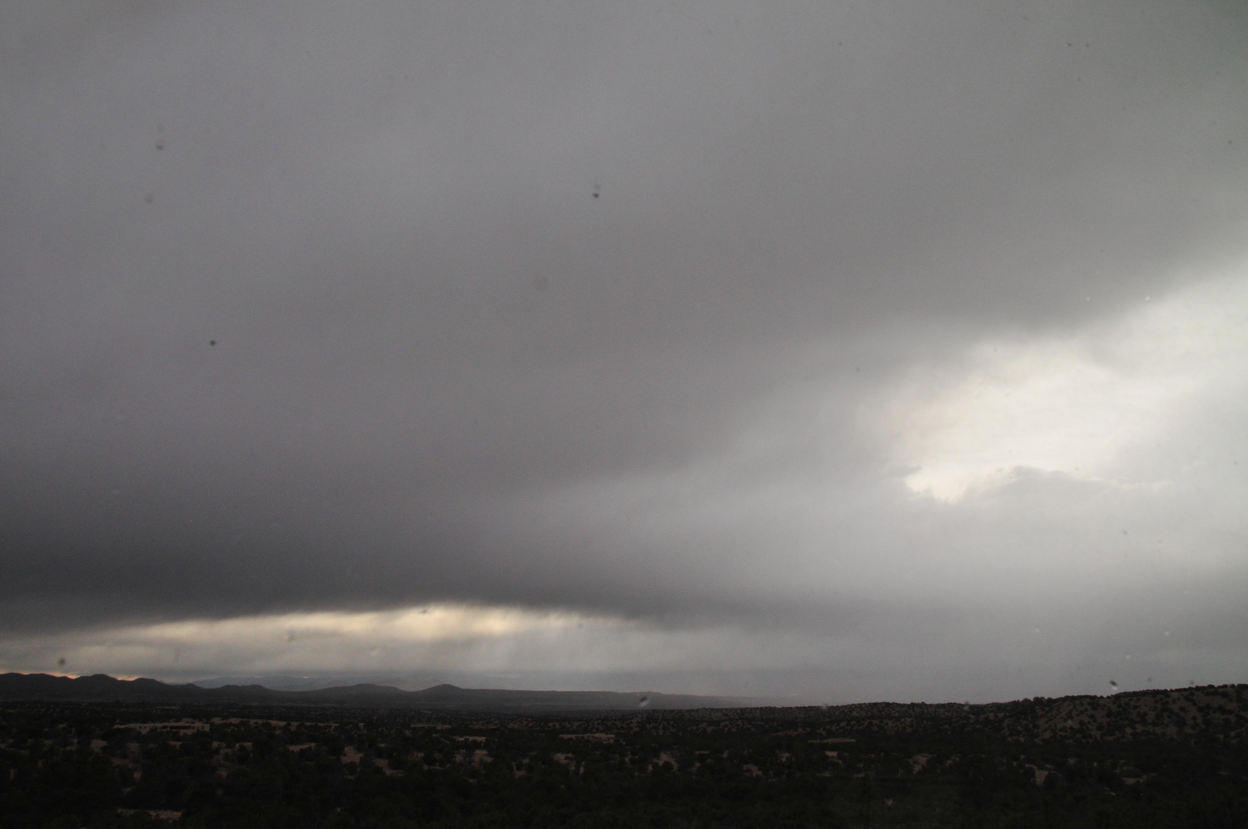
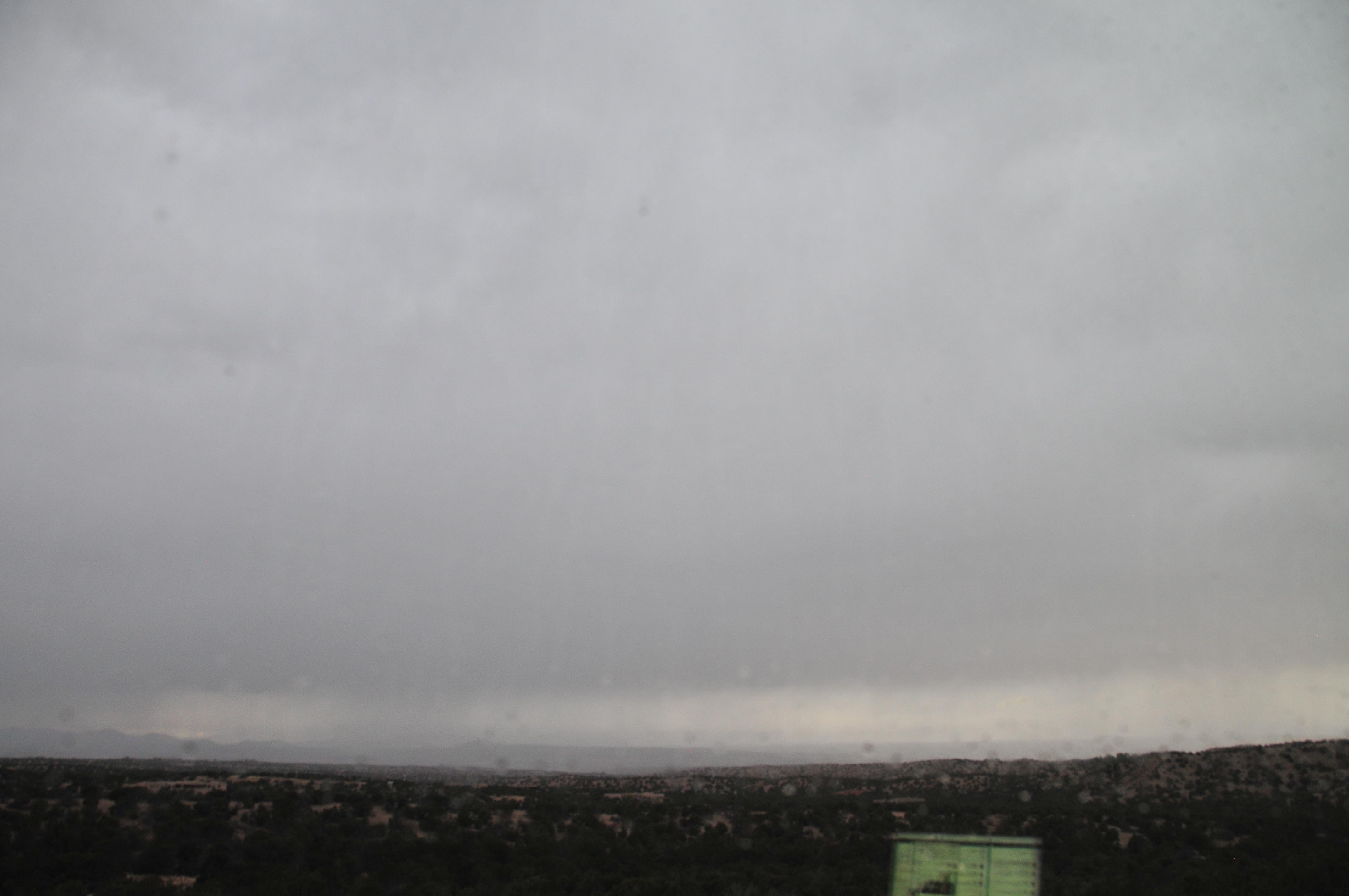
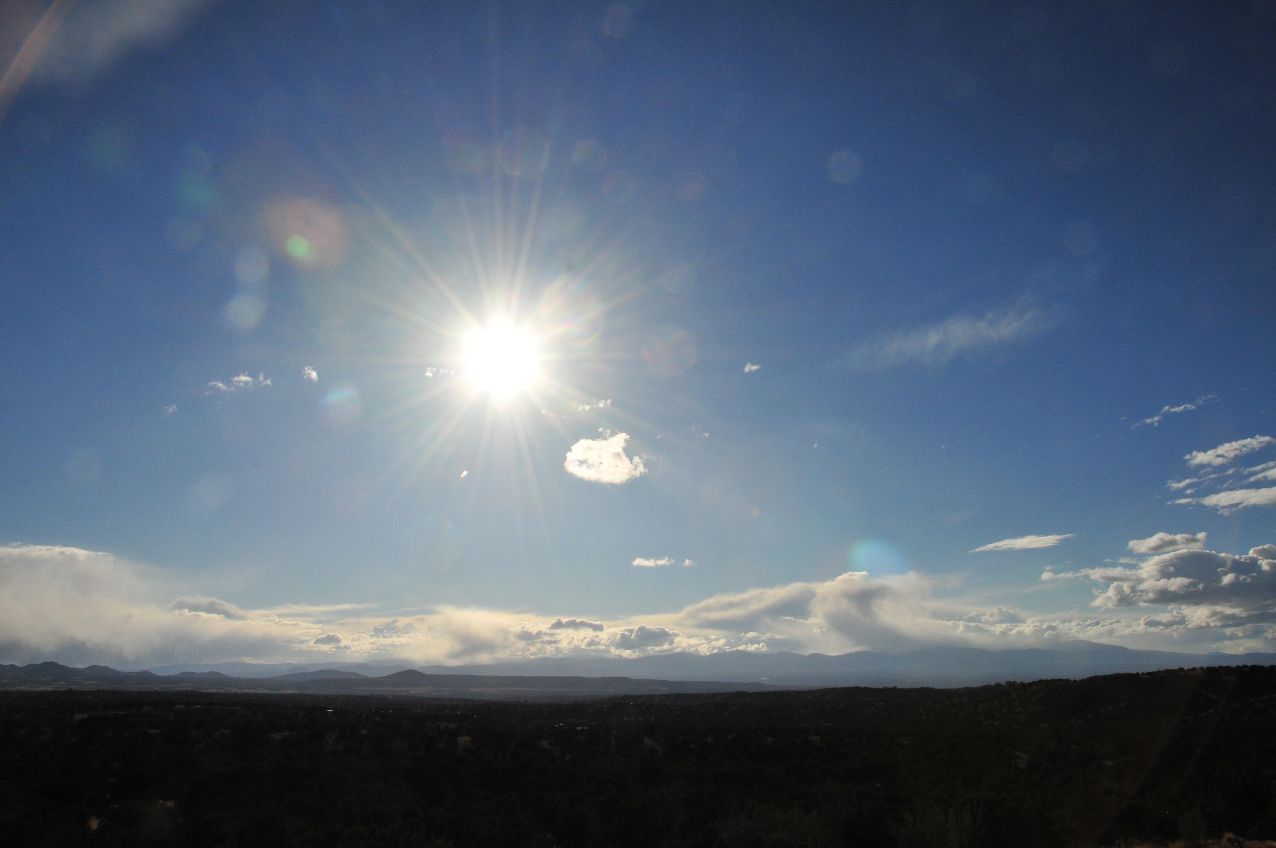
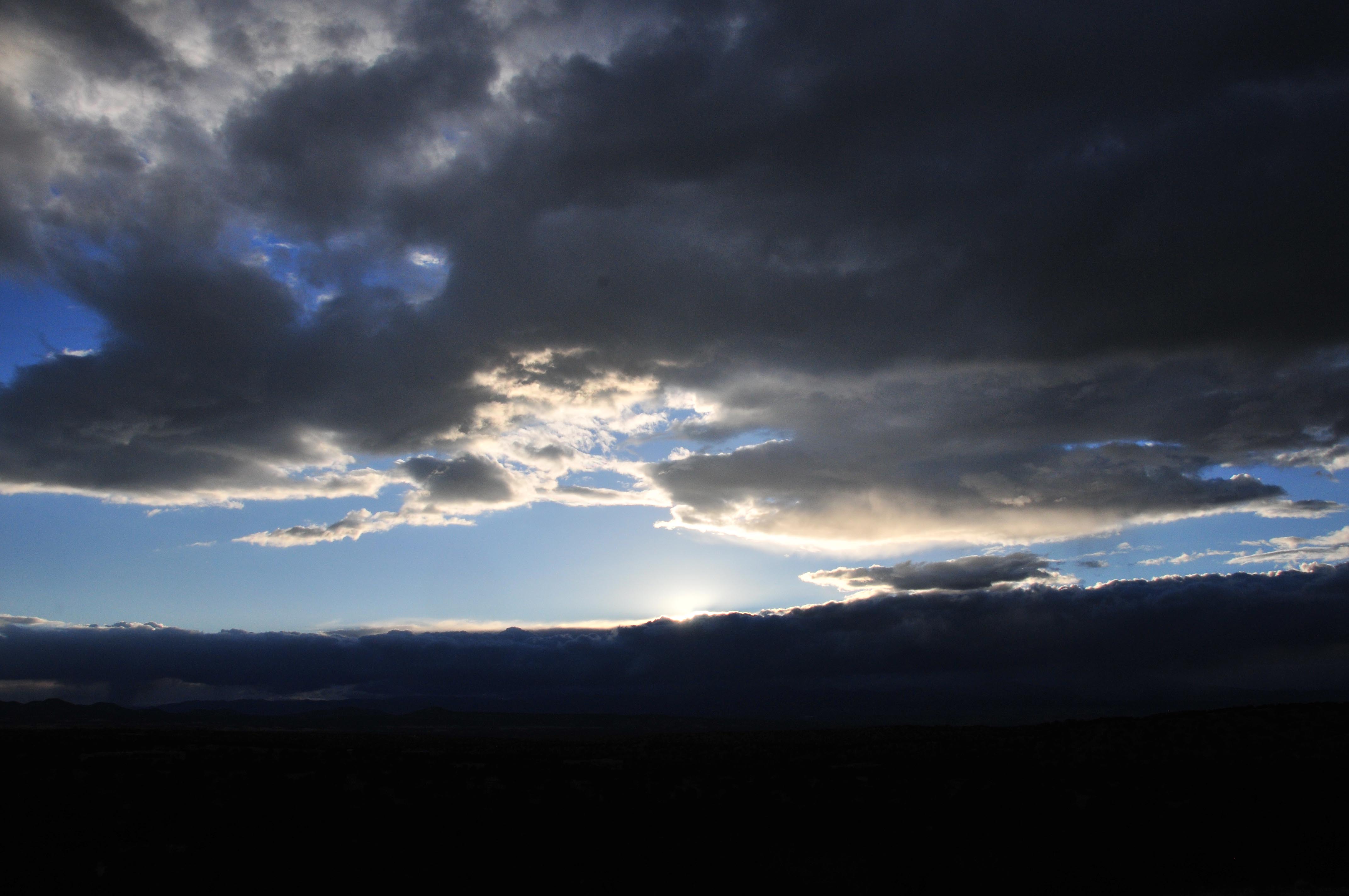


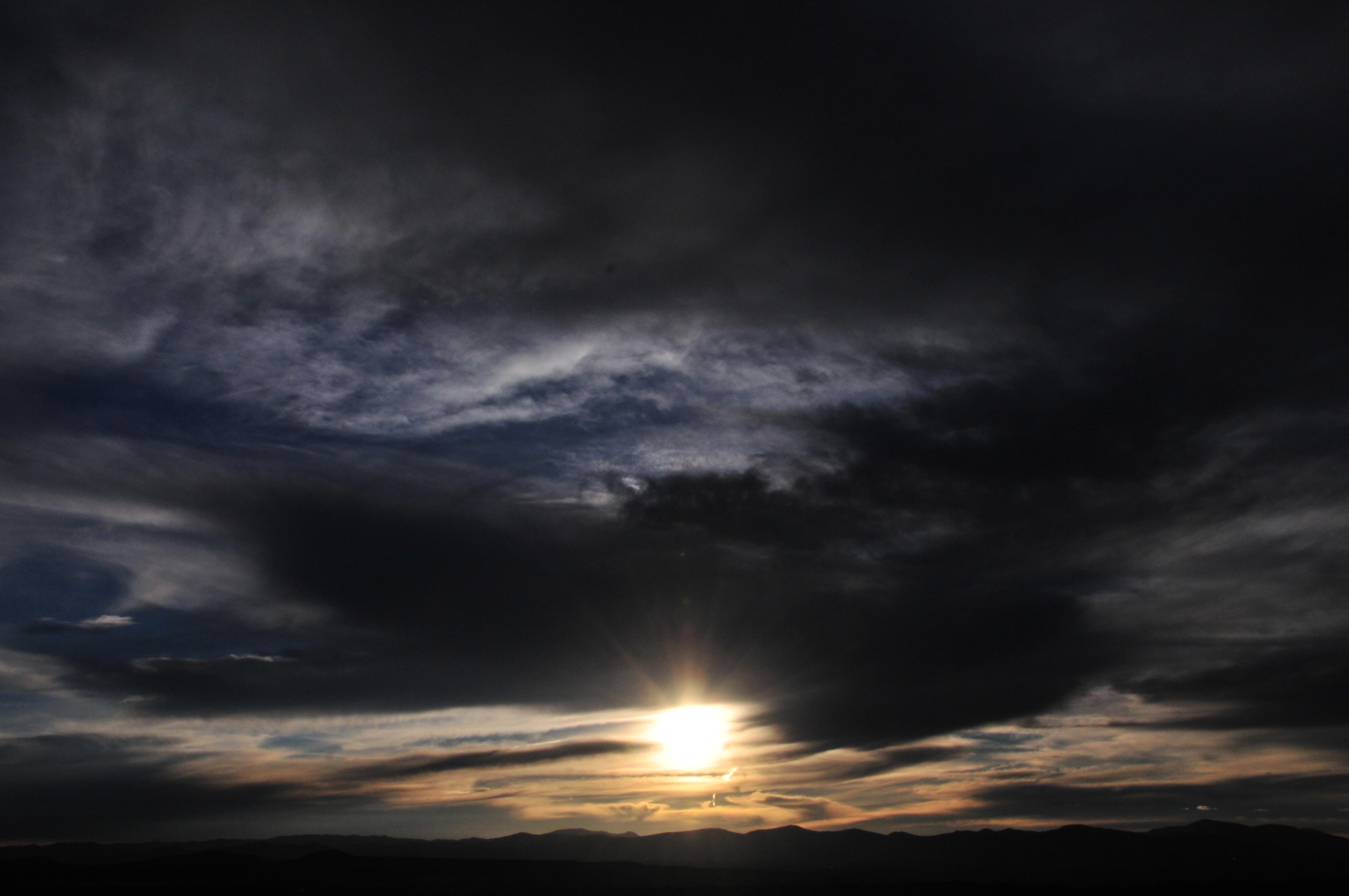
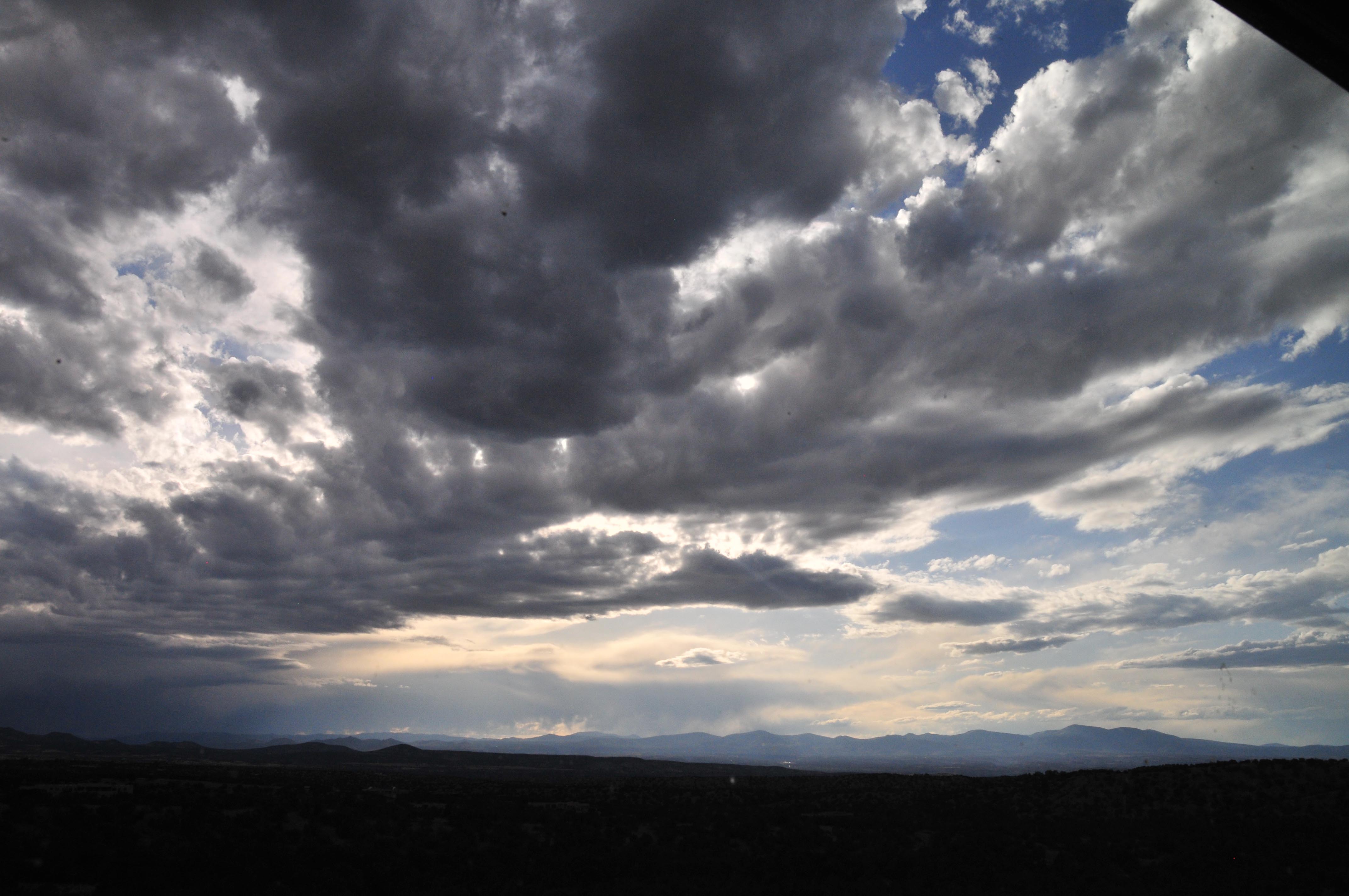
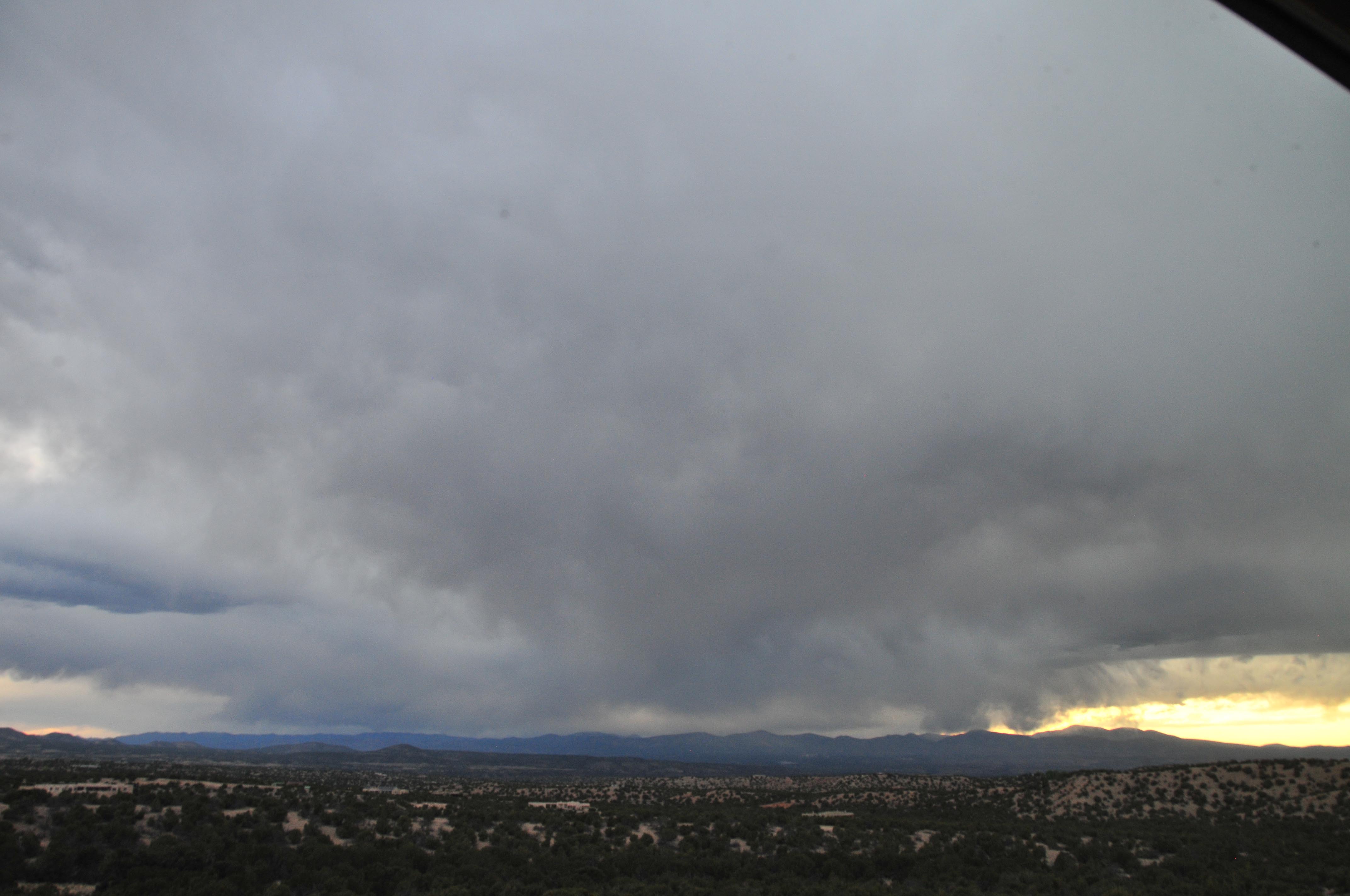
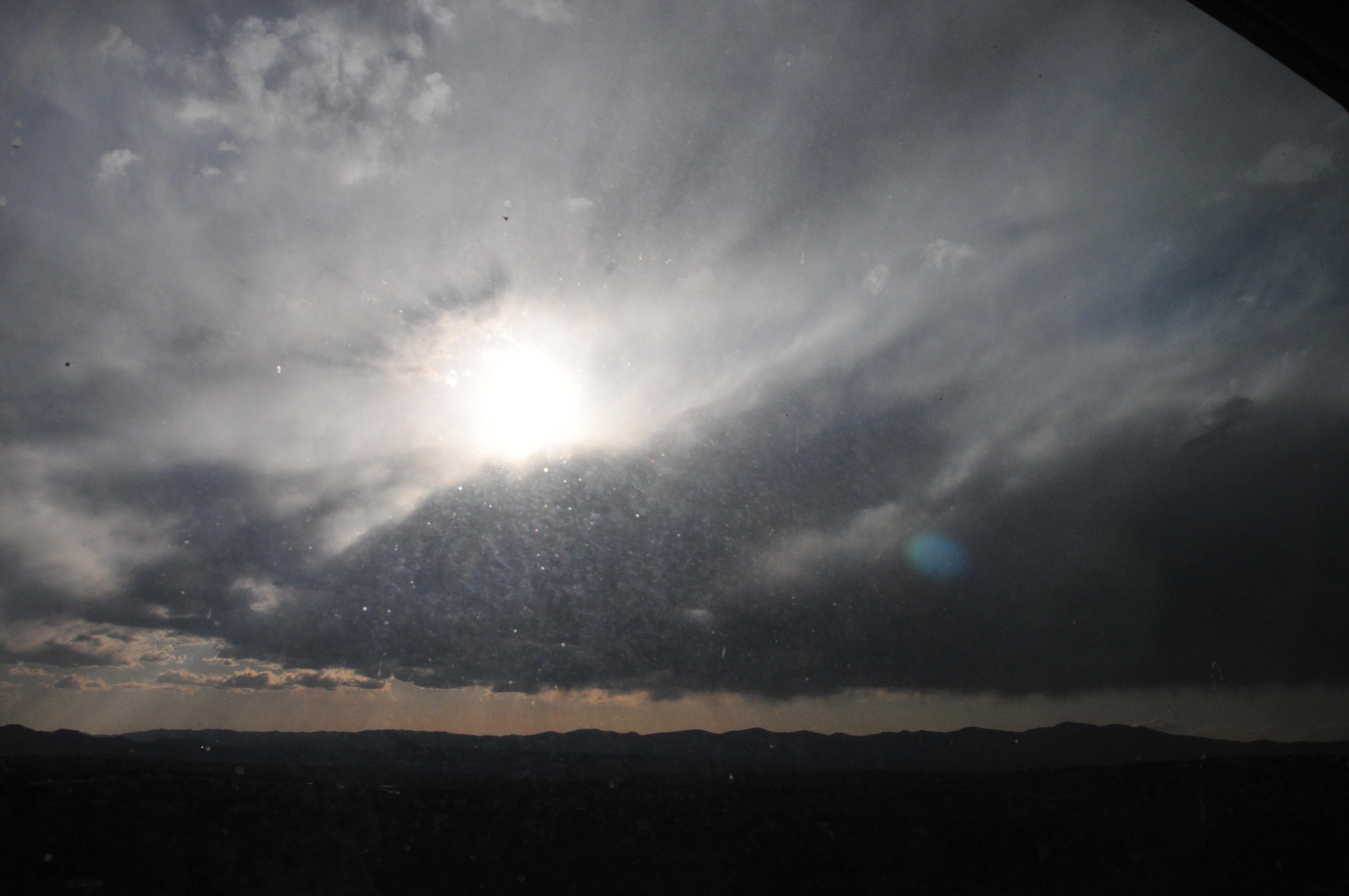
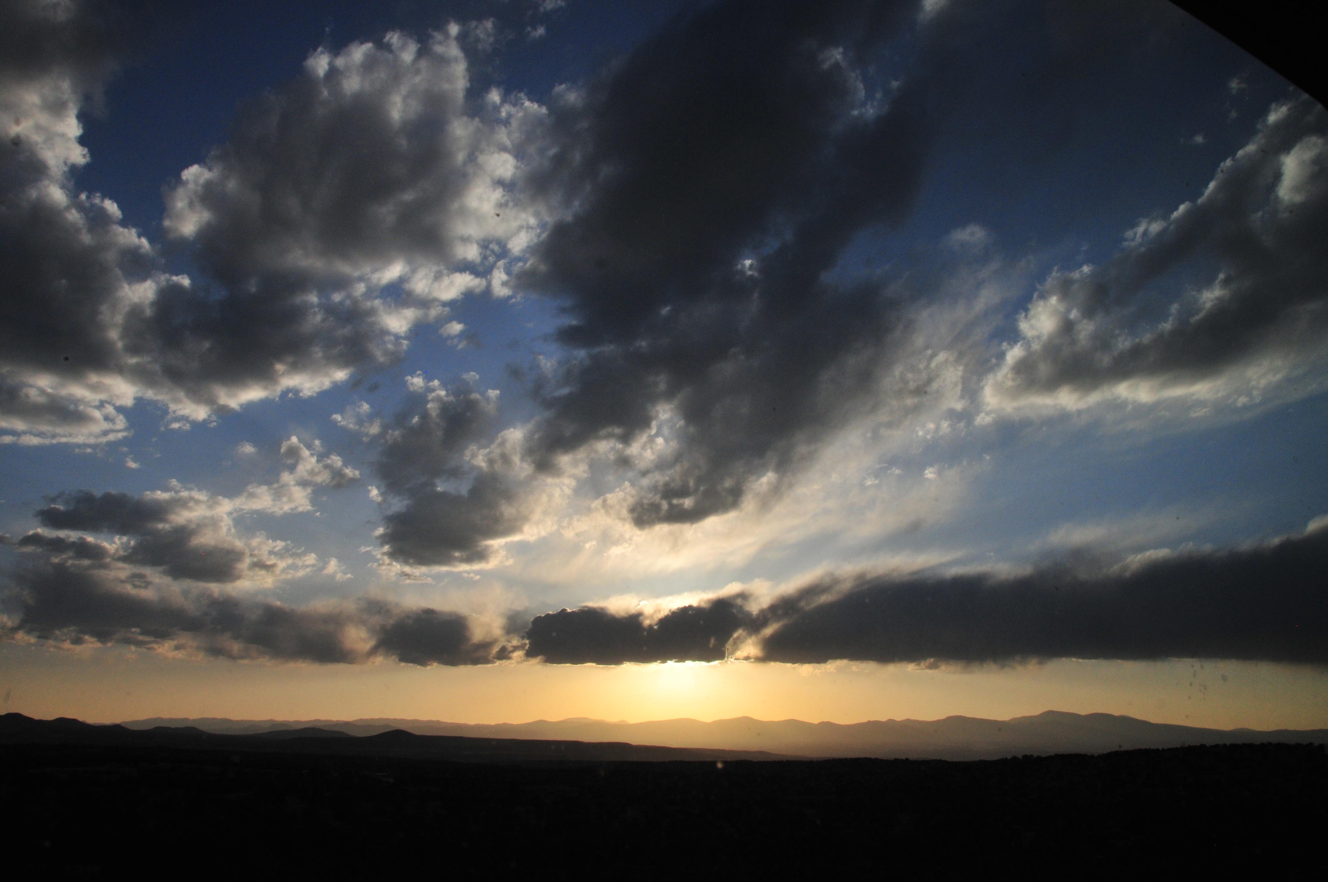
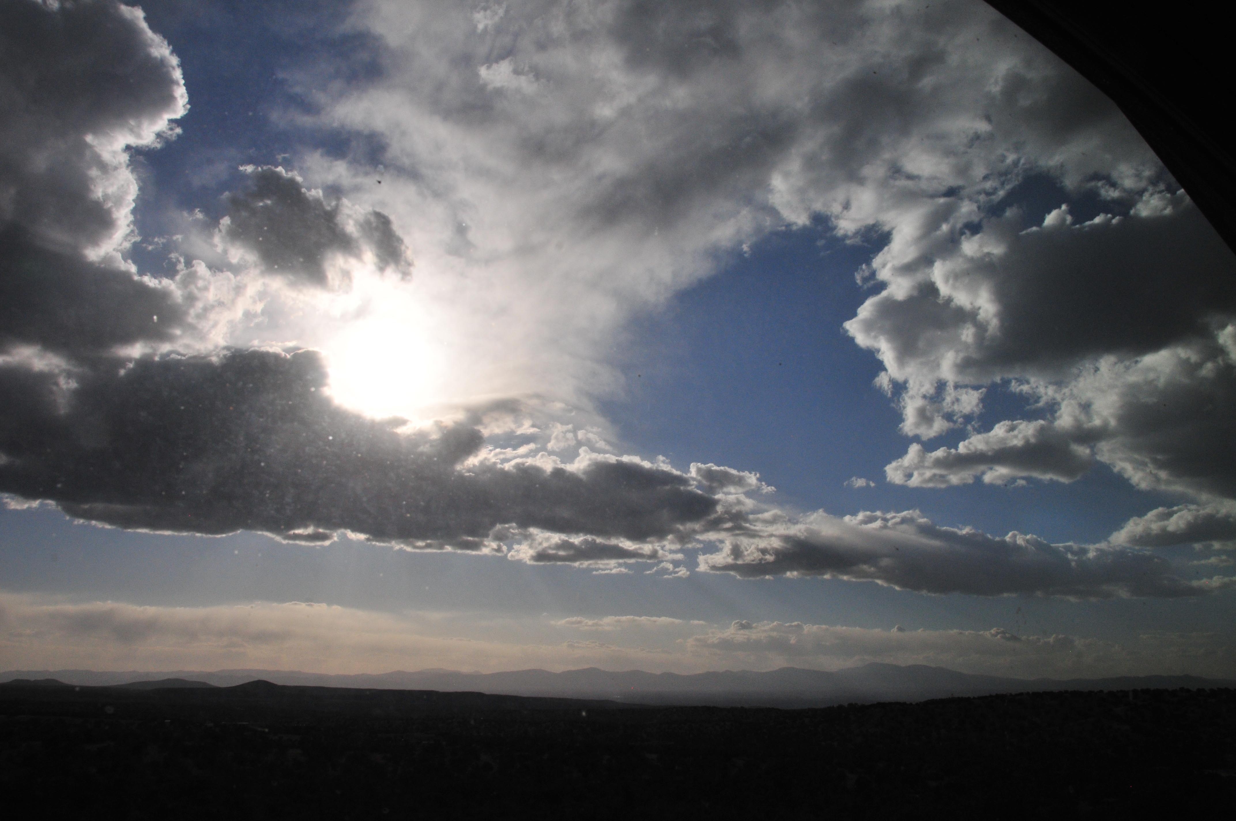
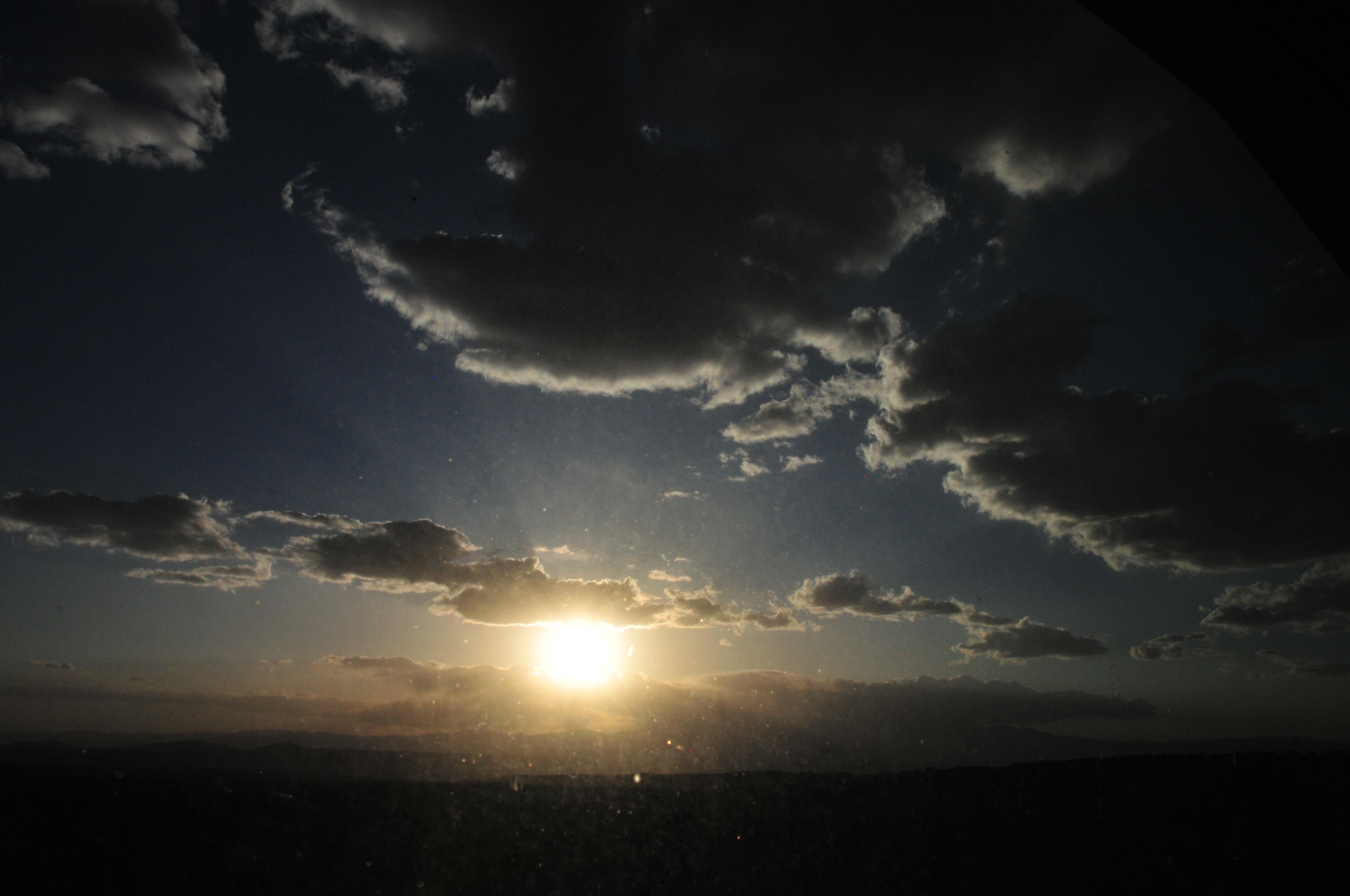
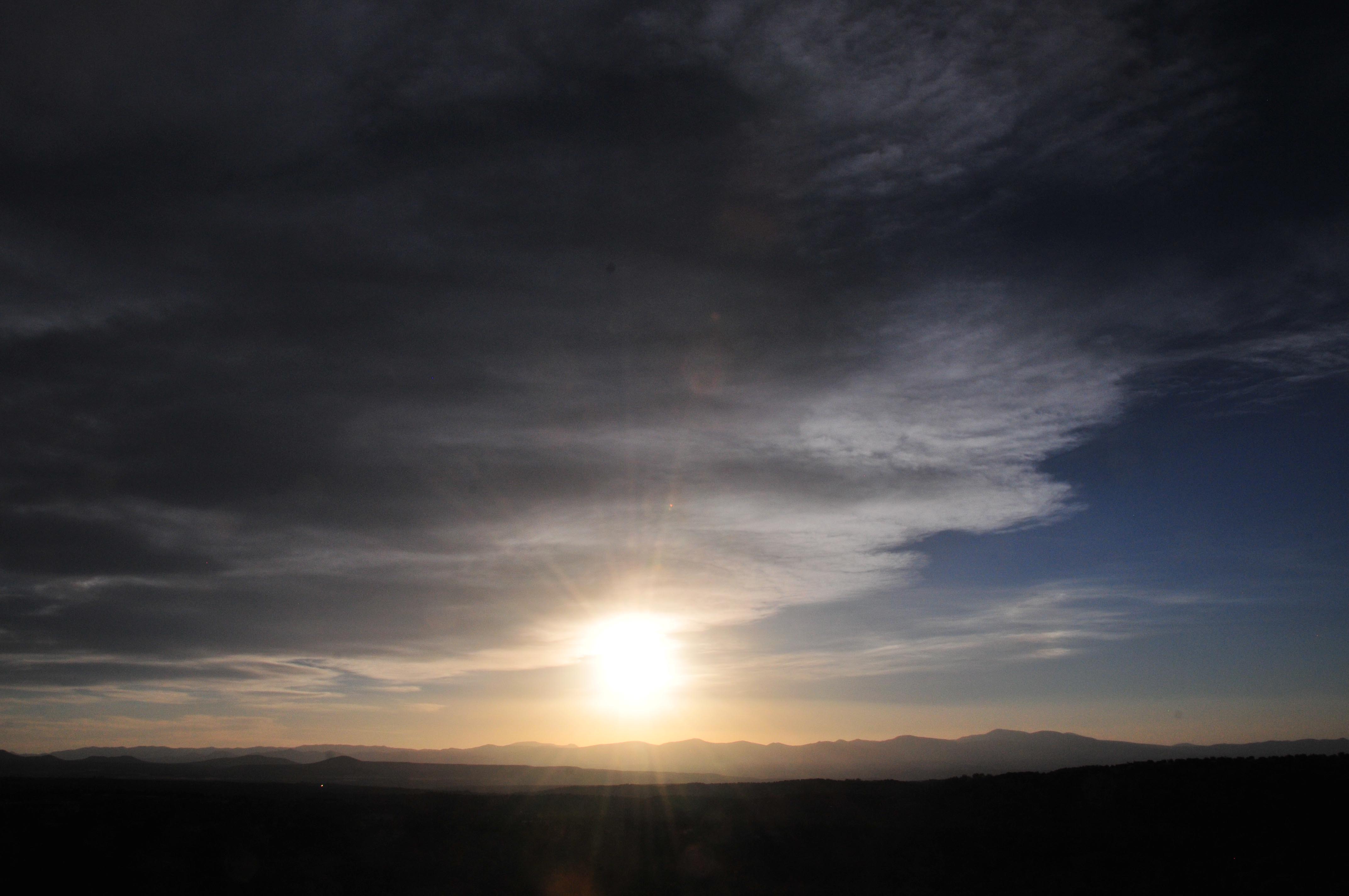
Based on my examination of the sky for these 12 days, I make these rough estimates for a stationary observer at the time of greatest eclipse (5 degrees sun altitude); 50% chance of clear sky, 20% chance of viewing annularity through cirrus clouds, and 30% chance of being completely clouded out. These odds can be significantly improved by being prepared on eclipse day to quickly relocate depending on real-time cloud cover. Your plan should include consideration of where the horizon is clear for low sun angles.
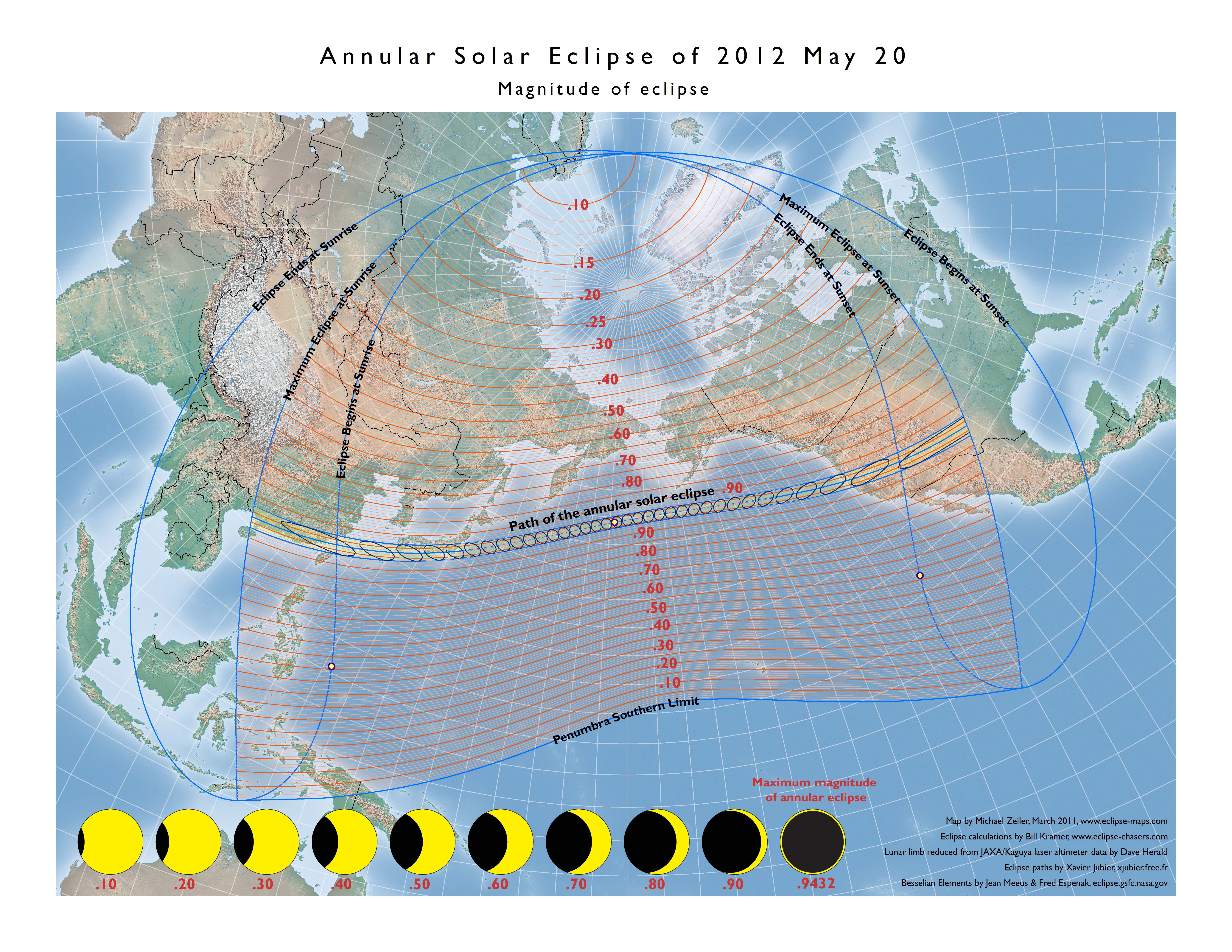
On May 21, 2012, an annular solar eclipse begins over southeast China and passes over Japan. When the eclipse crosses the International Date Line, the local date becomes May 20. The eclipse then enters the California/Oregon border, passes in the late afternoon over Nevada, Utah, Arizona, a corner of Colorado, New Mexico, and ends at sunset in Texas.
An annular solar eclipse occurs when the Moon’s apparent disk is just smaller than the Sun’s disk and the Sun appears as a brilliant ring. This spectacular sight can only be safely observed with approved solar filters or by projecting an image of the eclipsed Sun onto a flat white surface. See observing instructions at http://transitofvenus.nl/wp/observing/six-ways-to-see-the-transit/
Recommended links for further information
NASA’s eclipse web site http://eclipse.gsfc.nasa.gov/SEgoogle/SEgoogle2001/SE2012May20Agoogle.html
Detailed weather reports for this eclipse at Jay Anderson’s web site, http://eclipser.ca/
Descriptions and interactive maps by Bill Kramer at http://www.eclipse-chasers.com/tseNext.php?TSE=ase2012d
Interactive Google map by Xavier Jubier at http://xjubier.free.fr/en/site_pages/solar_eclipses/ASE_20120520_pg01.html.
National Astronomical Observatory of Japan: http://naojcamp.mtk.nao.ac.jp/phenomena/20120521/summary-en.html
U.S. Naval Observatory and HM Nautical Almanac Office: http://astro.ukho.gov.uk/eclipse/0132012/
Credits
The video and all maps on this page are made by Michael Zeiler, curator of eclipse-maps.com, using GIS software from his employer, www.esri.com. The maps apply eclipse calculations by Bill Kramer with eclipse timing corrections for the precise profile of the moon. The lunar profile was derived from laser altimeter data from the Japanese Kaguya lunar orbiter by Dave Herald. The eclipse lines were calculated by Xavier Jubier and the Besselian elements used for eclipse calculations are by Jean Meeus and Fred Espenak. The careful map reader will note that the isodurations (lines of equal eclipse duration) on the maps are not symmetric around the central line of eclipse or perfectly smooth; this is due to the corrections for the actual lunar profile.
Track of the annular solar eclipse from begin at sunrise over China to end at sunset over Texas. The yellow path is the central path of the annular eclipse. The broader shaded area is where a partial solar eclipse will be visible.
Click on any map on this page to display a high-resolution map suitable for your printer.
Overview map showing the maximum eclipse magnitude (fraction of Sun’s diameter eclipsed)
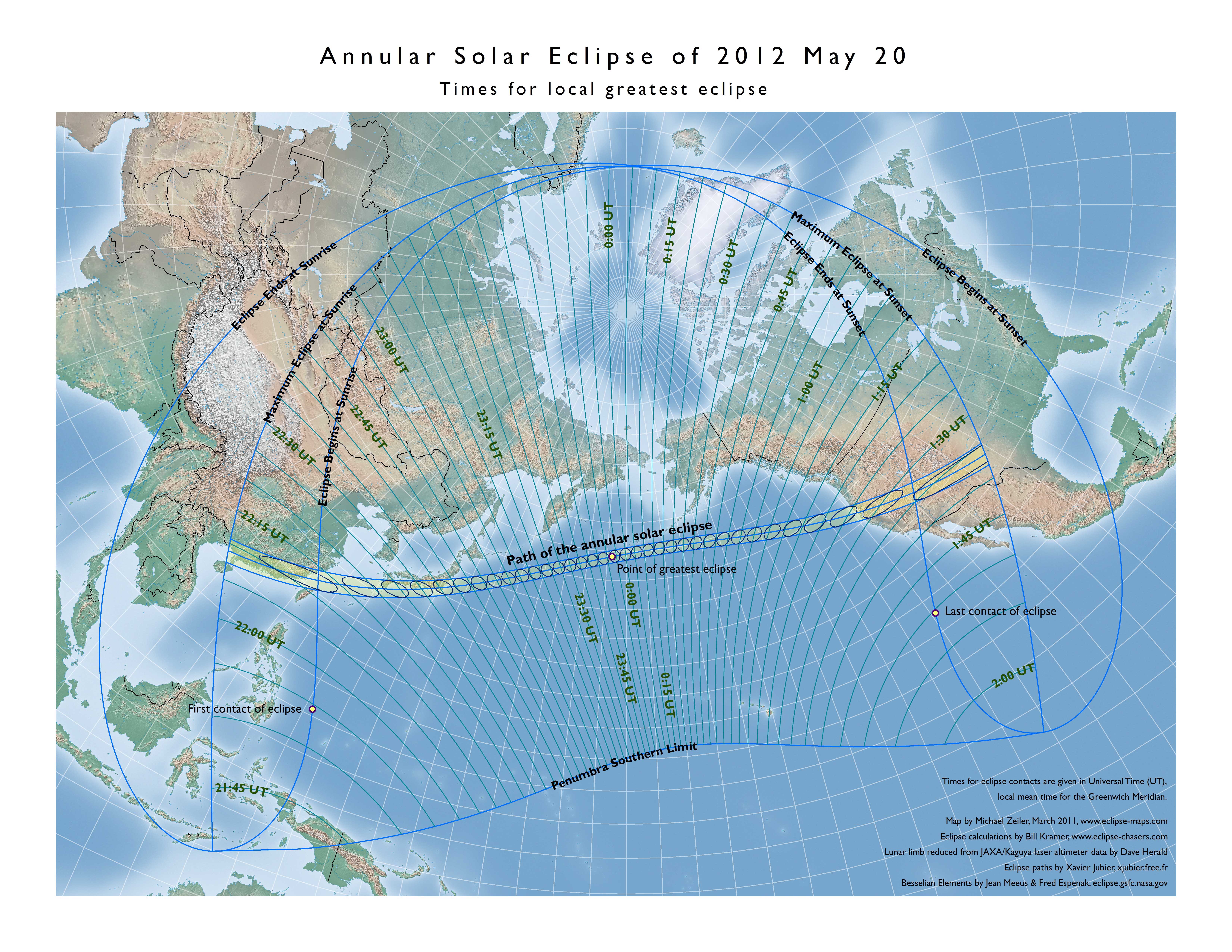
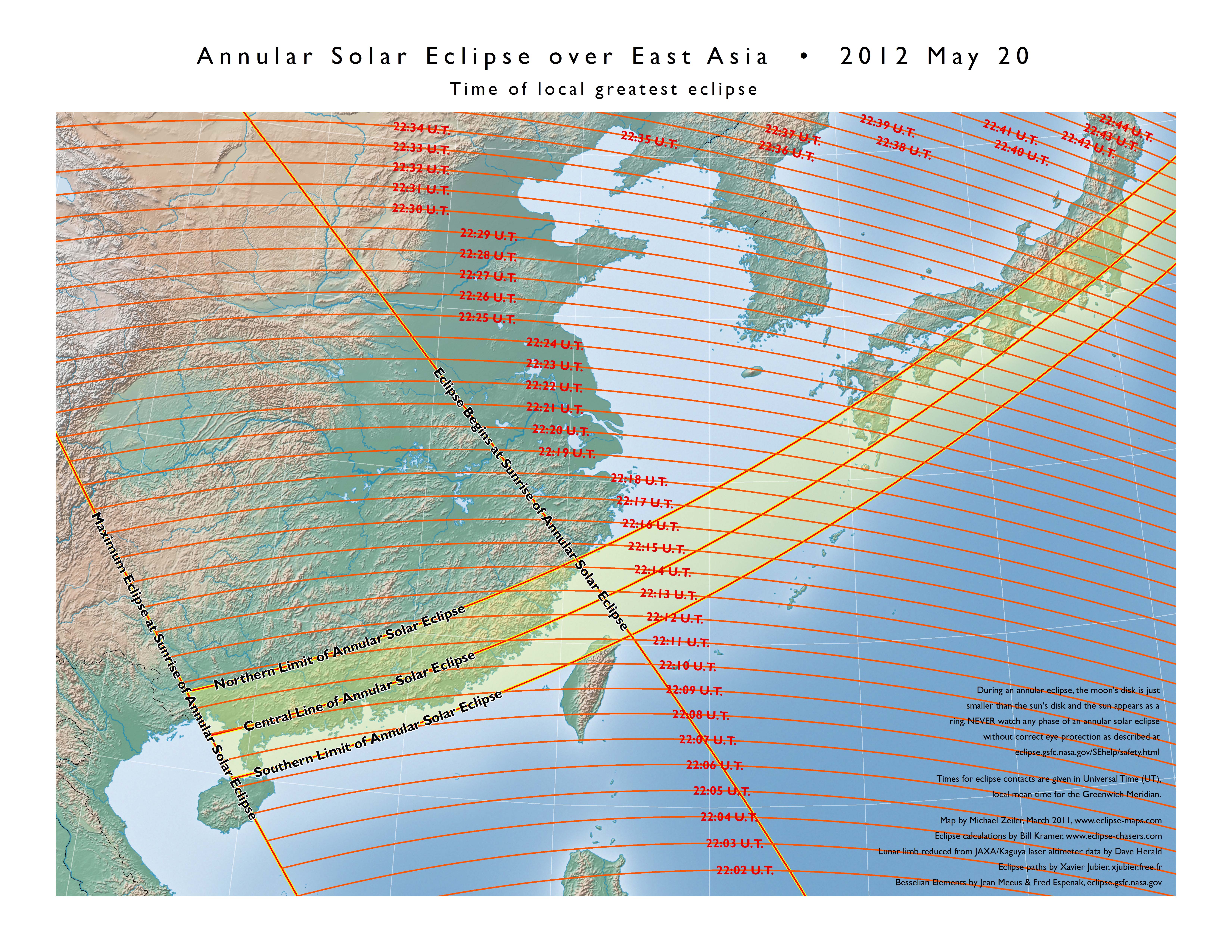
Overview map showing the times for local greatest eclipse in Universal Coordinated Time
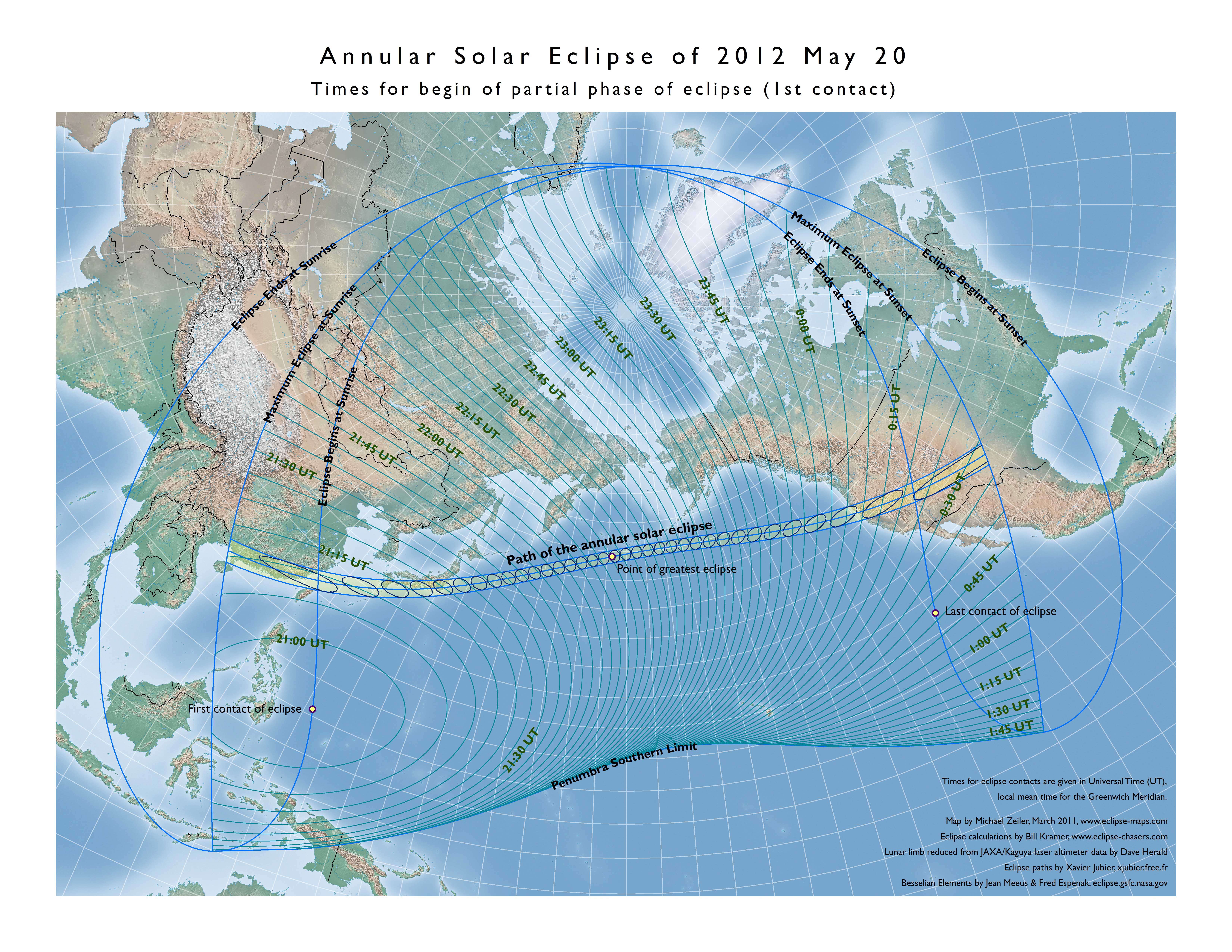
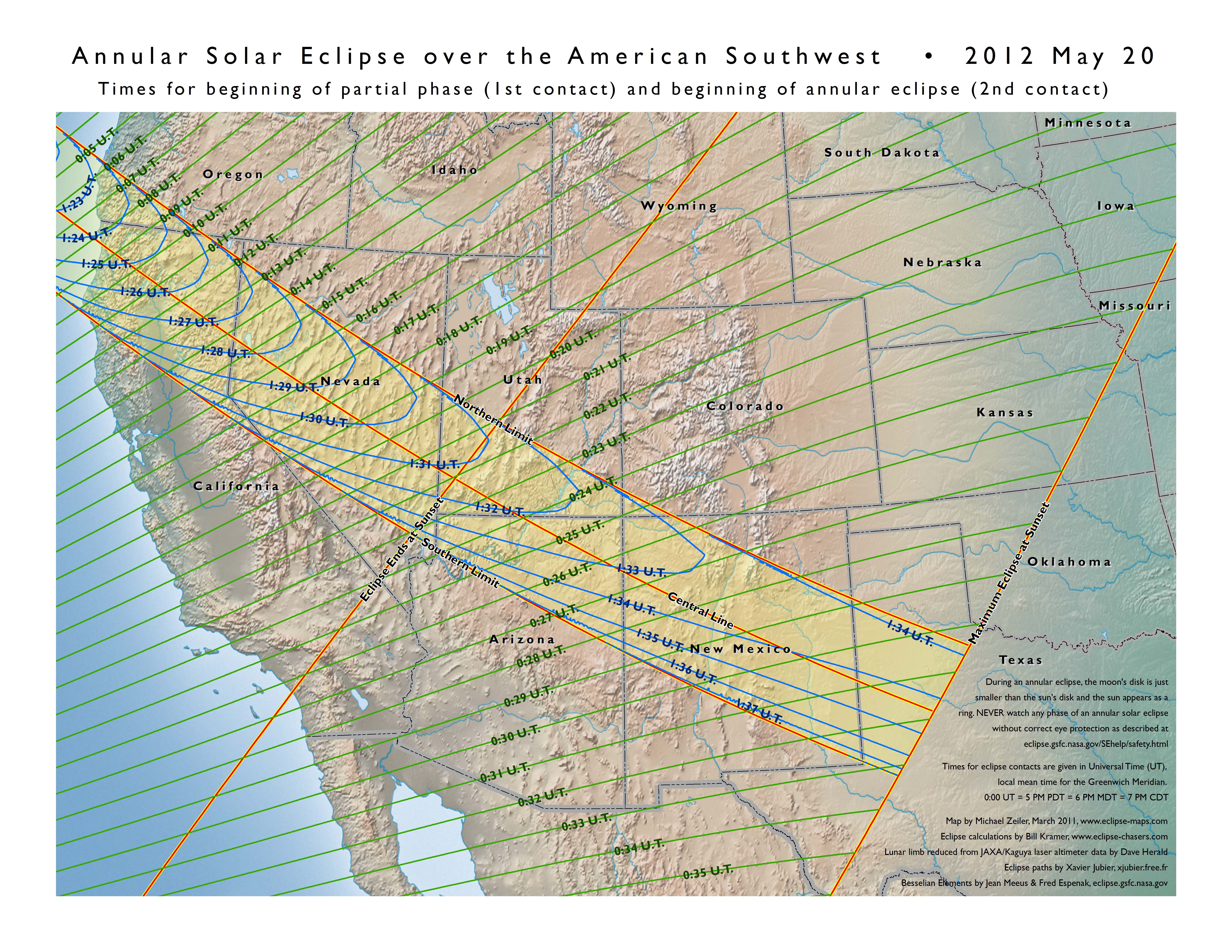
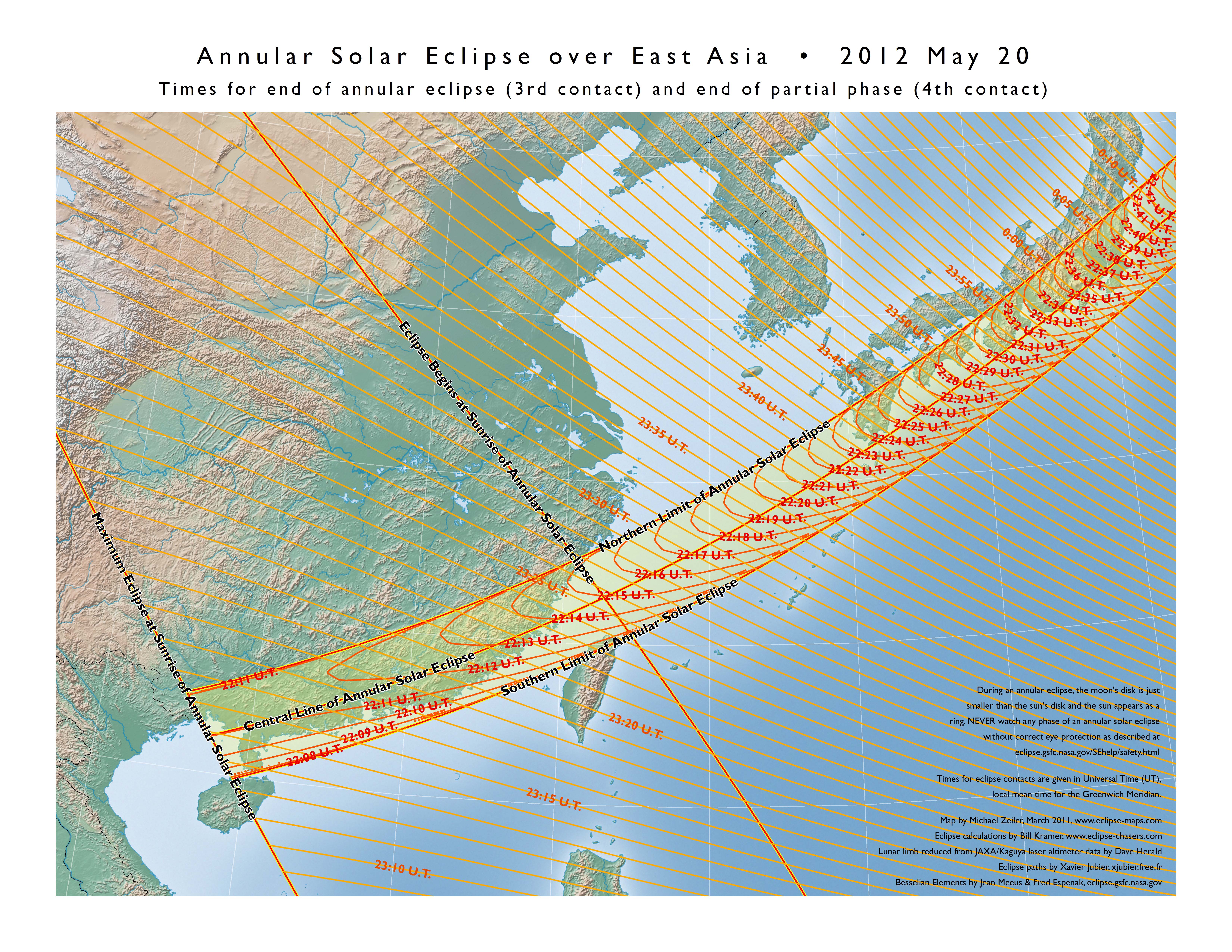
Overview map showing the times for begin of partial and annular solar eclipse in Universal Coordinated Time
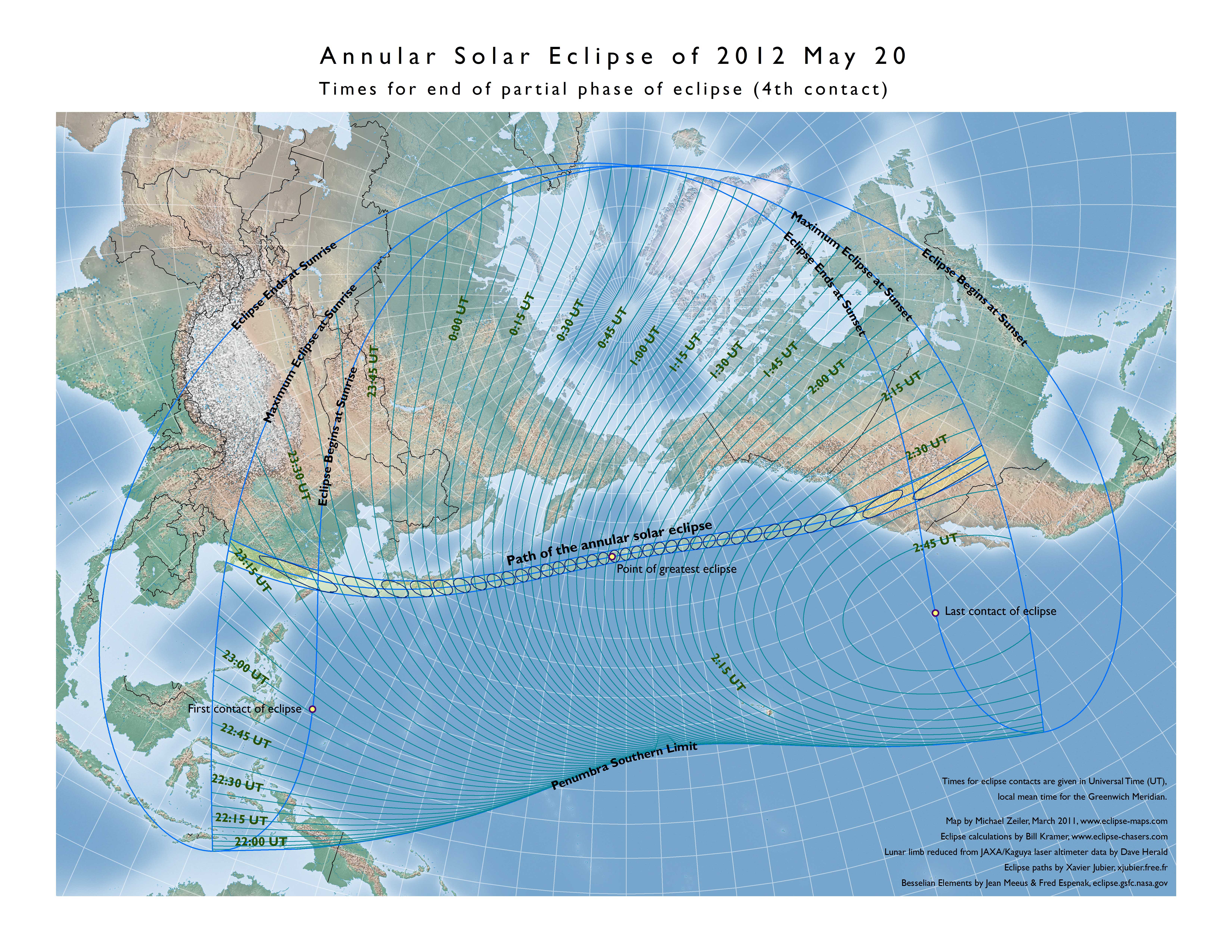
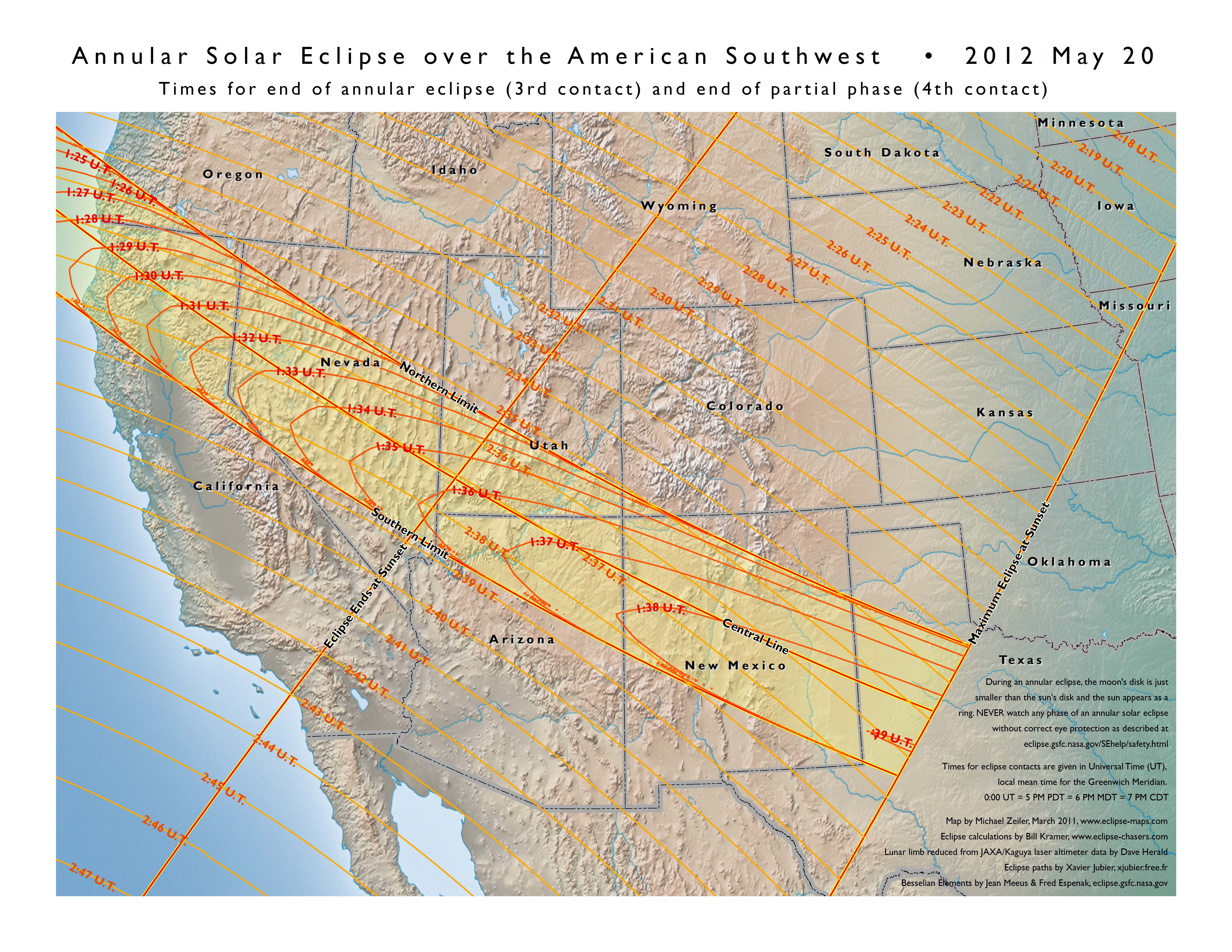
Overview map showing the times for end of partial and annular solar eclipse in Universal Coordinated Time
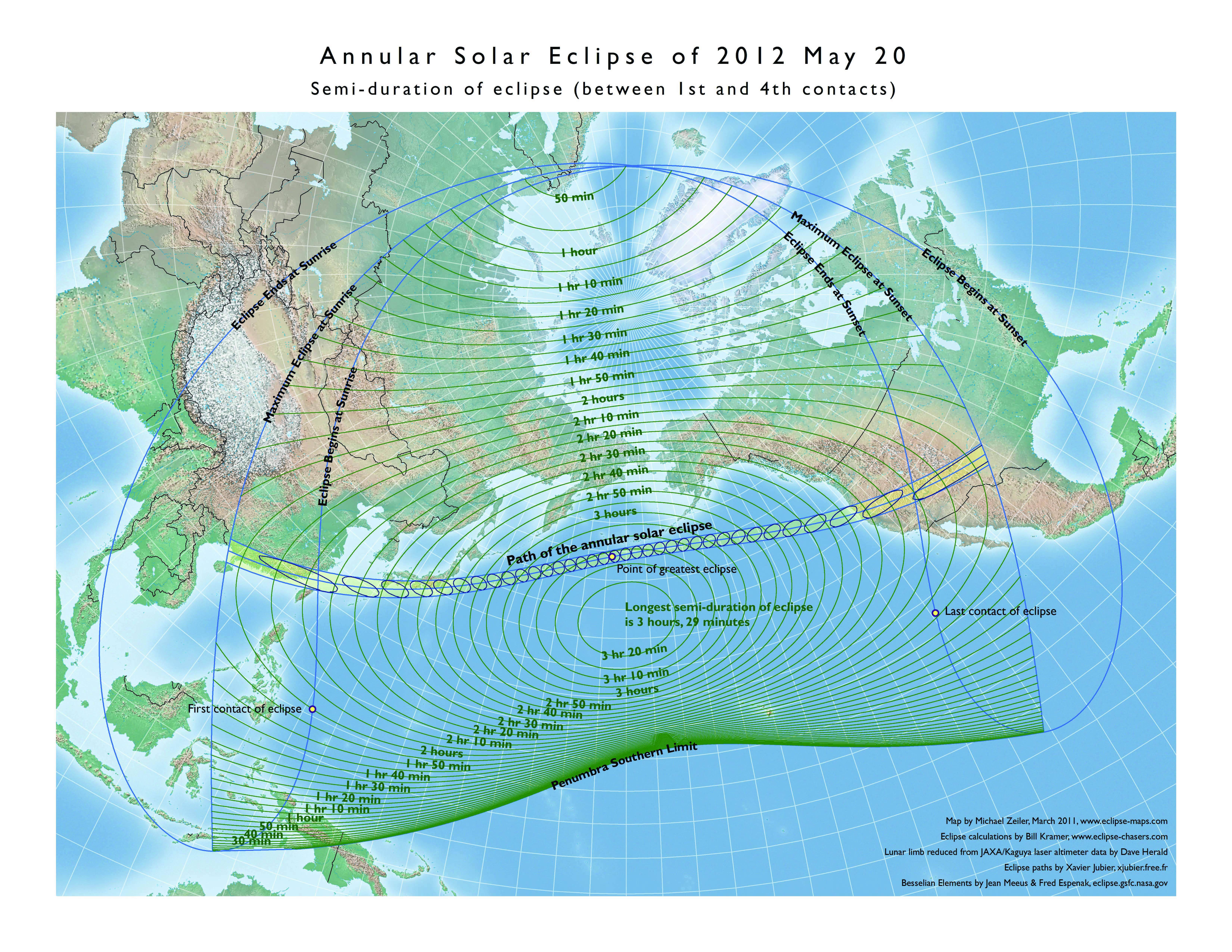
Overview map showing the duration of the partial phases of the annular solar eclipse
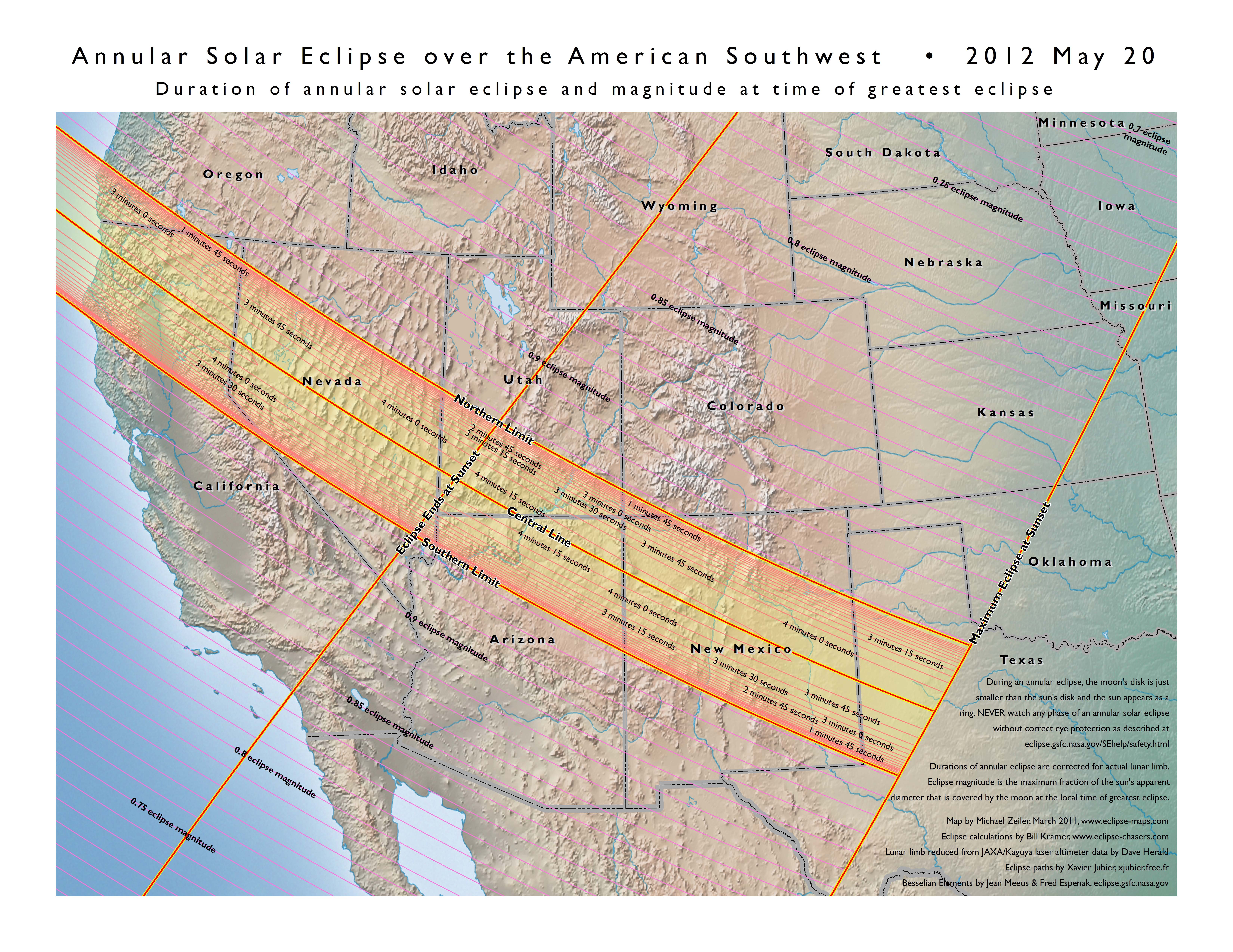
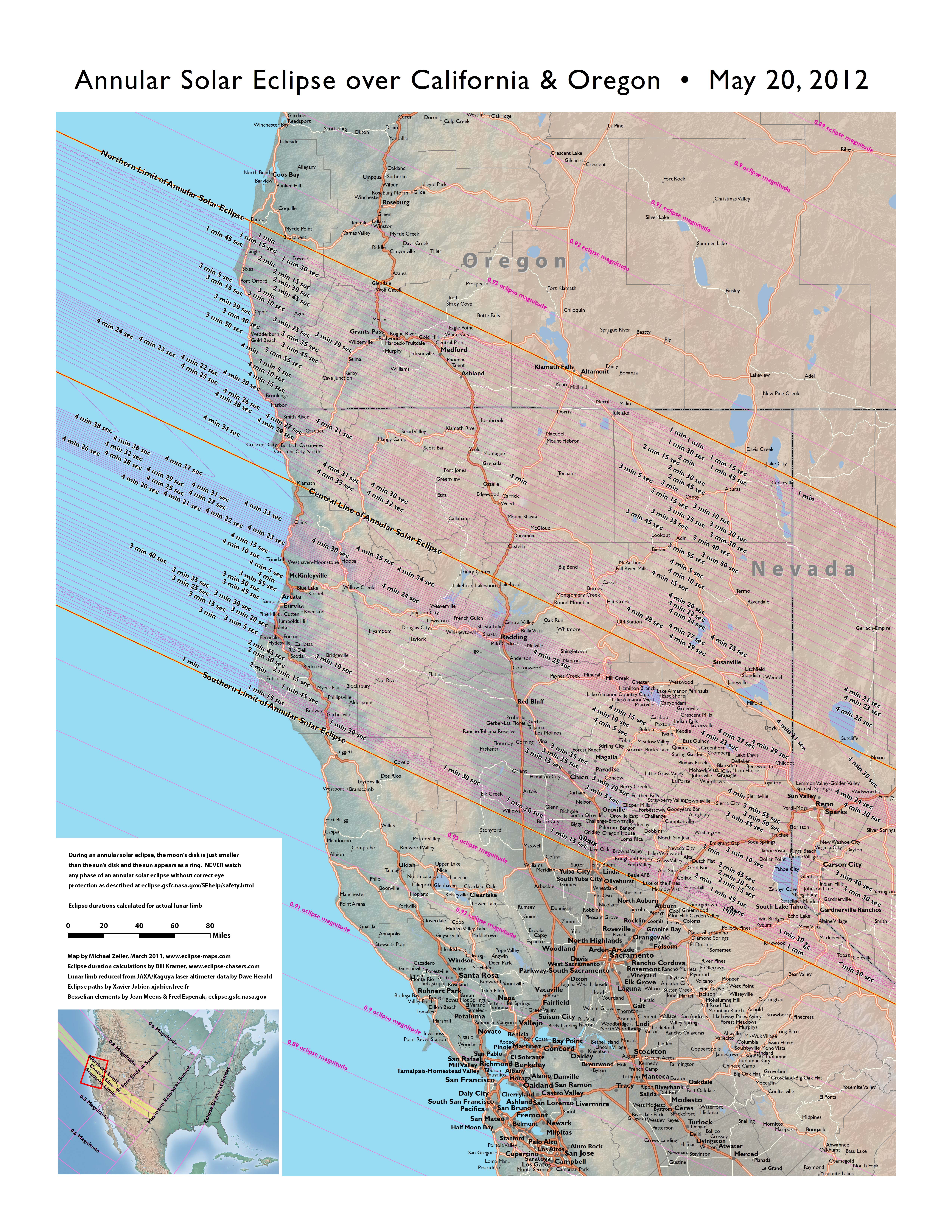
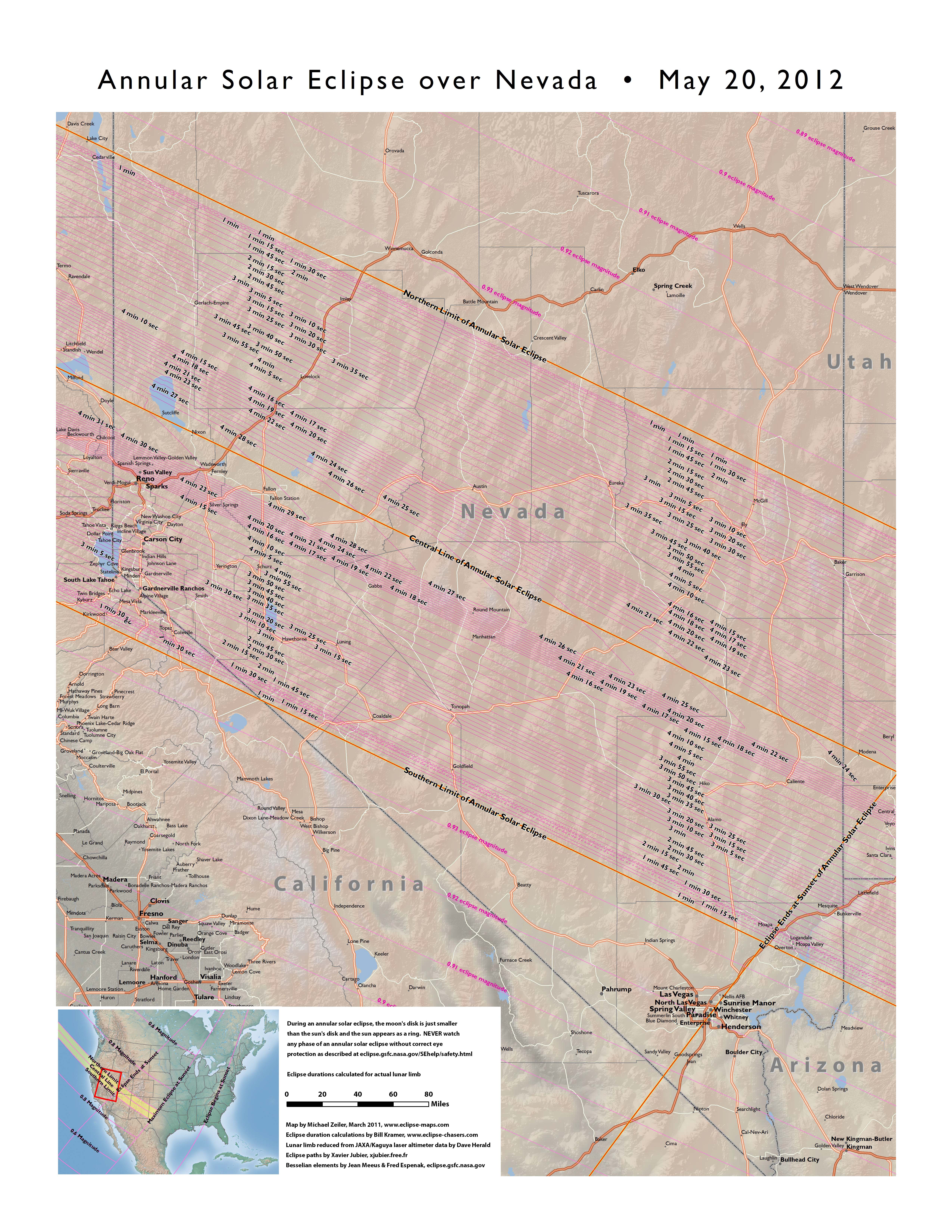
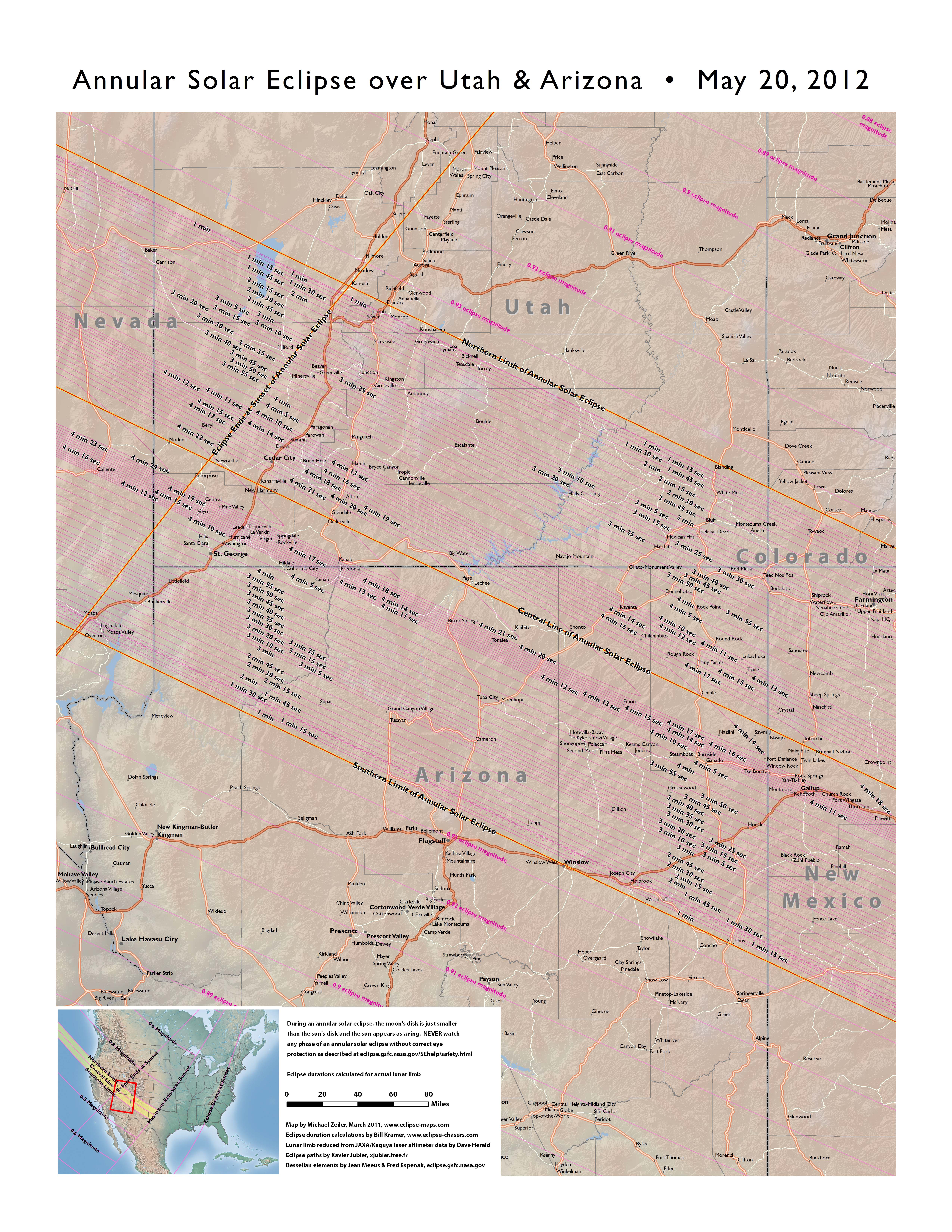
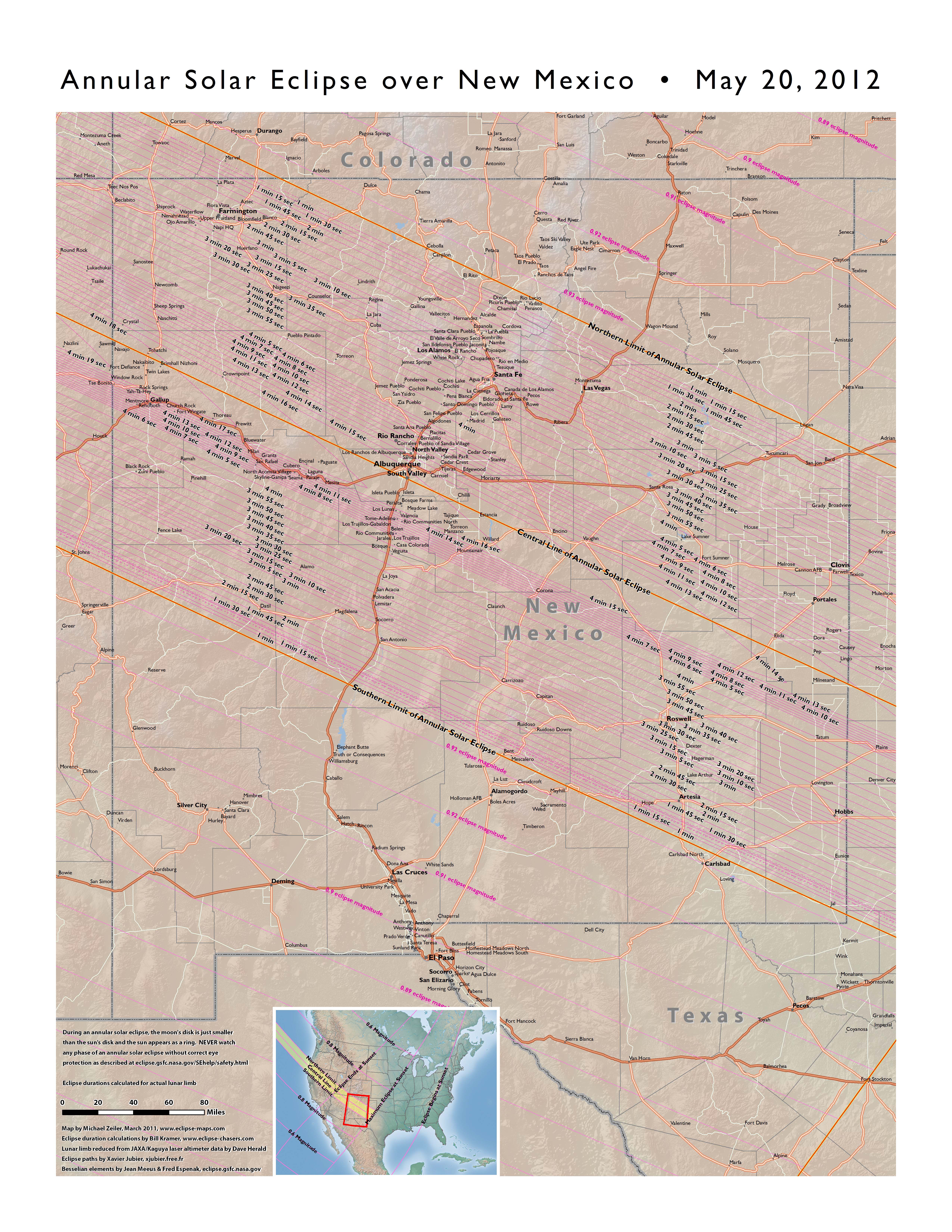
Duration of annular solar eclipse and maximum eclipse magnitude (fraction of Sun’s diameter eclipsed)
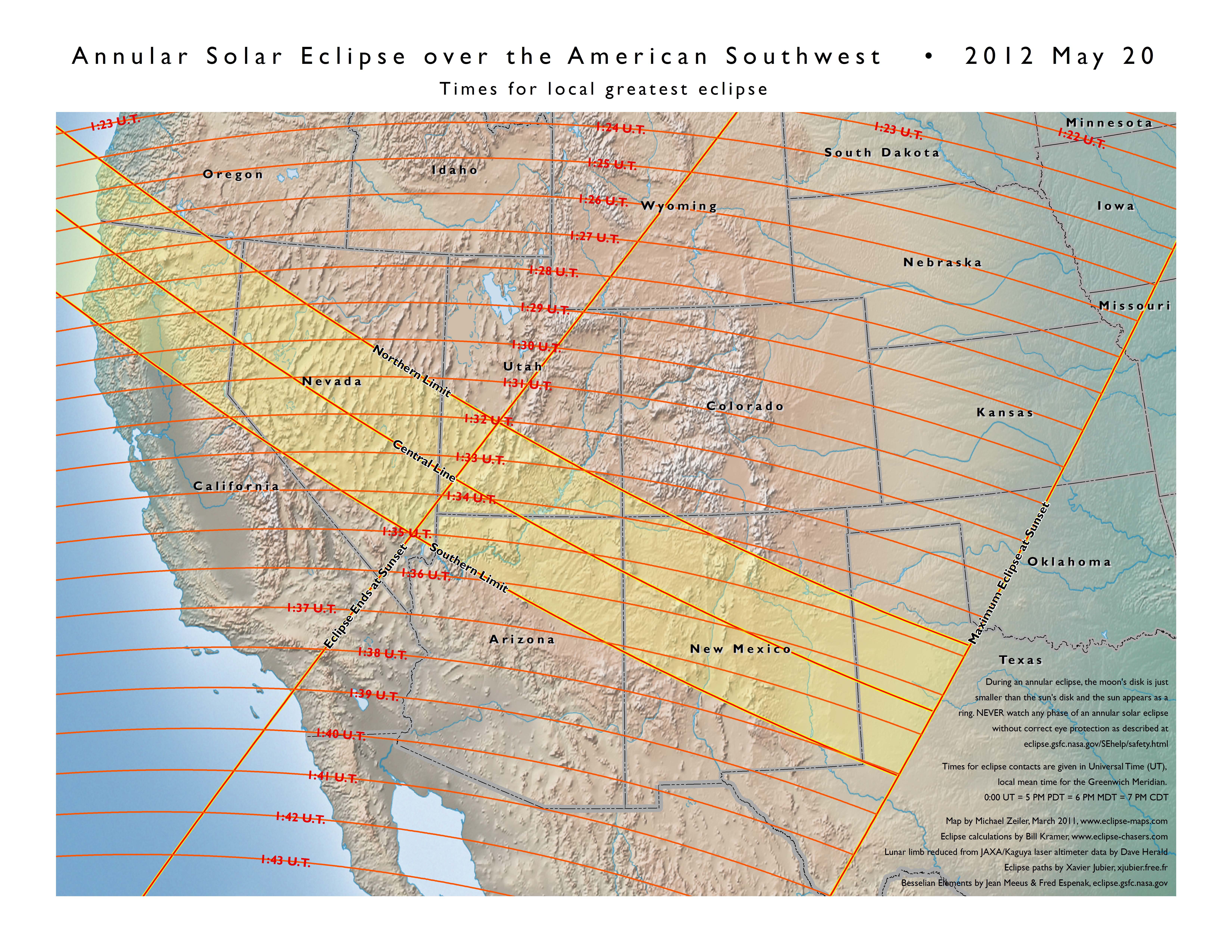
Western U.S. map showing the times for local greatest eclipse in Universal Coordinated Time
Western U.S. map showing the times for begin of partial and annular solar eclipse in Universal Coordinated Time
Western U.S. map showing the times for end of partial and annular solar eclipse in Universal Coordinated Time


This animated map is best seen in full-screen mode
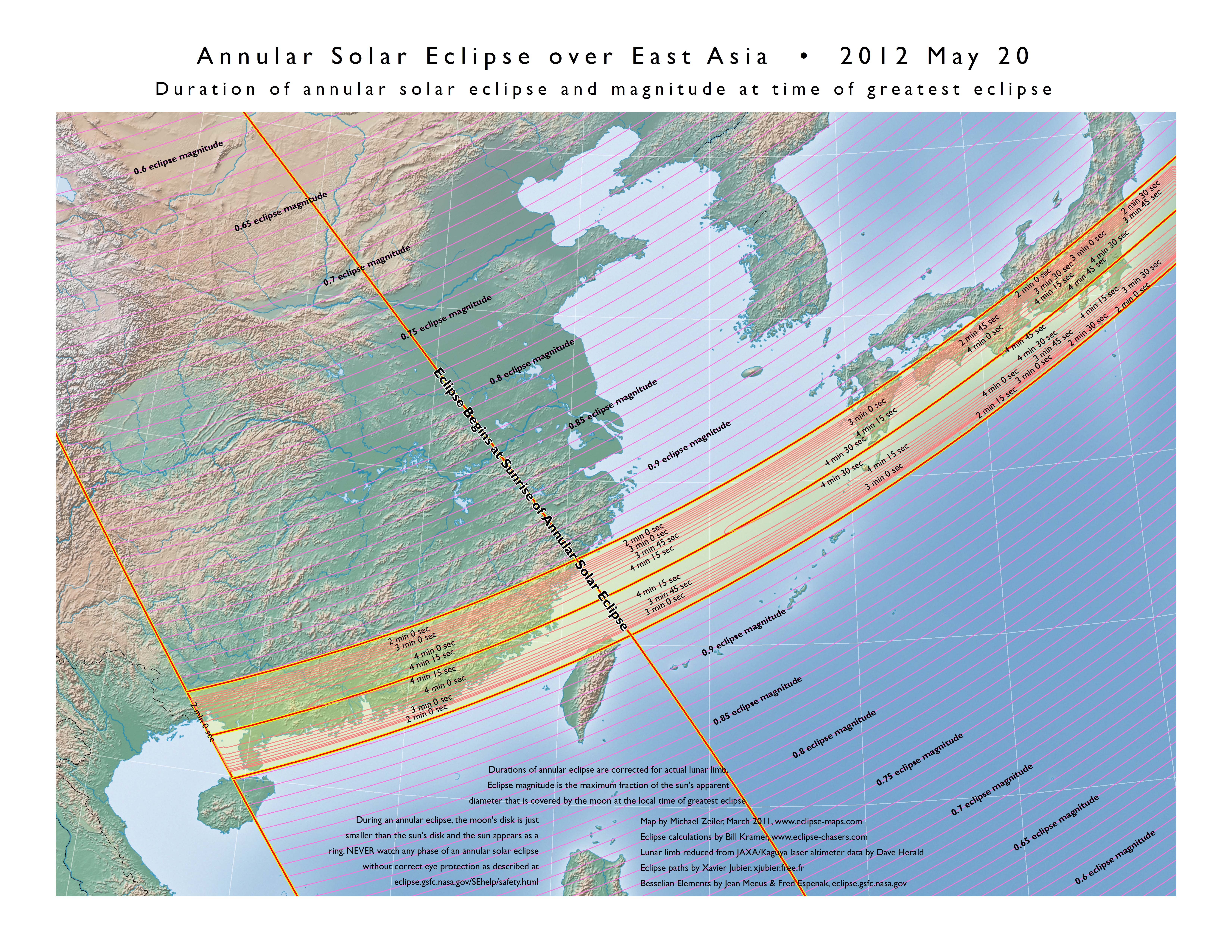
Duration of annular solar eclipse and maximum eclipse magnitude (fraction of Sun’s diameter eclipsed) over southeast Asia
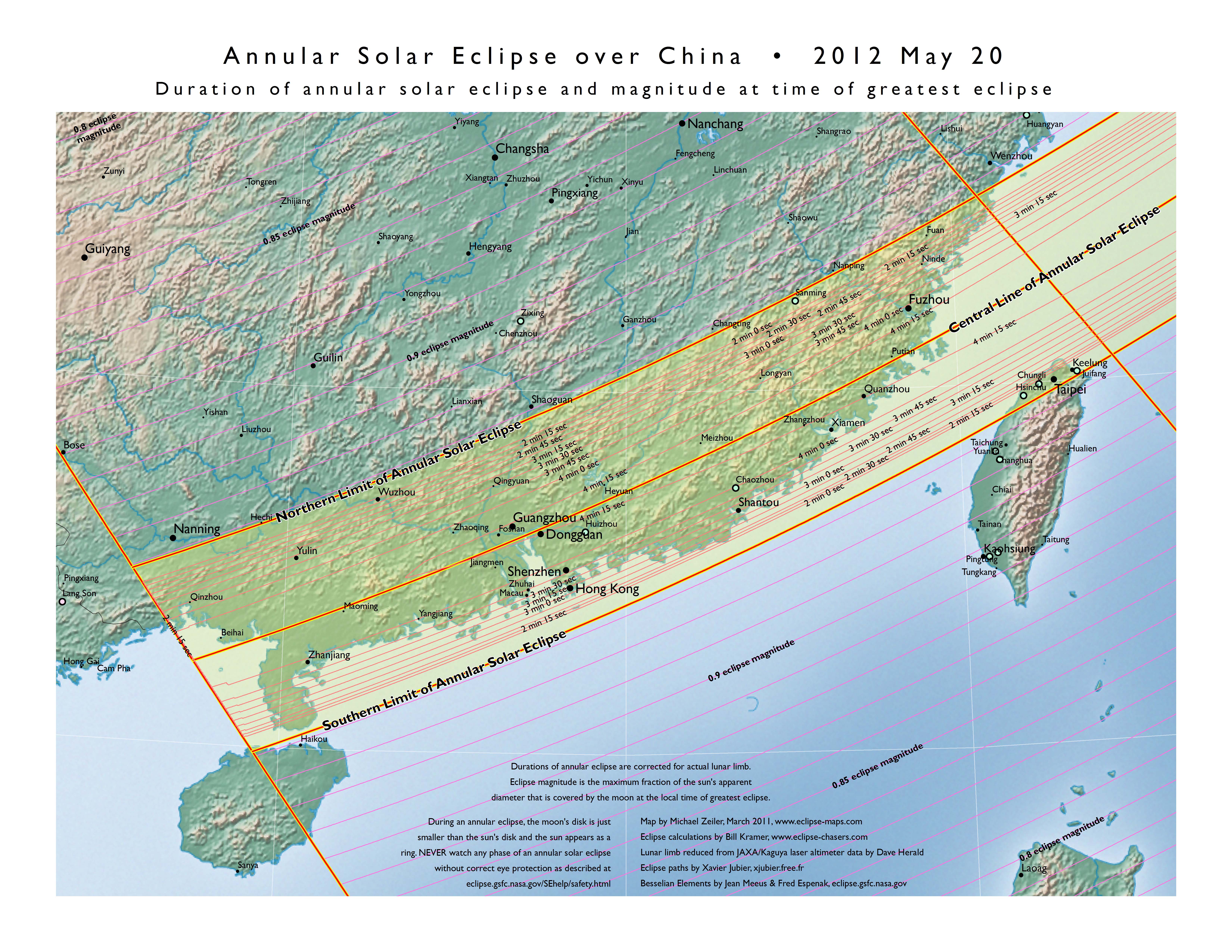
Duration of annular solar eclipse and maximum eclipse magnitude (fraction of Sun’s diameter eclipsed) over China
Duration of annular solar eclipse and maximum eclipse magnitude (fraction of Sun’s diameter eclipsed) over Japan
Time of local greatest eclipse over eastern Asia
Times of beginning of partial and annular eclipse over eastern Asia
Times of end of partial and annular eclipse over eastern Asia


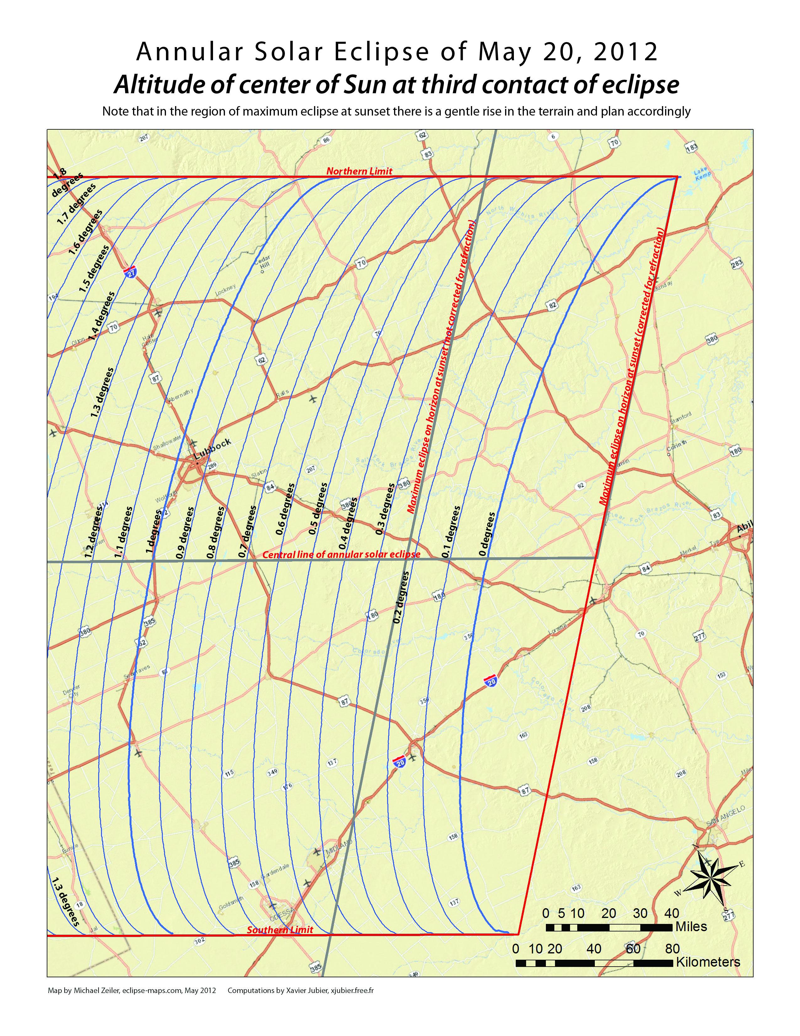
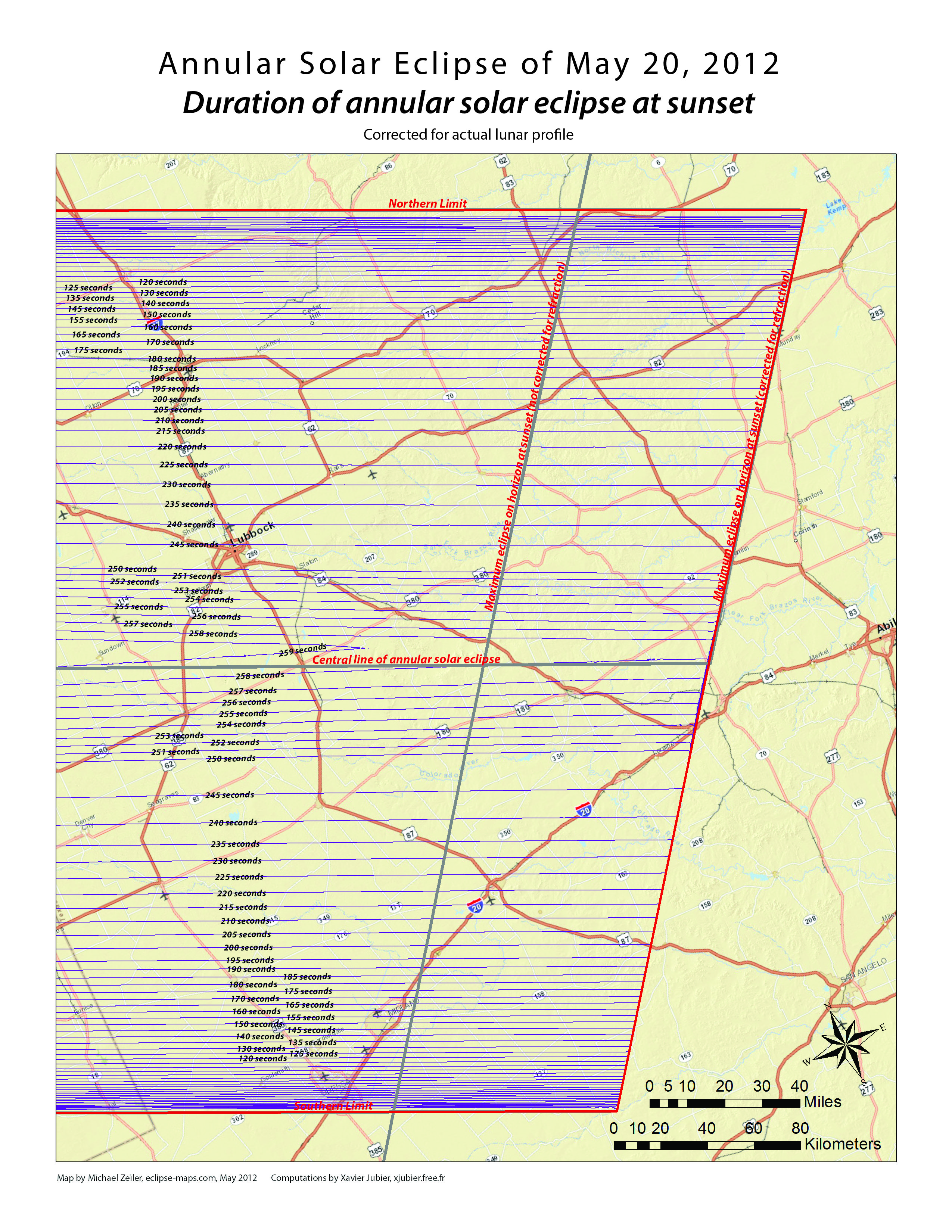
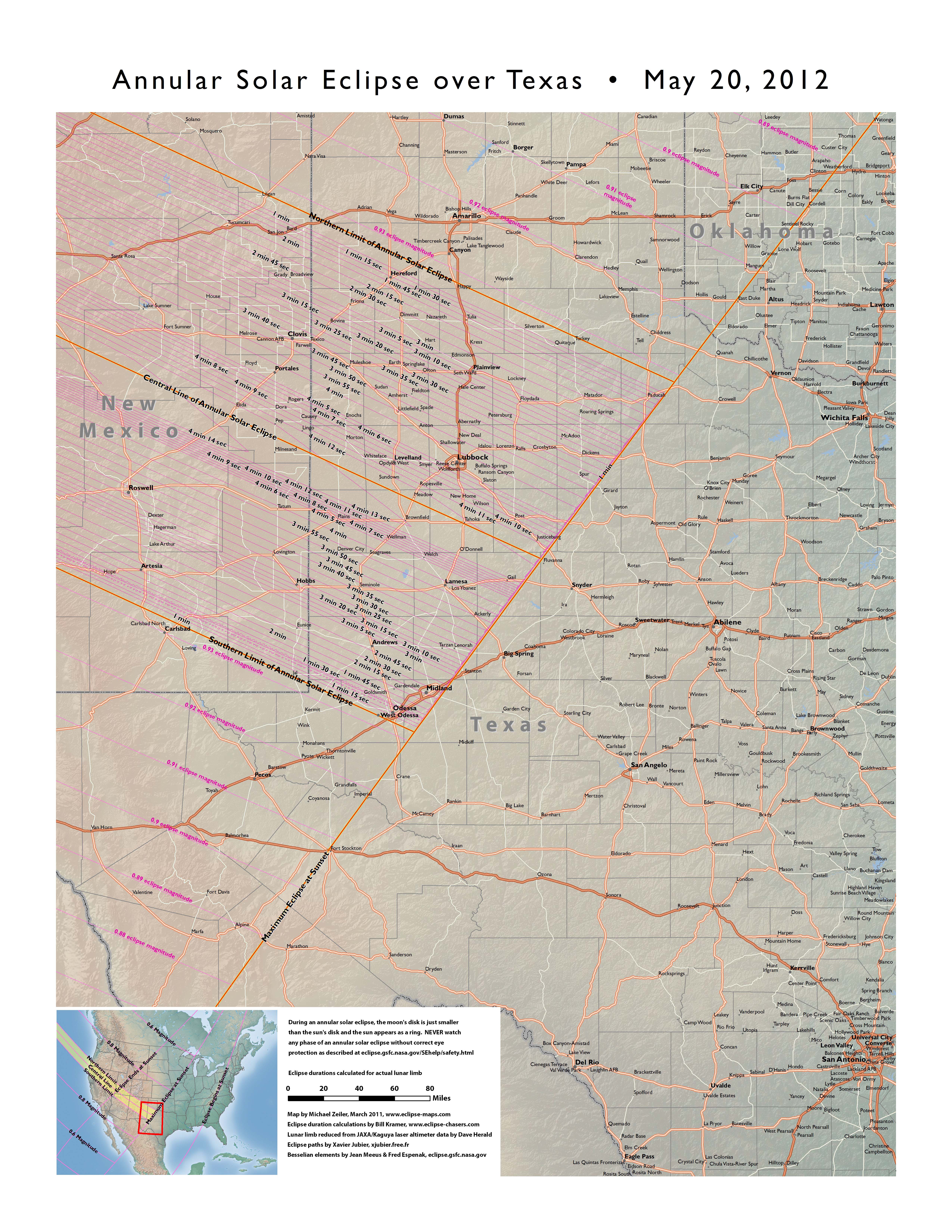
As many photographs of the January 4, 1992 annular solar eclipse from the San Diego area attest, one of the most dramatic views of an annular solar eclipse is at sunset or sunrise. Witnessing this sight is a high-risk venture considering that transparent and cloud free skies are required far in the direction of the sun, but the reward is the most photogenic view of the annular eclipse. Weather permitting, the vicinity of Lubbock, Texas on May 20, 2012 is the location for a sunset annular eclipse. Below are large scale maps to assist eclipse observers who seek to optimize their site location. These maps are corrected for refraction and based on computations from Xavier Jubier’s Solar Eclipse Maestro software, http://xjubier.free.fr/en/site_pages/solar_eclipses/Solar_Eclipse_Maestro_Photography_Software.html
Duration of annular solar eclipse at sunset
Altitude of center of Sun at second contact of eclipse
Altitude of center of Sun at maximum eclipse
Altitude of center of Sun at third contact of eclipse
What’s the first question after you see a solar eclipse? When’s the next one!
Click to visit the eclipse-maps store
You’ll find a world map detailing all coming
solar eclipses from the present to 2060 plus
a stylish t-shirt sporting a map of eclipses from 2012 to 2045 on front and a “world tour” listing of those eclipses on the back side of the shirt.
Click to visit the eclipse finder web app
This web app is a technology demonstration from the prototype software laboratory of my employer, www.esri.com. For any place on Earth, you can find eclipses past and present. Highly recommended.
Looking for maps of the November 14, 2012 total solar eclipse? Click here