The albums below present over 1,000 historical eclipse maps from the 17th century to the present. Click on each album to view the eclipse maps of that period. Each album is introduced with a summary of significant developments in eclipse mapping of that period, followed by a gallery of eclipse maps. Click on thumbnail maps to display larger versions or download the highest available resolution image of that map.
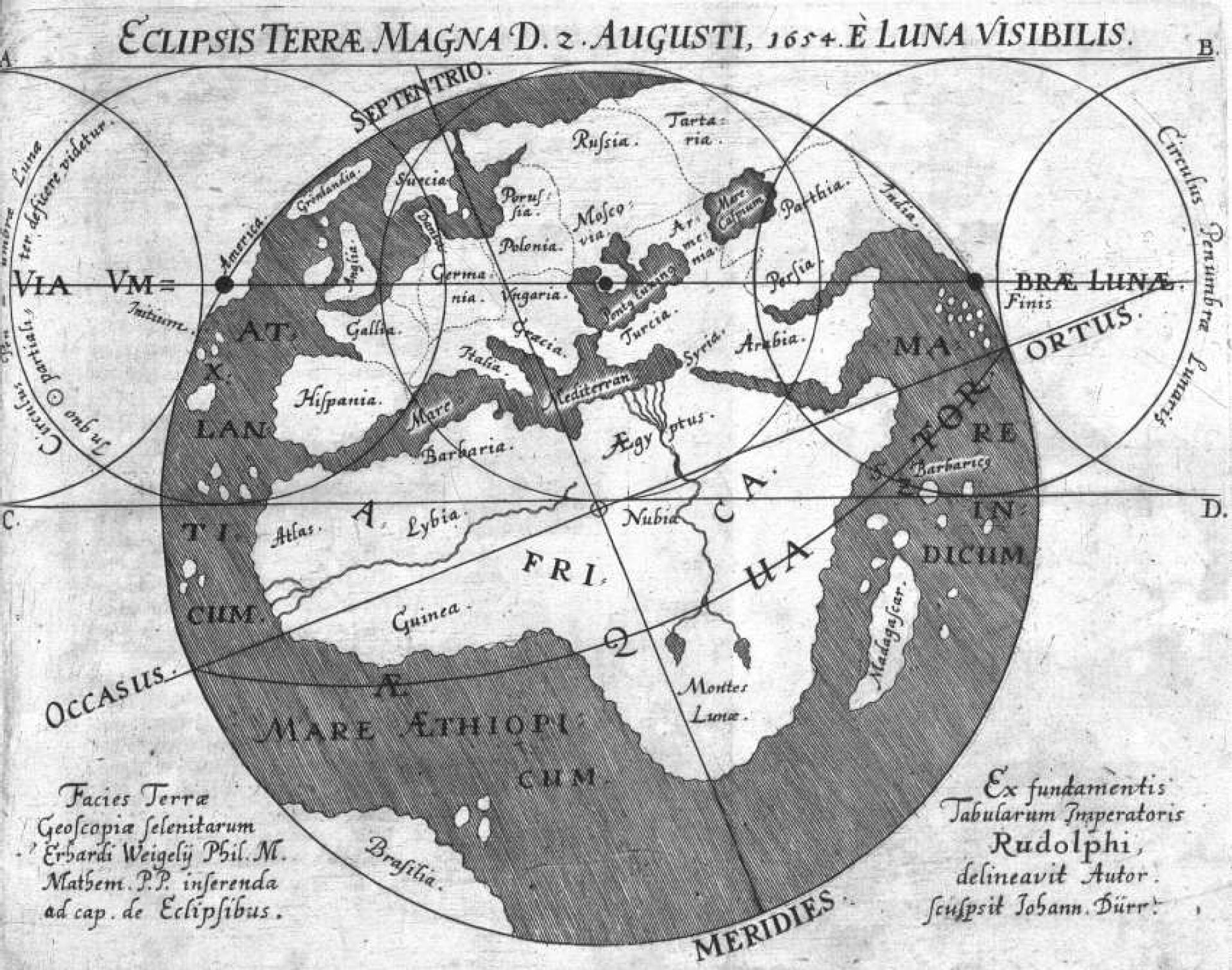
The story of solar eclipse maps begins in the 17th century. A total solar eclipse crossed northern Europe on August 12, 1654. Erhard Weigel, an important figure in the German Enlightenment, led a disputation on the theory of eclipses with a student and together they created the earliest known solar eclipse map on the day before the eclipse. There are historical records of a probable eclipse map in the 1660‘s by Giovanni-Dominique Cassini, the famous astronomer of the Paris Observatory. In 1676, Johann Christoph Sturm produced an almanac of eclipses which included a map of two eclipses, one total and one annular, for that year. Cassini created a second eclipse map in 1700 of the total solar eclipse of 1699.
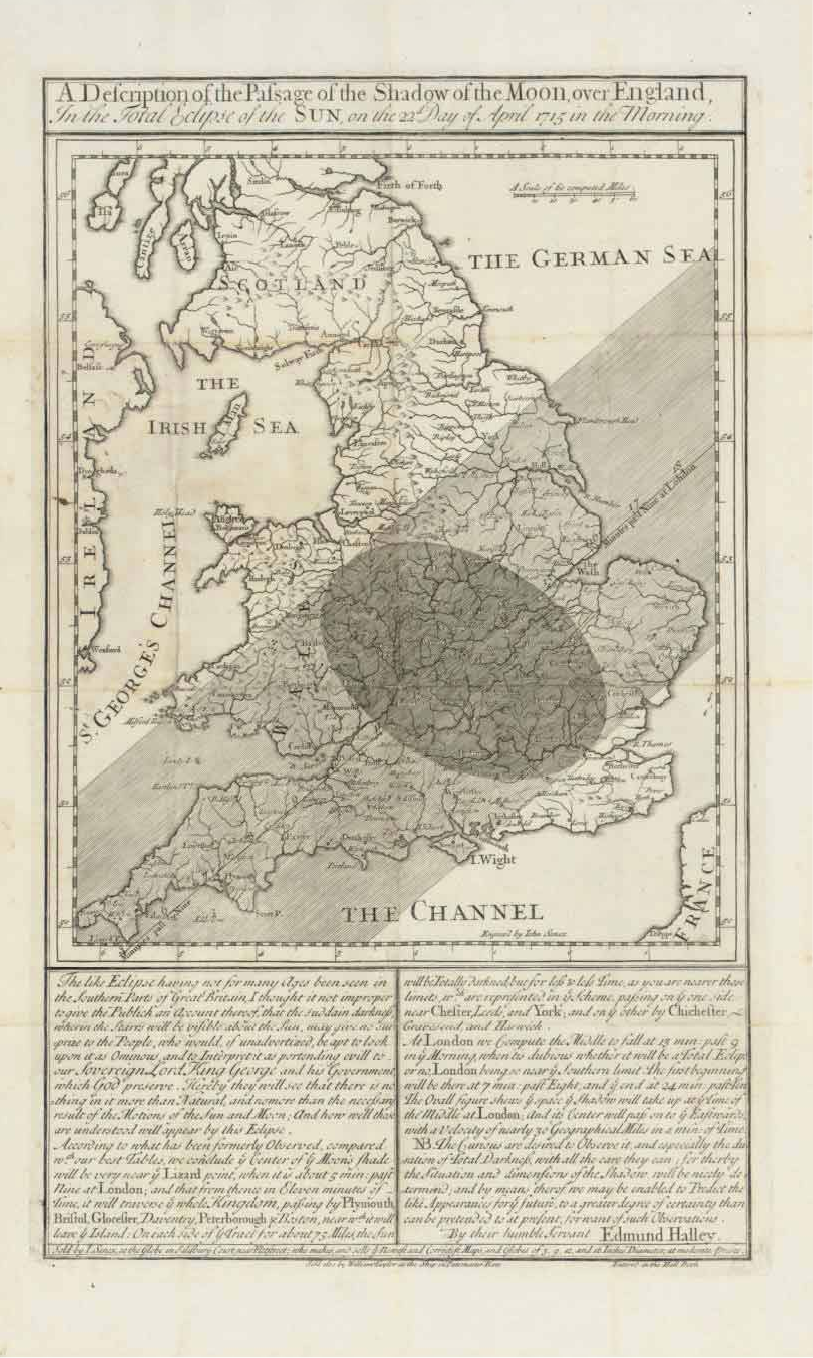
An impressive flowering of eclipse maps unfolded in the 18th century. An astronomer, Johann Doppelmayr, and a cartographer, Johann Homann, both of Nuremberg, Germany, created a series of maps of solar eclipses beginning in 1706 and culminating in 1742 in a magnificent atlas of celestial and eclipse maps, the Atlas Coelestis. Two Dutch astronomers, Lugtenberg and van Moolen, also produced eclipse maps for the 1706 eclipse. In 1715, Edmond Halley applied Isaac Newton’s universal theory of gravitation to create several eclipse maps of very high accuracy. Halley solicited observational reports from the 1715 eclipse and produced another map with a refinement of the path of the 1715 eclipse along with the forthcoming 1724 eclipse. Many other European cartographers and astronomers were inspired by these early maps and created a plethora of eclipse maps through the remainder of the 18th century.
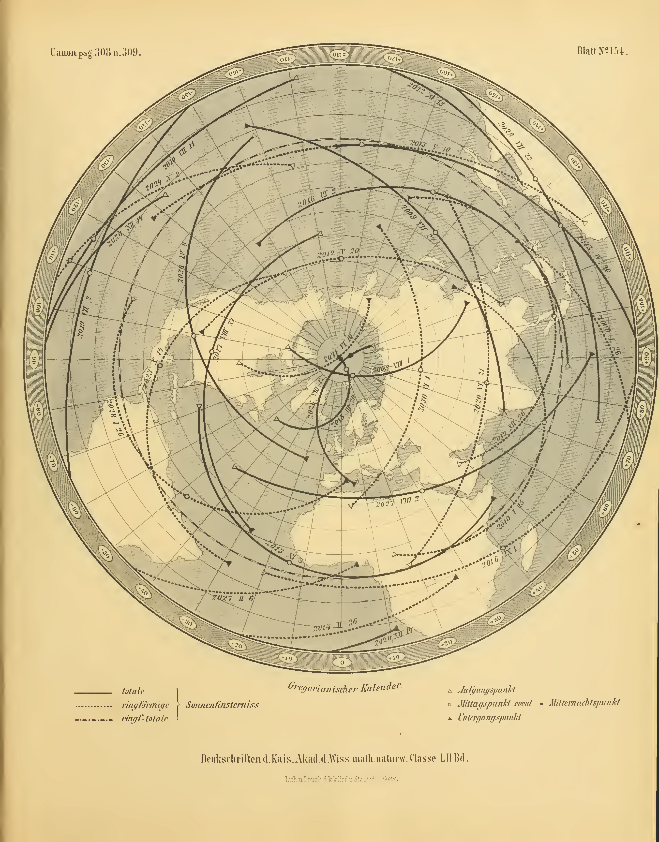
The 19th century brought a maturation in the development of eclipse maps. The first true canon of eclipses, the Elementa Eclipsium, was created in 1816 by Cassian Hallaschka of the present-day Czech Republic, followed by a second edition in 1820. In this century, the predominant production of eclipse maps shifted to almanacs. The first almanac to publish an eclipse map seems to be the American Almanac and Repository of Useful Knowledge for the year 1831, followed by another eclipse map in the 1834 edition. The first eclipse map in the British Nautical Almanac and Astronomical Ephemeris appeared in the 1834 edition. In the 1850’s, eclipse maps also begin to appear in the French almanac Connaissance des Temps and in the inaugural issue of the American Ephemeris and Nautical Almanac of 1855. A major milestone in eclipse maps was the 1887 Canon der Finsternisse by Theodor von Oppolzer, a set of 160 eclipse tables and maps spanning over three millennia from -1207 to 2161.
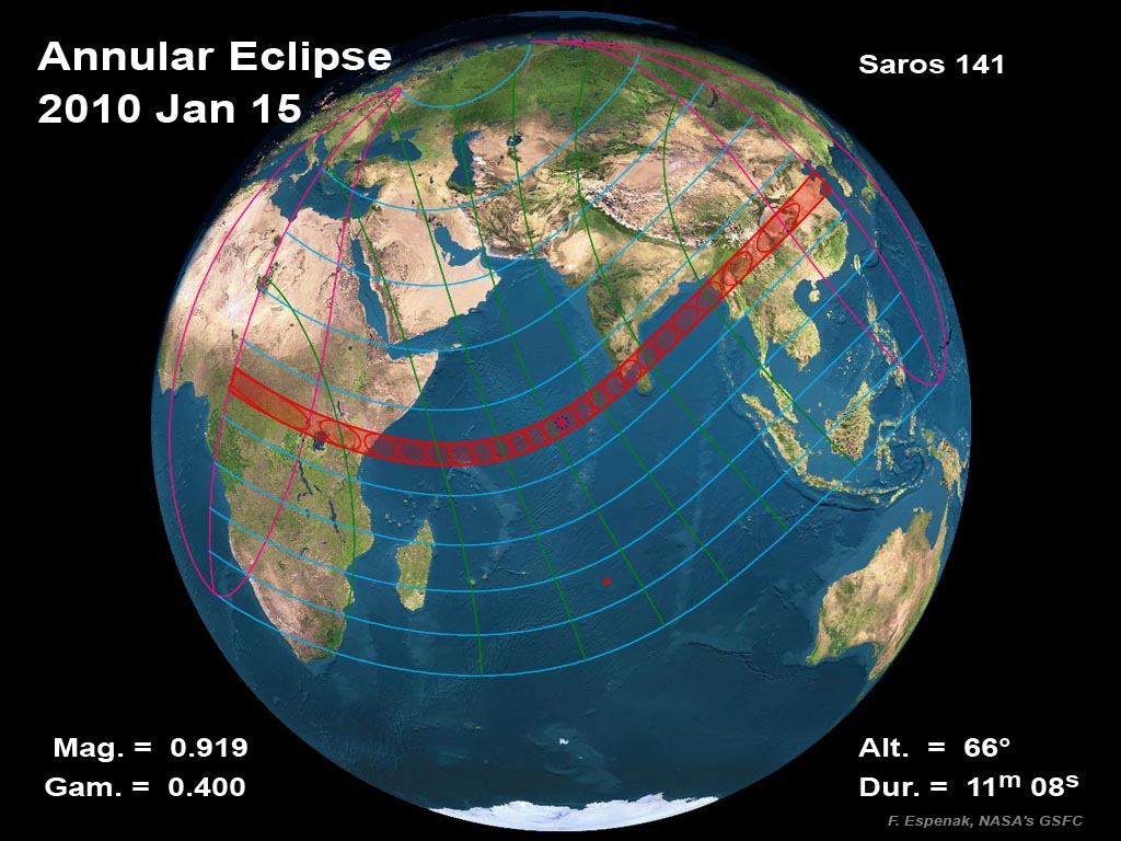
By the 20th century, the publication of eclipse maps became routine in most of the major almanacs of the world and continues to this day. In the United States, the U.S. Naval Observatory began publishing eclipse maps in USNO Eclipse Circulars in 1949. An important source of eclipse maps emerged in popular magazines such as Sky & Telescope. Starting in the 1970‘s, computer technology was applied to very precise calculations and new maps of solar eclipses, culminating in the Five Millennium Canon of Eclipses by Jean Meeus and Fred Espenak. In the 1980’s, the task of publishing detailed eclipse reports and maps was transferred to NASA under the leadership of Fred Espenak of the NASA/Goddard Space Flight Center and Jay Anderson of the Royal Astronomical Society of Canada.
Although the 21st century is still young, the development of eclipse mapping is accelerating with many new forms of eclipse maps. GIS (geographic information systems) software is being combined with eclipse computation software to create detailed eclipse maps. Graphic artists and scientists are creating animations that tell the story of how eclipses work in a way that anyone can understand. People planning eclipse expeditions can create custom eclipse maps through the Internet, such as the online eclipse maps developed on Google Maps by Xavier Jubier. New eclipse maps are reaching even higher precision by factoring in the precise shape of the moon’s profile as derived from laser altimeter data from lunar orbiters. Eclipse map apps are just beginning to appear on mobile devices such as iPhones, iPads, and Android phones. The present era is a second golden age of eclipse mapping with many innovations that are rivaling the flourishing of eclipse maps of the late 17th and 18th centuries.
While it is easier than ever before for an eclipse enthusiast to produce eclipse maps, there is much to learn from the past masters of eclipse mapping. The maps below are offered as guidance to eclipse mappers, for exploration by eclipse enthusiasts interested in historical eclipses, and for the appreciation of the remarkable and sophisticated eclipse maps that combine detailed spatial information and precise timings to guide people to the greatest show on earth, a total solar eclipse.