The annular solar eclipse of May 10, 2013 over Australia and the South Pacific
On May 10, 2013, an annular solar eclipse begins over Western Australia at sunrise and passes over Papua New Guinea, the Solomon Islands, Kiribati, and ends at sunset over a remote region of the eastern South Pacific Ocean. When the eclipse crosses the International Date Line, the local date becomes May 9.
An annular solar eclipse occurs when the Moon’s apparent disk is just smaller than the Sun’s disk and the Sun appears as a brilliant ring. This spectacular sight can only be safely observed with approved solar filters or by projecting an image of the eclipsed Sun onto a flat white surface. Find safe observing instructions here.
Recommended links for further information
Interactive Google eclipse map by Xavier Jubier
NASA’s eclipse web site by Fred Espenak
Weather prospect and maps by Jay Anderson
Eclipse maps and photography by Bill Kramer
IAU Working Group on Solar Eclipses by Jay Pasachoff
U.S. Naval Observatory & HM Nautical Almanac Office
Credits
The maps on this page are made by Michael Zeiler, curator of eclipse-maps.com, using GIS software from his employer, www.esri.com. The eclipse calculations behind these maps are from Solar Eclipse Maestro by Xavier Jubier. The Besselian elements used for eclipse calculations are calculated by Fred Espenak from the JPL DE405 ephemeris.
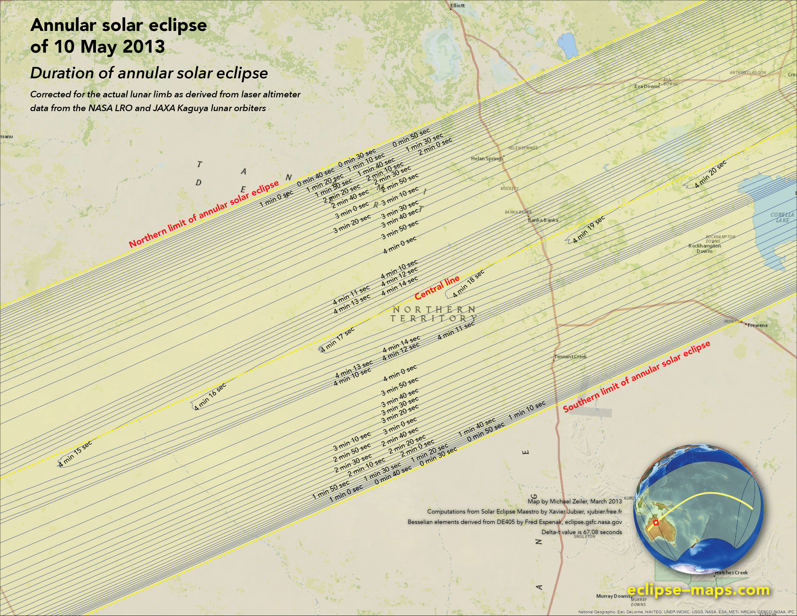
The careful map reader will note that isodurations (lines of equal eclipse duration) on the maps are not symmetric around the central line of eclipse or perfectly smooth; this is due to corrections for the actual lunar profile.


Overview map showing eclipse magnitude (fraction of Sun’s diameter eclipsed)
Note that the path of annular eclipse extends slight past the curves of maximum eclipse at sunrise and sunset. This extension is due to corrections made for atmospheric refraction which lengthen the eclipse path.
Times of greatest eclipse
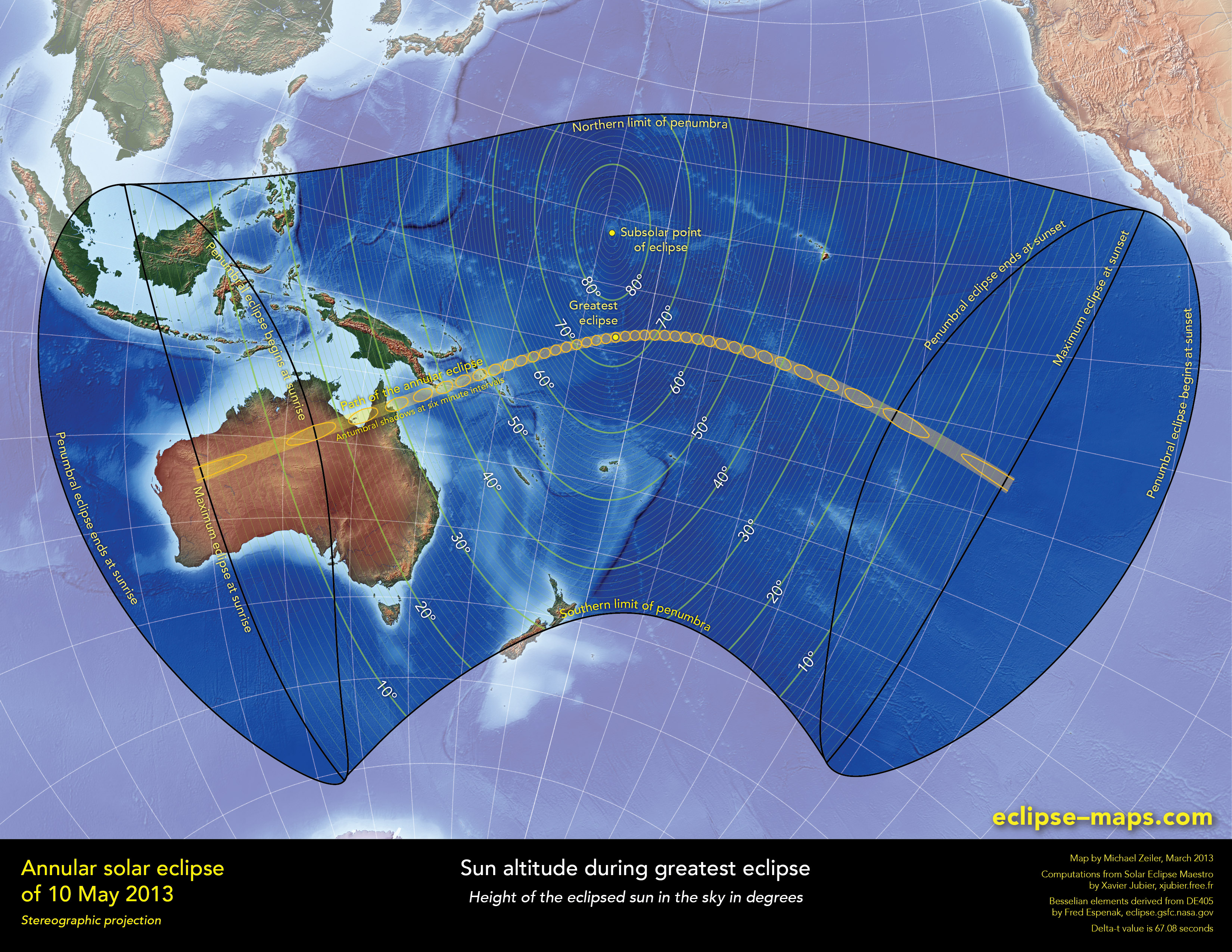
Sun altitude during greatest eclipse
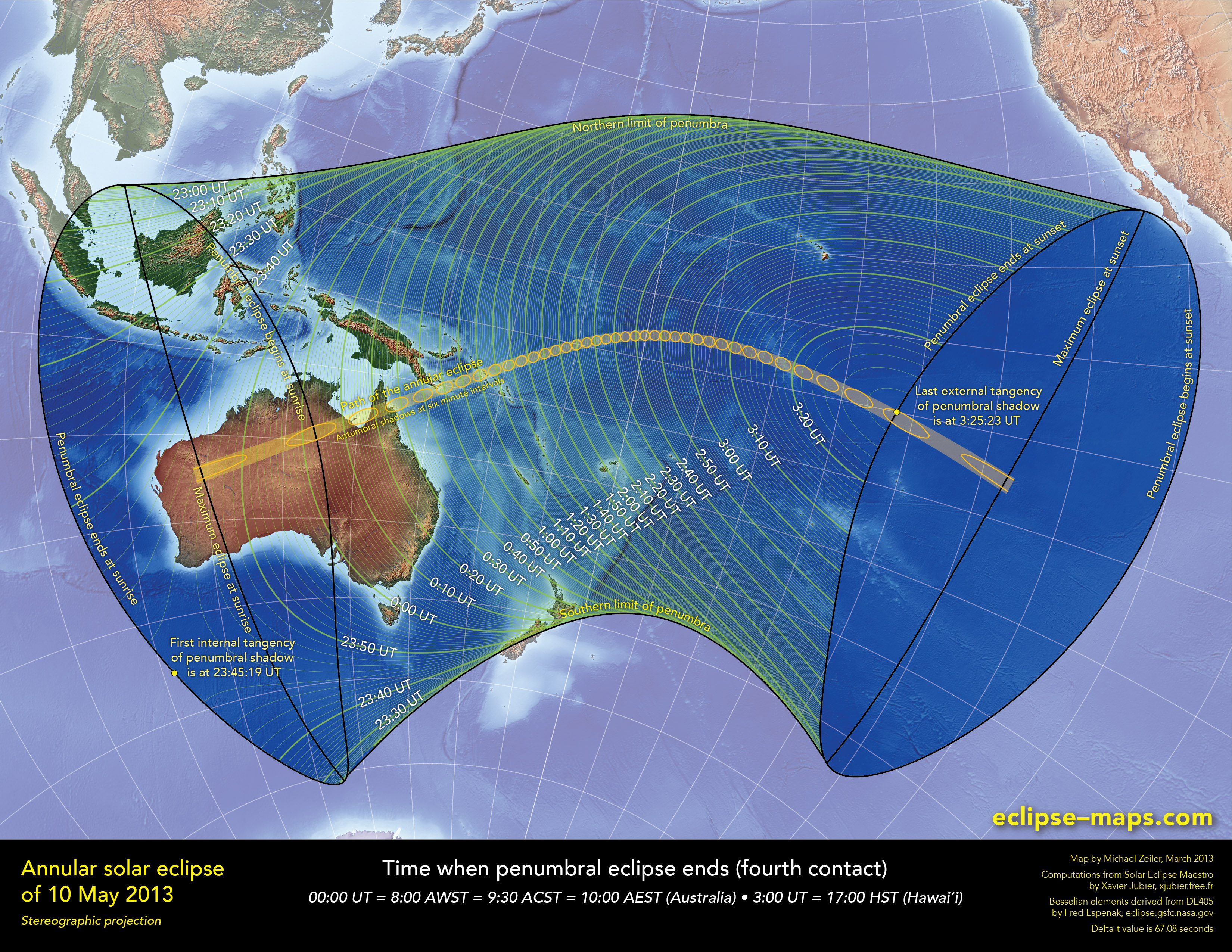
Times when penumbral eclipse ends
(fourth contact)
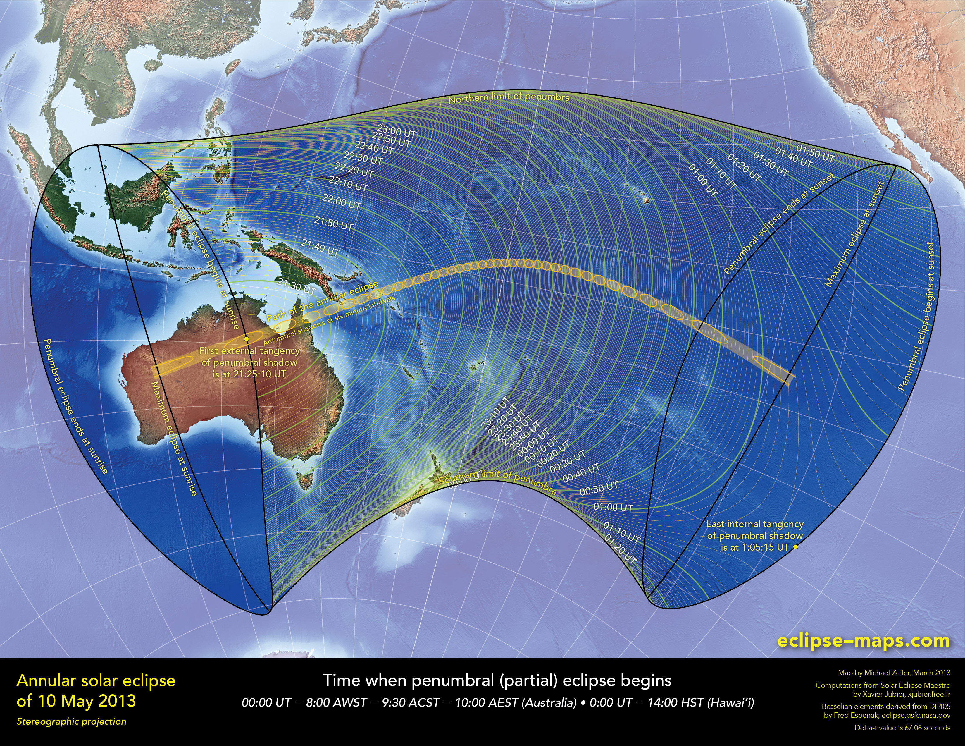
Times when penumbral eclipse begins
(first contact)
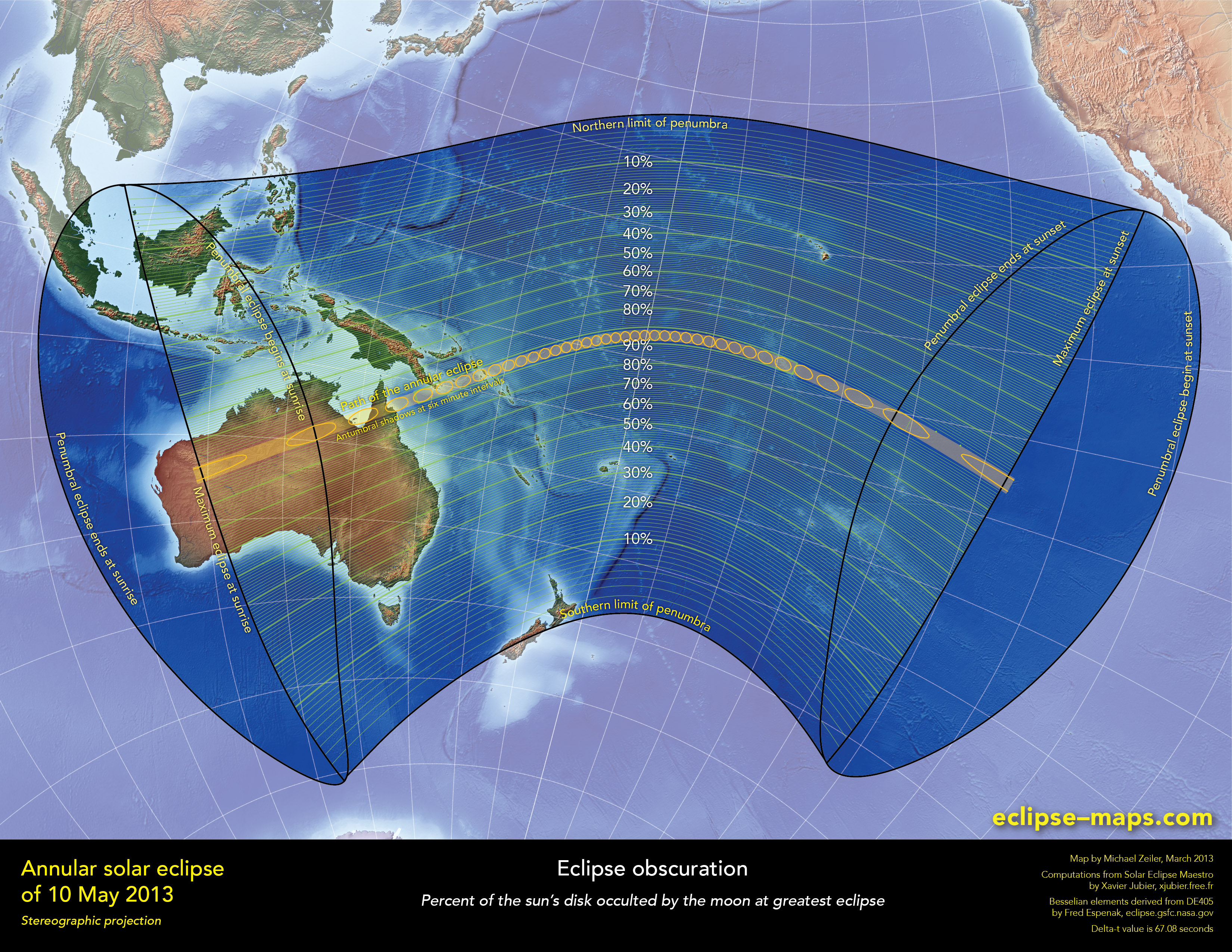
Eclipse obscuration (percent of sun’s disk occulted, indicating dimming of sunshine)
The major land mass visited by this annular solar eclipse is Australia. It begins at sunrise near Newman, Western Australia and passes over North Territory and Queensland. The eclipse passes over no major cities, but visits Newman, Tennant Creek, some Aboriginal communities, and is accessible by several highways.
In Queensland, the path of this annular eclipse intersects the path of the recent total solar eclipse of November 14, 2012.
Eclipse magnitude
(fraction of sun’s diameter occulted)
Eclipse obscuration
(percent of sun’s disk occulted)
Times when penumbral eclipse begins
(first contact of eclipse)
Times of greatest eclipse
Times when penumbral eclipse ends
(fourth contact of eclipse)
Click on any map for a high-resolution view suitable for printing
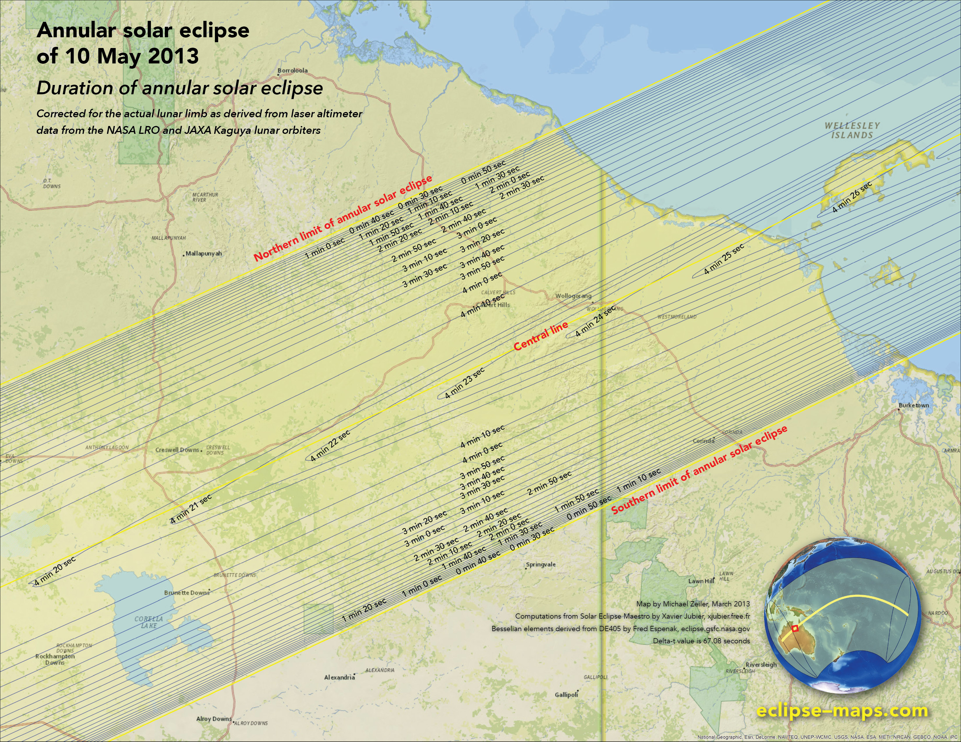
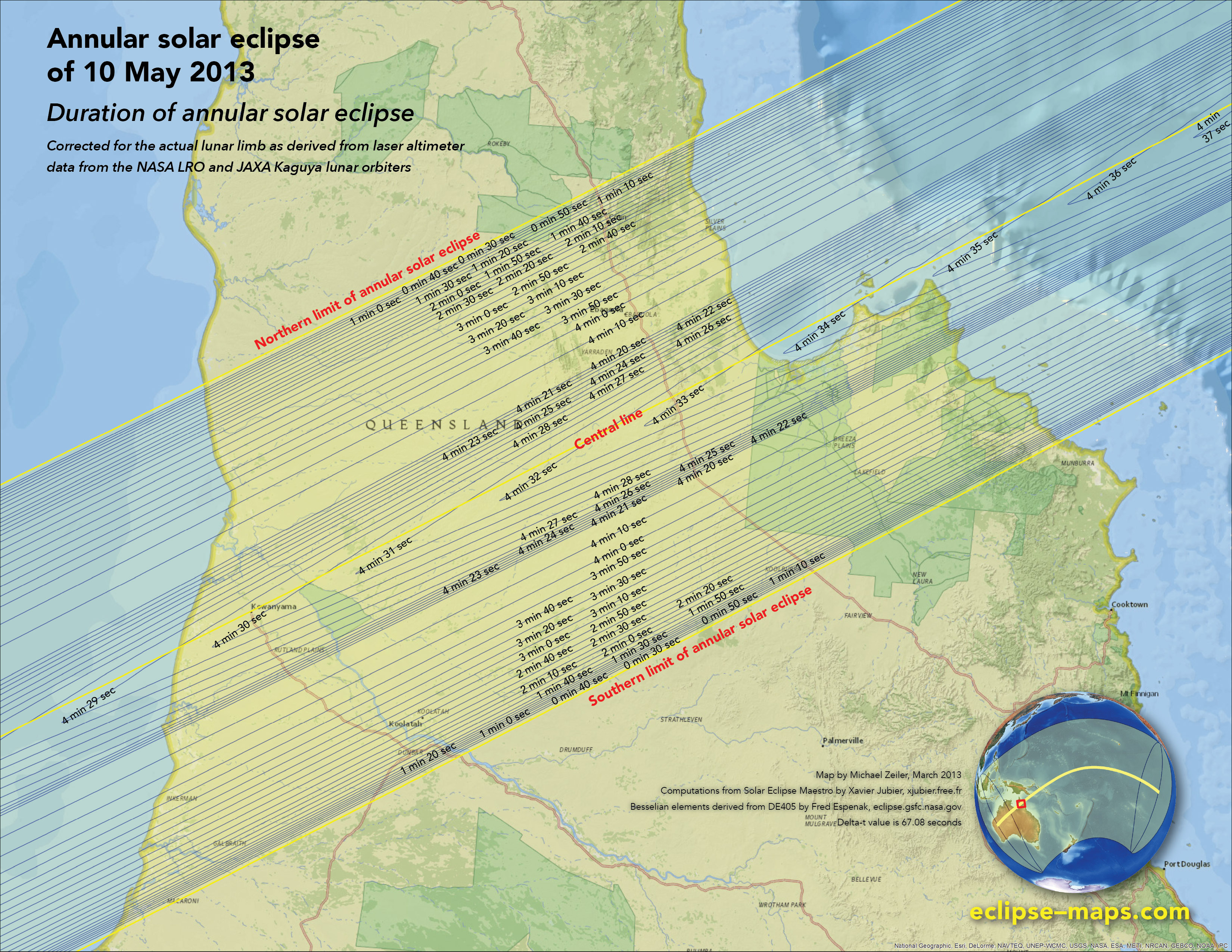
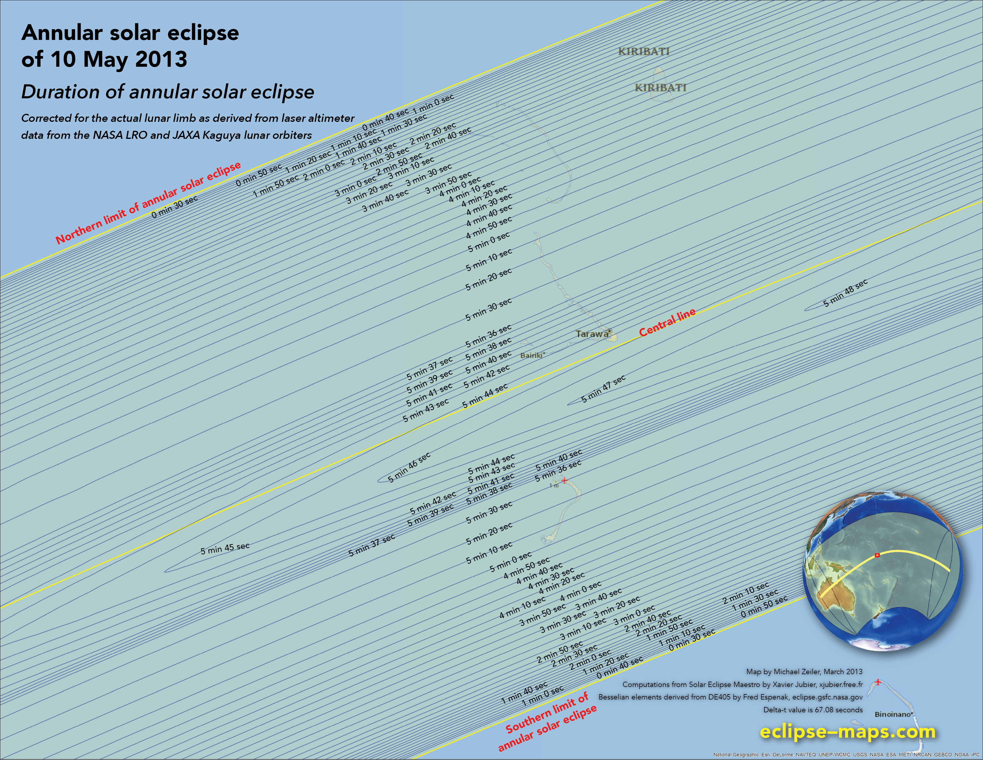
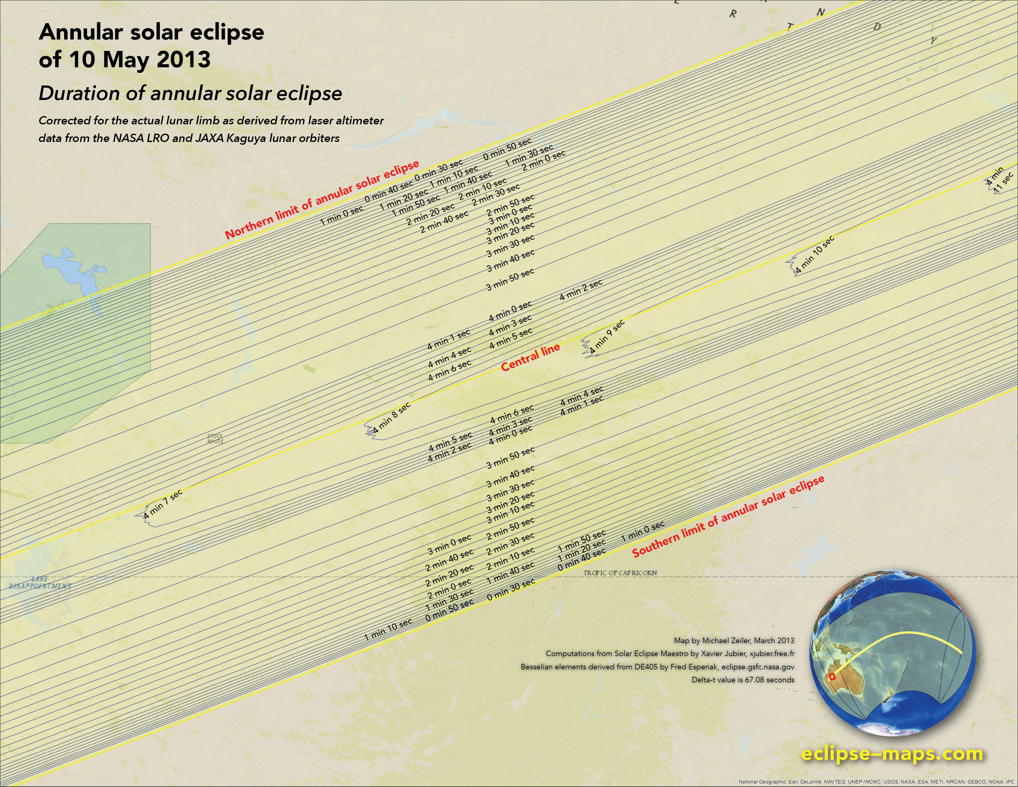
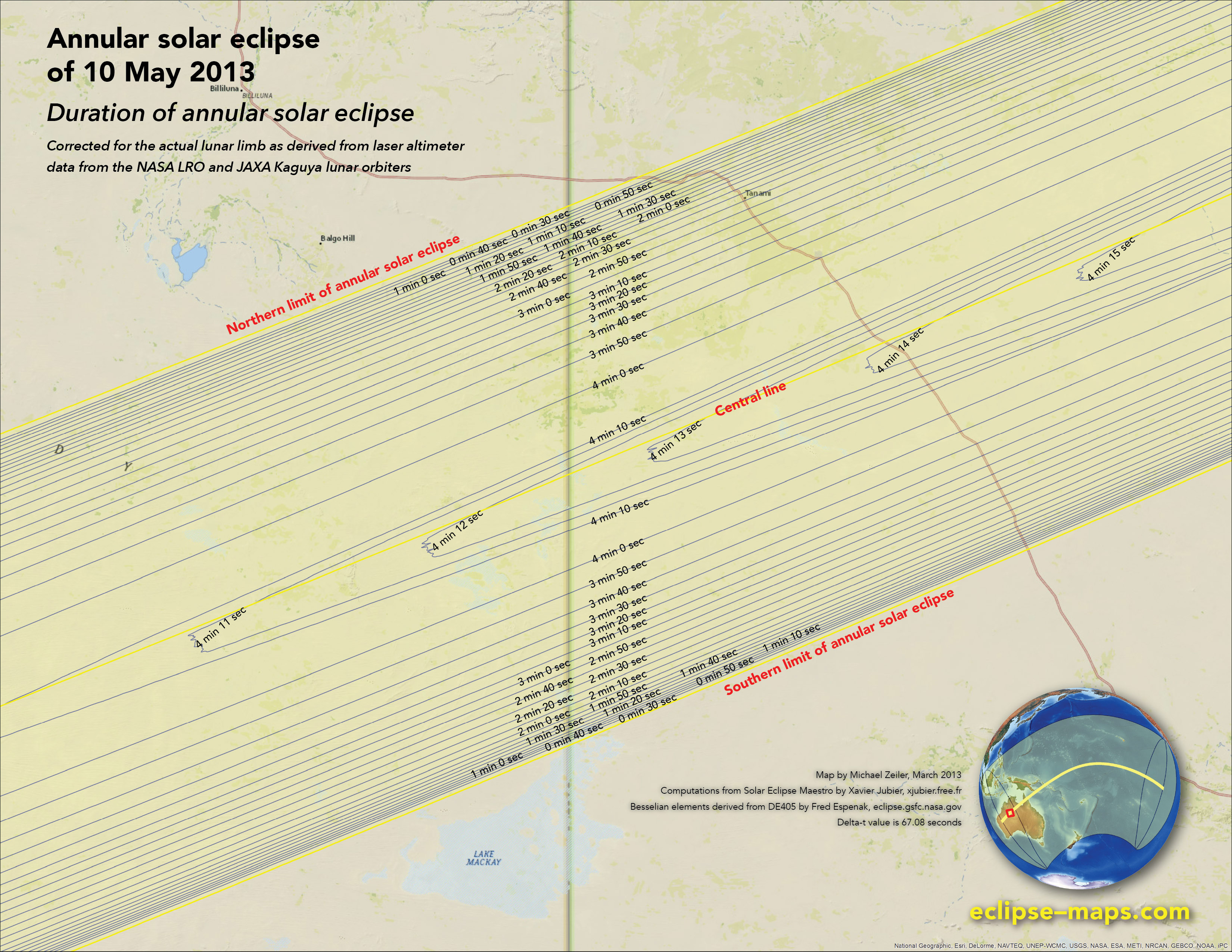
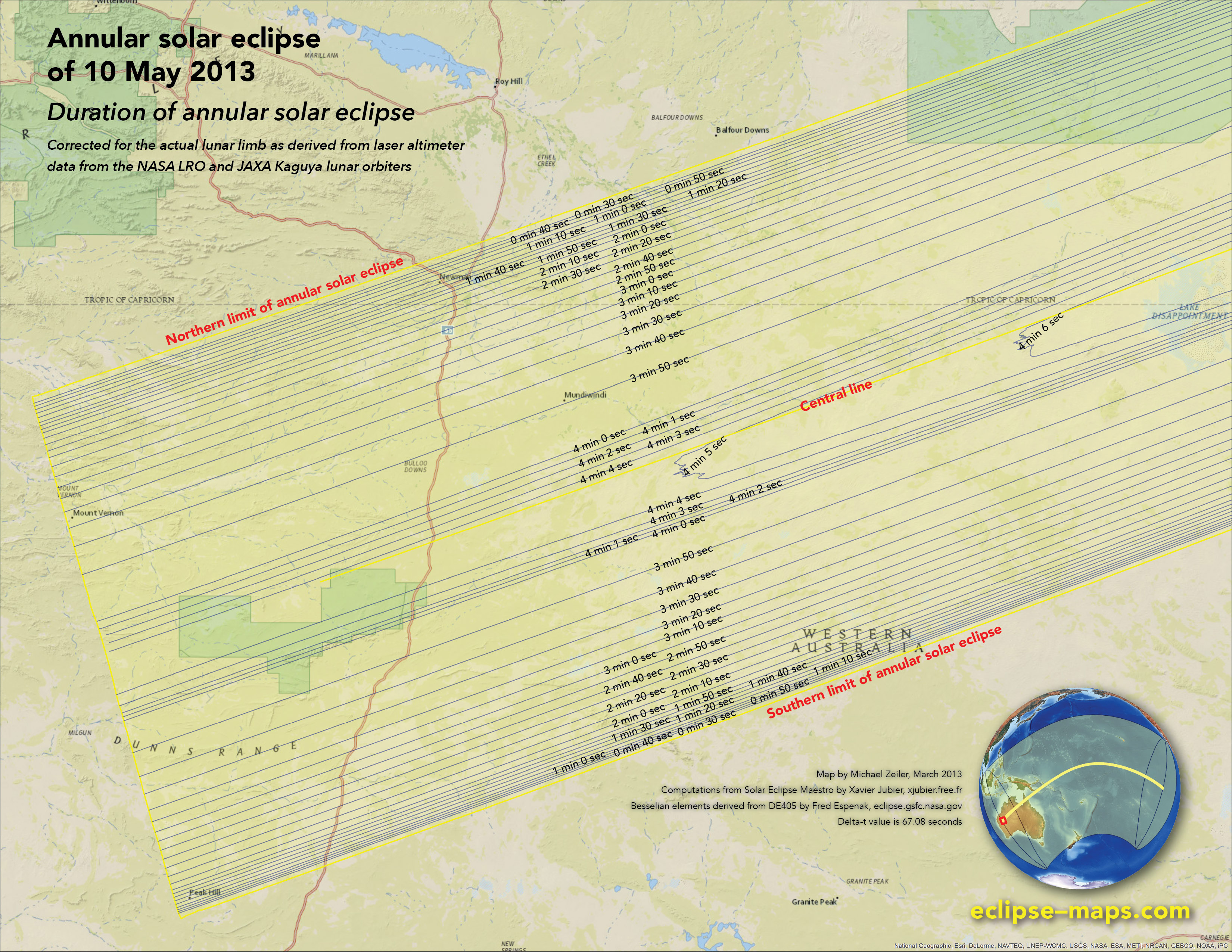
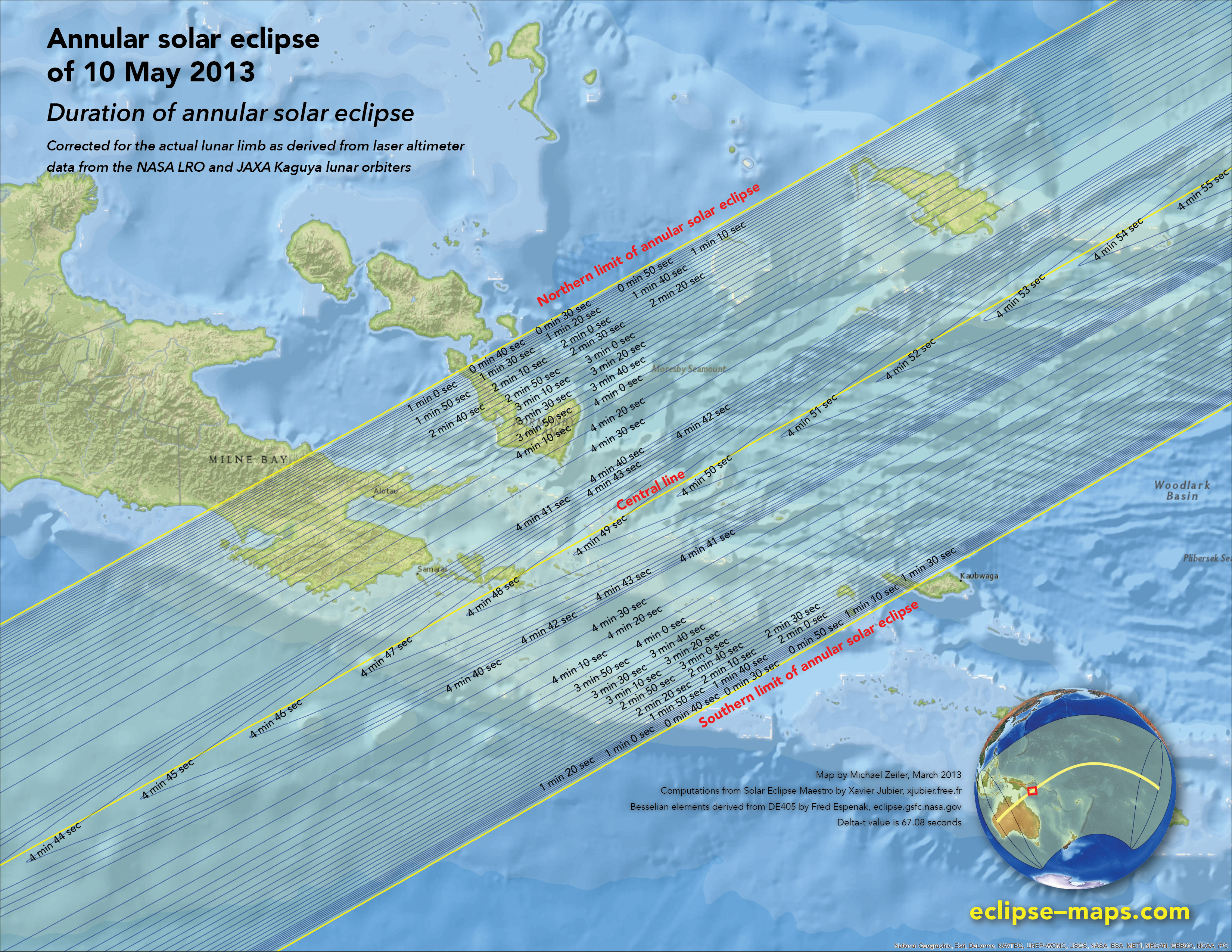
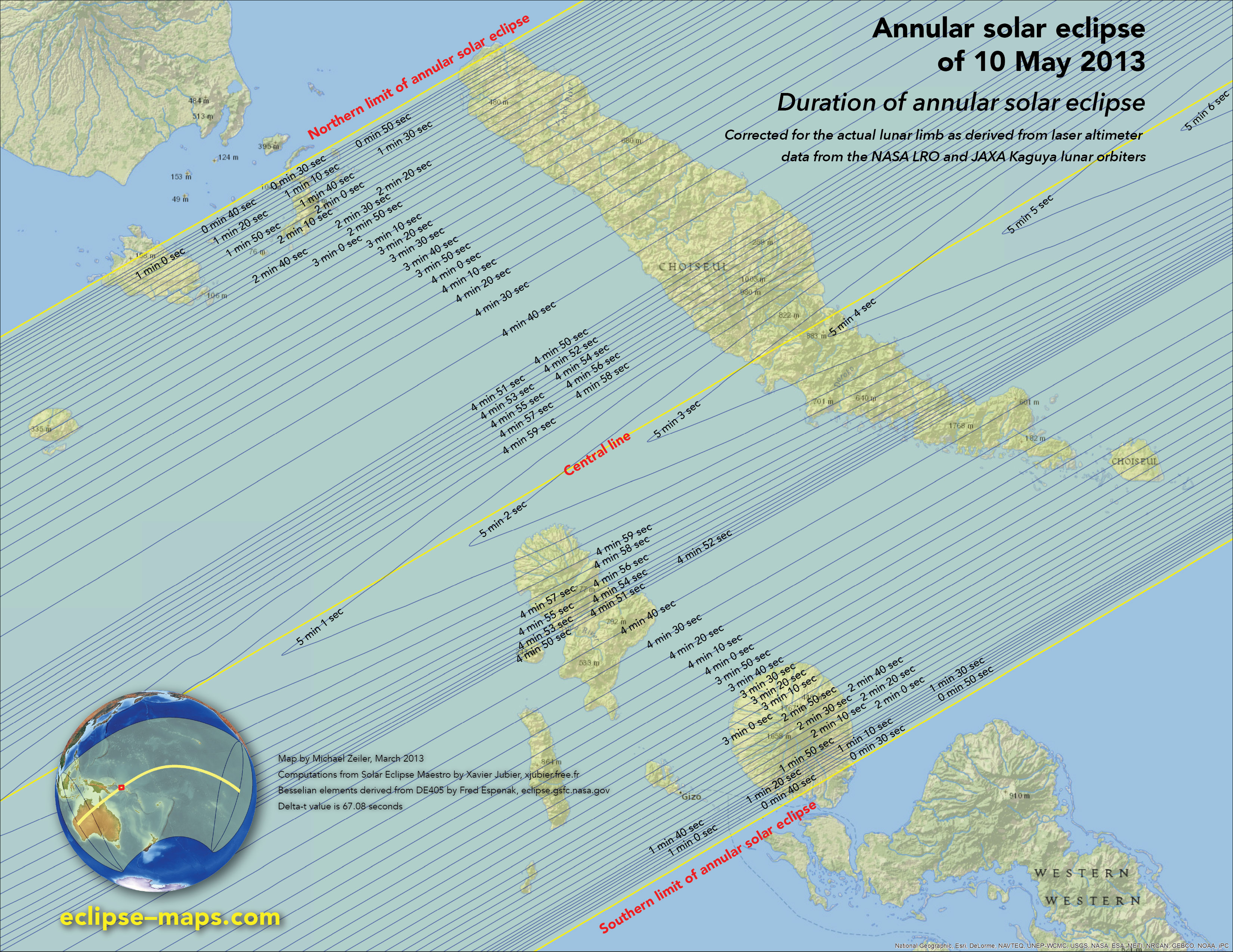
These nine eclipse duration maps below show every land area and inhabited island accessible to travelers that are visited by the annular solar eclipse.
The durations shown for the annular eclipse include corrections due to the irregular lunar limb. Xavier Jubier derived precise lunar limb profiles from extensive laser altimeter data captured by the NASA Lunar Reconnaissance Orbiter and the Japanese JAXA Kaguya lunar orbiter.
Tennant Creek, Northern Territory, Australia
Burketown and Gulf of Carpentaria, Australia
Cape York Peninsula, Queensland, Australia
Lake Disappointment, Western Australia
Newman, Western Australia
Lake Mackay, Western Australia & Northern Territory
Papua New Guinea
Solomon Islands
Kiribati
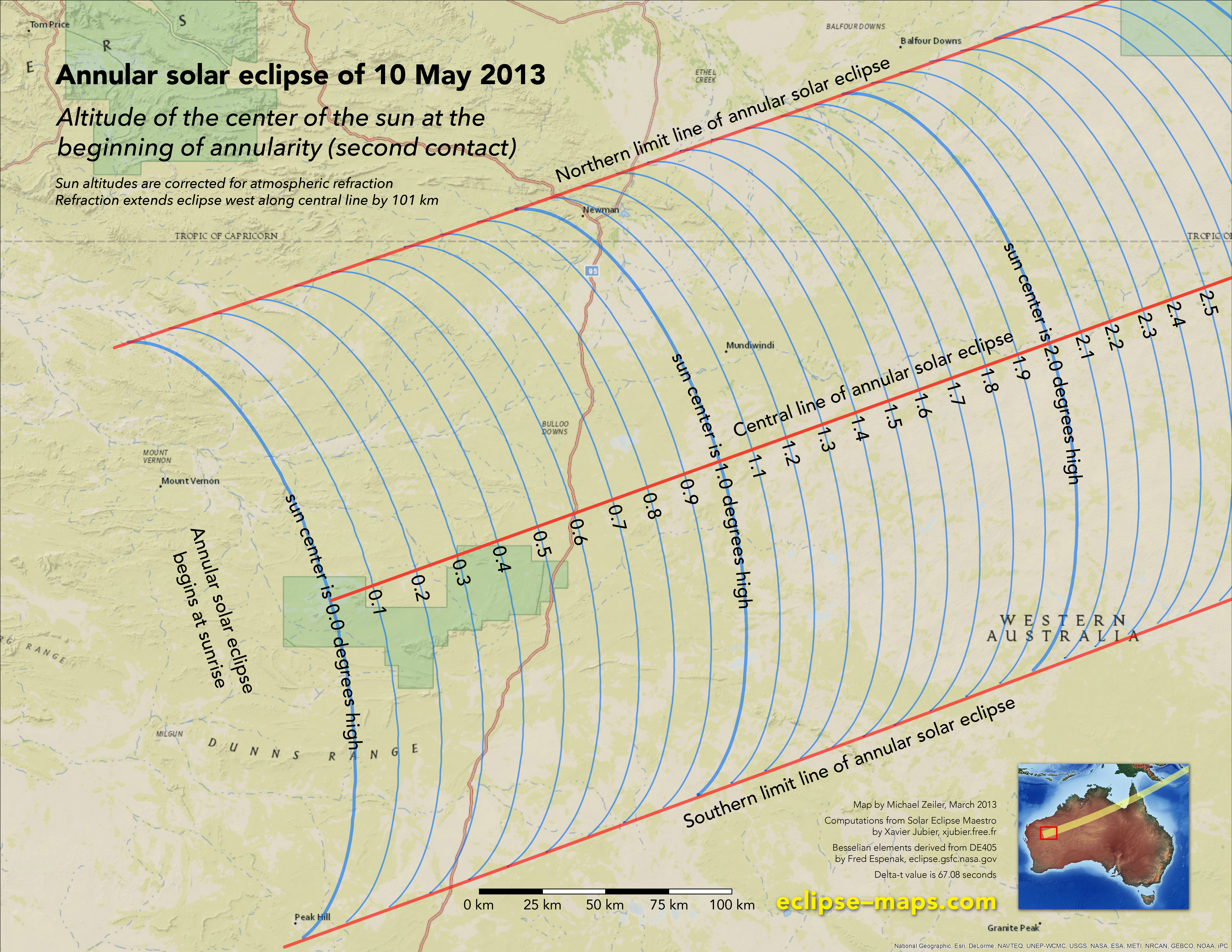
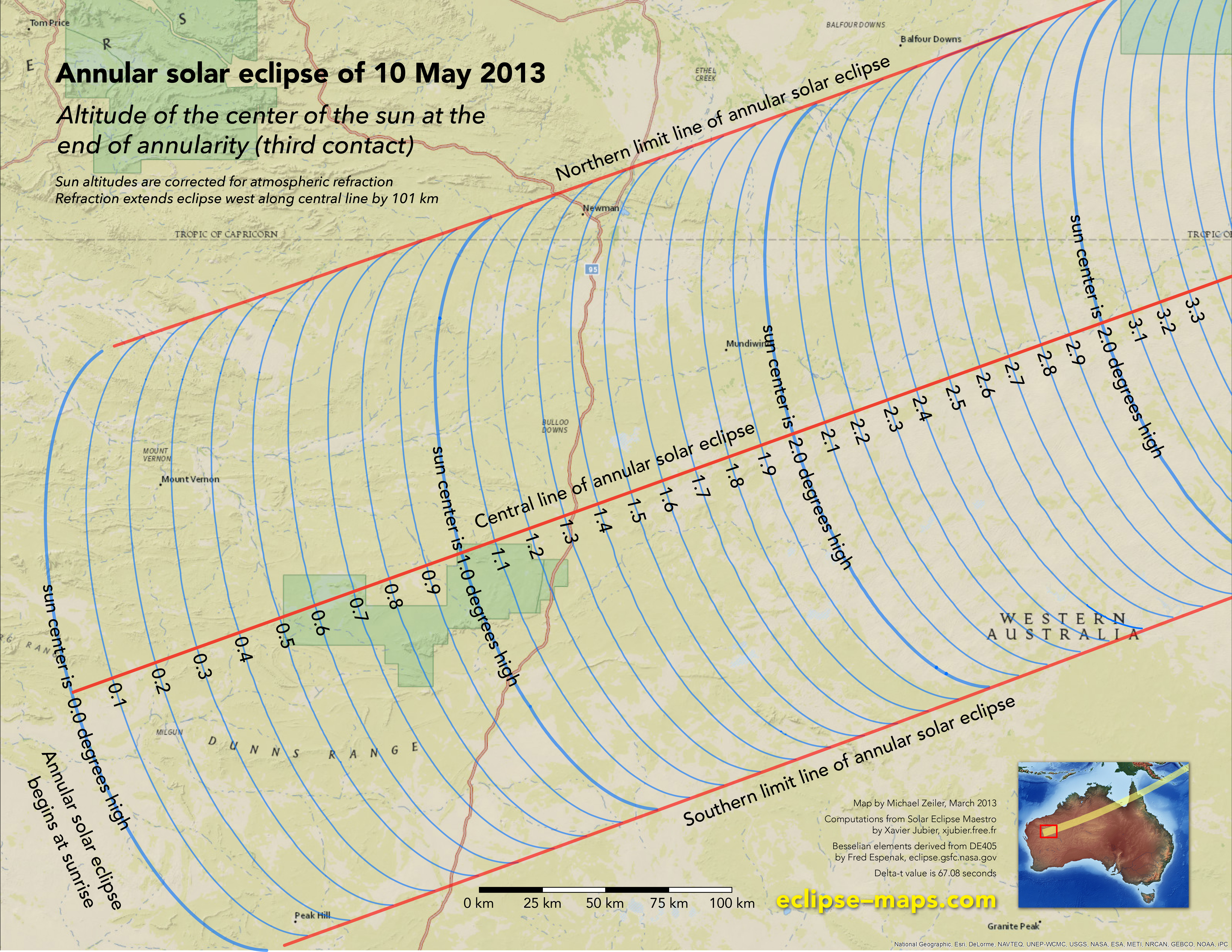
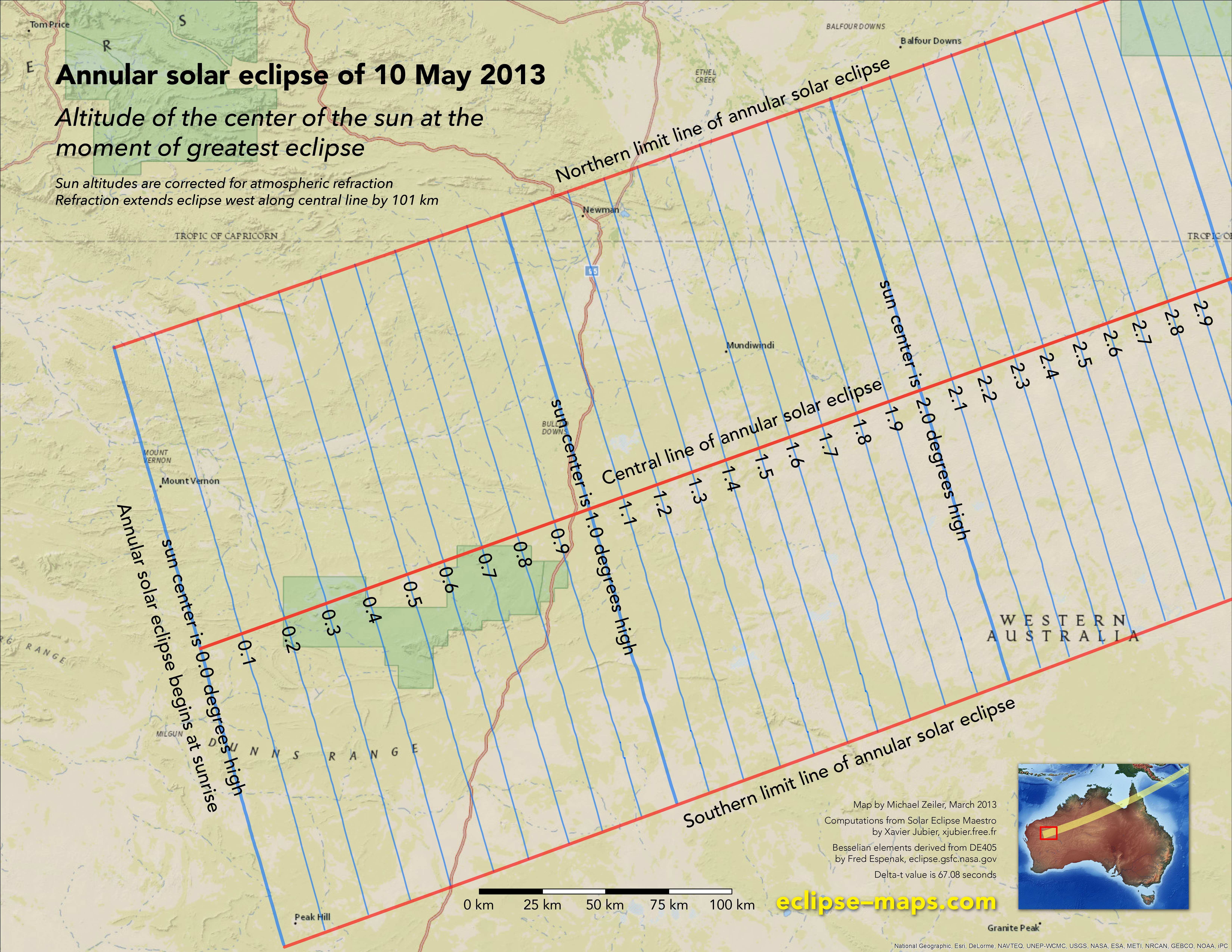
Duration and sun altitude at greatest eclipse, Newman, Western Australia
While annular solar eclipses lack the extreme drama of a total solar eclipse (when the solar corona becomes visible and day turns to night), they nonetheless provide a dramatic view. The most spectacular view of an annular solar eclipse is at sunrise or sunset when framed against a landscape.
A cadre of experienced eclipse observers and photographers will situate themselves along highway 95 south of Newman, a mining town in Western Australia. This highway provides ideal access to a remote area from which the annular eclipse can be spied at its peak during sunrise.
Success depends on careful planning with consideration to the local topography, altitude of the sun during the beginning, peak, and end of the annular eclipse, and weather prospects (generally good for this area). These maps provide precise information on the sun altitude to support this planning. Of course, the successful eclipse observer will need to scout positions before eclipse day which have a perfect or near perfect eastern horizon.
These altitude curves have been corrected for refraction. Refraction extends the visibility of the rising sun about 101 km along the central line of eclipse, so that the sunrise annular just reaches highway 95.
Note that sun altitudes are given with respect to the center of the eclipsed sun. The apparent disk of the sun extends about 31 arc minutes (half a degree) in the sky, so if you wish to frame the full eclipse sun at a perfect horizon, you will need to shift a location to an isoaltitude about 0.25 degrees greater along the eclipse path.
Extended views of Baily’s Beads will be from the upper and lower areas of this zone. The most symmetric view of a sunrise annular eclipse will be from the central line of annular eclipse.
If the weather cooperates on May 10, the most dramatic photographs and videos of this annular eclipse will come from expert astrophotographers in this area.
Altitude of the center of the sun at when the annular solar eclipse begins
Altitude of the center of the sun at the peak of annular solar eclipse
Altitude of the center of the sun at when the annular solar eclipse ends
You can view a slideshow of all the maps on this page by clicking on any map below.
Eclipse t-shirts and
maps here